With 2024 officially being the year of OpenStreetMap vector maps lets do a deep-dive into vector maps: their history and how the underlying vector tiles work in detail.
Can’t eat a whole planet-sized pizza by yourself? Don’t worry, OpenStreetMap data is now available by the Slice!SliceOSM is a new OpenStreetMap US Community Project that lets you draw an area on the map and ...
Introduction In today's data driven world, interactive and visually appealing web based maps have become an integral part of countless applications and services. Whether it's fo...
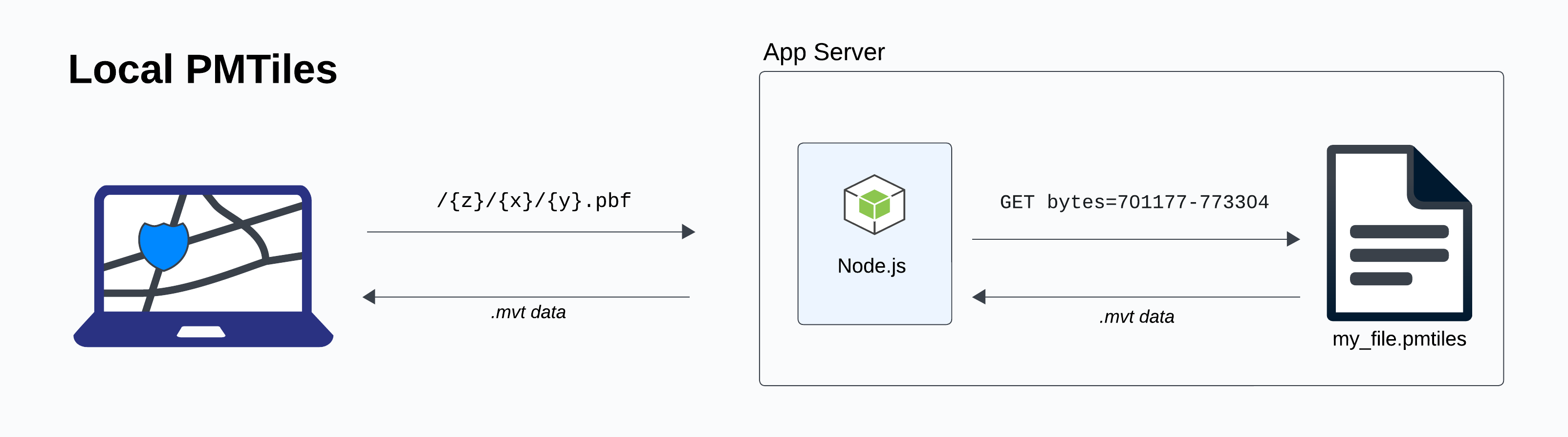
One detail in the PMTiles version 3 specification is a boolean flag called clustered. Popular tools like the pmtiles CLI, tippecanoe and Planetiler always create clustered archives. PMTiles is an open specification in the public domain, so this post is to aid developers in implementing this optional feature. Clustered The term clustered comes from relational databases: the PostgreSQL manual defines that “When a table is clustered, it is physically reordered based on the index information.
I just had this weird need to self-host OSM for just internal use, not accessible from the Internet. These are notes on how to do it. Source data The easiest is to download an appropriate .osm.pbf1 file from https://download.geofabrik.de/ external link . Unfortunately they are not directly usable for (at least those I’ve found) web renderers. Downloading other whole planet Use planetiler external link in case you want to download some other regions or even the whole planet. It can generate mbtiles directly.