The glacial lake left a layer of silt and clay in southeastern Manitoba, creating fertile farmland that was divided during 19th-century land surveys and is still farmed today.
Editor’s Note: Today’s story is the answer to the May Puzzler.
About 15,000 years ago, southeastern Manitoba sat beneath tens of meters of frigid water. Lake Agassiz—which once encompassed present-day Lake Manitoba, Lake Winnipeg, and Lake of the Woods—covered an area larger than all of the Great Lakes combined. It formed in front of the retreating Laurentide Ice Sheet, which dammed rivers that otherwise might have drained into Hudson Bay, producing an expansive body of water 1,100 kilometers (700 miles) long by 300 kilometers wide that spanned parts of today’s Manitoba, Ontario, Saskatchewan, North Dakota, and Minnesota.
The lake began draining roughly 12,000 years ago, but its legacy remains visible across the region. In April 2026, an astronaut aboard the International Space Station snapped this photograph of farmland along the southern shore of Lake Winnipeg, where Lake Agassiz once deposited a thick, nearly flat bed of nutrient-rich silt and clay. Former lakebed areas like this one now support some of Canada’s most productive agricultural landscapes.
A grid-based land survey has also left its mark. The Dominion Land Survey, one of the world’s largest and most systematic surveying efforts, divided much of western Canada into one-square-mile sections after the Canadian government purchased Rupert’s Land from the Hudson’s Bay Company in 1869. The grid continues to define the layout of farm fields, roads, shelterbelts, and drainage channels.
When the photo was taken late in the afternoon on April 19, a layer of snow and ice covered the landscape. The brightest, whitest blocks appear to be snow-covered farmland or icy ponds, while the darker areas are forests, wetlands, or exposed ground with less uniform snow cover.
Wheat, barley, oats, and canola are among the crops often grown in the area. In the upper part of the image, cottages and lake houses are clustered around Gull Lake, a popular site for boating, fishing, and other water sports. Common fish species found in the lake include northern pike, walleye, and yellow perch.
Astronaut photograph ISS074-E-494130 was acquired on April 19, 2026, with a Nikon Z9 digital camera using a focal length of 560 millimeters. It is provided by the ISS Crew Earth Observations Facility and the Earth Science and Remote Sensing Unit at NASA Johnson Space Center. The image was taken by a member of the Expedition 74 crew. The image has been cropped and enhanced to improve contrast, and lens artifacts have been removed. The International Space Station Program supports the laboratory as part of the ISS National Lab to help astronauts take pictures of Earth that will be of the greatest value to scientists and the public, and to make those images freely available on the Internet. Additional images taken by astronauts and cosmonauts can be viewed at the NASA/JSC Gateway to Astronaut Photography of Earth.Story by Adam Voiland.
Written by Lucy Lim, Planetary Scientist at NASA Goddard Space Flight Center Earth planning date: Friday, May 15, 2026 After freeing the rover’s arm from the “Atacama” block, we are ready to drill again! The new drill target will represent the same geologic stratum as Atacama, which is the layered sulfate unit above the boxwork […]
Curiosity Blog, Sols 4893-4899: Drilling at Campo Marte and a Visit From the Psyche Spacecraft
NASA’s Mars rover Curiosity acquired this image, as the rover used its APXS instrument to measure the composition of the “Campo Marte” block in preparation for drilling. Curiosity captured the image using its Front Hazard Avoidance Camera (Front Hazcam) on May 14, 2026 — Sol 4895, or Martian day 4,895 of the Mars Science Laboratory mission — at 16:29:02 UTC.
NASA/JPL-Caltech
Written by Lucy Lim, Planetary Scientist at NASA Goddard Space Flight Center
Earth planning date: Friday, May 15, 2026
After freeing the rover’s arm from the “Atacama” block, we are ready to drill again! The new drill target will represent the same geologic stratum as Atacama, which is the layered sulfate unit above the boxwork structures. We’ve named the new block “Campo Marte” after a natural red sandstone feature in Bolivia, following the theme of choosing target names in this Martian quadrangle from locations near the Uyuni region in South America. The name can be literally translated from Spanish as “Field of Mars” or “Mars Field,” appropriate for a target on Mars. In preparation for drilling, we measured the composition of Campo Marte with the ChemCam LIBS and the APXS as well as obtaining close-up imaging with MAHLI. Additional LIBS rasters provided geochemical data on nearby blocks, including a couple of vein and nodule-like features. As we’ve seen in several rover stops in this unit, the “Paso Malo” block and several others are covered in a prominent polygonal texture.
We’ve also imaged the Campo Marte block from several angles and determined that it’s substantially thicker than the Atacama block, so we’re hoping that its greater mass will keep it on the ground after drilling so that we can withdraw the drill bit normally this time. The team did get some interesting data on the volume and density of the Atacama block from our little adventure but we don’t feel the need to repeat that particular experiment.
In the meantime, we had a chance to support another solar system exploration mission as the Psyche spacecraft flew close by Mars in order to pick up a gravitational boost on its way to the main asteroid belt.
The Psyche spacecraft’s eventual destination is the asteroid 16 Psyche, one of the largest members of an unusual spectral category of asteroids that hasn’t yet been visited by a spacecraft. Although 16 Psyche is expected to be quite different from Mars as a science target (for example, it is too small to maintain a Mars-like atmosphere) this flyby was still a valuable opportunity to exercise the spacecraft’s instruments and data analysis pipelines, and validate their calibration. Because of this the Curiosity team planned an extra set of atmospheric observations timed to coordinate with the Psyche flyby: a zenith movie with Navcam to document clouds and a Mastcam solar observation to measure atmospheric opacity. The Mastcam was also supported by a fresh set of calibration data. Together with other coordinated observations from the Mars orbiters and Perseverance rover, these are intended to contribute to the Psyche instrument validation effort.
Three photographers at NASA’s Johnson Space Center who inspire the world through visual storytelling earned top honors in the portrait category at the 2025 NASA Imagery Experts Program Annual Awards. “Congratulations to all three on this impressive achievement and for capturing such breathtaking imagery,” said Johnson Director Vanessa Wyche. “Their work represents the collaboration, precision, […]
Show full content
Three photographers at NASA’s Johnson Space Center who inspire the world through visual storytelling earned top honors in the portrait category at the 2025 NASA Imagery Experts Program Annual Awards.
“Congratulations to all three on this impressive achievement and for capturing such breathtaking imagery,” said Johnson Director Vanessa Wyche. “Their work represents the collaboration, precision, and creativity that drive human space exploration forward.”
David DeHoyos, Josh Valcarcel, and Bill Stafford were recognized during the award ceremony held April 20, 2026, in Las Vegas.
From engineering tests to astronaut training to mission control operations, these photographers document the people and work central to NASA’s human spaceflight mission.
First place: David DeHoyosESA (European Space Agency) astronaut Sophie Adenot pauses for a pensive moment during her official NASA portrait session at Johnson Space Center.NASA/David DeHoyos
Sophie is so kind and friendly with a beautiful presence. Being around her made everyone feel good, which allowed my creativity to flow.
David Dehoyos
NASA Photographer
Portrait of NASA photographer David DeHoyos.
A Houston native, born in 1963, David DeHoyos’ life has been deeply shaped by the city’s dual legacy of arts and aerospace.
DeHoyos graduated from Houston’s High School for the Performing and Visual Arts in 1981 with a specialization in photography. After spending a decade refining his technical craft in photo labs, he joined Johnson’s photography department in 1991.
“This opportunity represented the fulfillment of a lifelong ambition,” said DeHoyos. “Growing up during the fervor of the Apollo era, I always dreamed of contributing to NASA’s mission. I am so honored and blessed to be amongst a team of wonderful people and, more importantly, friends.”
Second place: Josh ValcarcelNASA astronaut Jessica Meir poses with an Extravehicular Mobility Unit (EMU) spacesuit during an official portrait sessionNASA/Josh Valcarcel
Jessica’s quiet presence reflects years of preparation, passion, and responsibility. She understands, more clearly than most of us ever will, the fragility of the body, the precision of systems, and the narrow margins within which exploration unfolds.
Josh Valcarcel
NASA Photographer
Portrait of NASA scientific photographer Josh Valcarcel.
Josh Valcarcel has worked as a professional photographer and videographer for over 20 years and has been a scientific photographer at Johnson since 2017. He previously served as a staff photographer and photo editor at WIRED magazine and as a mass communication specialist in the U.S. Navy, capturing stories from flight deck operations to remote island nations across the Pacific.
“As a NASA photographer, I’ve had the privilege of witnessing impossible dreams become reality every day,” said Valcarcel. “That experience has shown me that with the right vision, culture, and trust, what once seemed impossible can become part of everyday life.”
Third place: Bill StaffordExpedition 74 crew member Christopher Williams in an EMU spacesuit.NASA/Bill Stafford
There’s a stillness and quiet resolve in Chris’ expression that says everything about who he is and what he’s about to do.
Bill Stafford
NASA Photographer
Portrait of NASA scientific photographer Bill Stafford.
A Texas native and 1999 graduate of East Texas A&M University, Bill Stafford has served as a photographer and videographer for NASA since graduation, documenting over two decades of the nation’s space exploration milestones.
In addition to his work with NASA, Stafford teaches photography at the Gilruth Center. He is passionate about sharing his expertise and helping others develop their skills behind the lens.
“Photography is how I find meaning in the moments around me, and working at NASA has given me a front-row seat to some of the most remarkable stories of our time,” said Stafford. “My job is to slow things down long enough to find the moment inside the moment: the small details that tell the bigger story.”
Goddard Space Flight CenterMarsMAVEN (Mars Atmosphere and Volatile EvolutioN)The Solar System
In December 2023, scientists looking at Mars data stumbled across something completely unexpected — observations of an atmospheric effect never before seen in the Red Planet’s atmosphere. Using instruments aboard NASA’s MAVEN (Mars Atmosphere and Volatile Evolution) mission, scientists identified a phenomenon known to occur in Earth’s magnetosphere, where charged particles are squeezed like toothpaste […]
Show full content
In December 2023, scientists looking at Mars data stumbled across something completely unexpected — observations of an atmospheric effect never before seen in the Red Planet’s atmosphere. Using instruments aboard NASA’s MAVEN (Mars Atmosphere and Volatile Evolution) mission, scientists identified a phenomenon known to occur in Earth’s magnetosphere, where charged particles are squeezed like toothpaste coming out of a tube along magnetic structures called flux tubes. This so-called Zwan-Wolf effect aids in the deflection of solar wind around Earth and has been observed and studied there for decades. Now, a new study published in Nature Communications provides the first comprehensive observations of the same effect in Mars’ atmosphere.
An artistic representation of the Zwan-Wolf effect at Mars, as observed by NASA’s MAVEN (Mars Atmosphere and Volatile Evolution) mission. While this effect typically helps to deflect the solar wind at Earth, at Mars it is shown to “squeeze” the atmosphere and have implications on how space weather interacts with the planet. The yellow arrows represent the movement of the effect in the Martian atmosphere.
LASP/CU Boulder
“When investigating the data, I all of a sudden noticed some very interesting wiggles,” said Christopher Fowler, a research assistant professor at West Virginia University in Morgantown and lead author of the study. “I would never have guessed it would be this effect, since it’s never been seen in a planetary atmosphere before.”
The Zwan-Wolf effect was first discovered in 1976, and until now has only been observed in planetary magnetospheres, not their atmospheres. Unlike Earth, Mars is not protected by a global magnetic field, affecting how it interacts with the solar wind and space weather. In this new study, the Zwan-Wolf effect was observed in the ionosphere — deep within the Martian atmosphere below 200 km — which contains significant numbers of electrically charged particles. The data showed that these charged particles were being squeezed and distributed around Mars’ atmosphere.
Although Mars has an induced magnetosphere, a magnetic field generated by the solar wind interacting with the Martian ionosphere, it can greatly change in size and shape with large solar wind and space weather events. That is what Fowler and his team saw in the MAVEN data when a large solar storm hit Mars. Based on their findings, the Zwan-Wolf effect may be occurring constantly in the Martian ionosphere but at levels undetectable by MAVEN’s instrumentation. The impact of the space weather event appears to have amplified the effect, allowing the scientists to observe it in the data.
In the beginning, Fowler and his team came across some interesting-looking fluctuations in measurements of the magnetic field as the spacecraft flew through the atmosphere. To explain this, they dug into observations made by several instruments on MAVEN, including measurements of the charged particle environment in the ionosphere. Their sleuthing uncovered even more weird and interesting features in the data. After ruling out several other possibilities, the team was able to identify the culprit as the Zwan-Wolf effect, which explained all the features they were seeing.
“No one expected that this effect could even occur in the atmosphere,” said Fowler. “That’s what makes this even more exciting. It introduces interesting physics that we haven’t yet explored and a new way the Sun and space weather can change the dynamics in the Martian atmosphere.”
Understanding the Zwan-Wolf effect at Mars will further our understanding of how space weather affects the planet and provides new insight into how this effect might occur at similar unmagnetized bodies, such as Venus and Saturn’s moon Titan. Observations like this also highlight the importance of knowing how large space weather events can lead to changes in the environment at and around the Red Planet and potentially affect assets on or near Mars.
“Knowing how space weather interacts with Mars is essential,” said Shannon Curry, the principal investigator of MAVEN and research scientist at the Laboratory for Atmospheric Space Physics at the University of Colorado Boulder. “The MAVEN team continues making new discoveries with our datasets and finding these links between our host star and the Red Planet.”
The MAVEN spacecraft launched in November 2013 and entered Mars’ orbit in September 2014. The mission’s goal is to explore the planet’s upper atmosphere, ionosphere, and interactions with the Sun and solar wind to explore the loss of the Martian atmosphere to space. Understanding atmospheric loss gives scientists insight into the history of the Red Planet’s atmosphere and climate, liquid water, and planetary habitability. The MAVEN spacecraft, in orbit around Mars, experienced a loss of signal with ground stations on Earth on Dec. 6, 2025. In Feb. 2026, NASA launched an anomaly review board to assess the probable current state of the spacecraft and the likelihood of its recovery.
The MAVEN mission is part of NASA’s Mars Exploration Program portfolio. The mission’sprincipal investigator is based at the Laboratory for Atmospheric and Space Physics at the University of Colorado Boulder, which is also responsible for managing science operations and public outreach and communications.NASA’s Goddard Space Flight Center in Greenbelt, Maryland, manages the MAVEN mission. Lockheed Martin Space built the spacecraft and is responsible for mission operations. NASA’s Jet Propulsion Laboratory in Southern California provides navigation and Deep Space Network support.
By Willow Reed Laboratory for Atmospheric and Space Physics, University of Colorado Boulder
The NASA-funded Translational Research Institute for Space Health (TRISH) has selected two early‑career scientists for its next class of postdoctoral fellows. The new fellows will begin their projects in May, focusing on space food systems and astronaut eye health. The TRISH Postdoctoral Fellowship Program supports independent research that advances biomedical, behavioral, and technological approaches relevant […]
Show full content
A view of NASA’s Orion spacecraft aboard the SLS (Space Launch System) rocket on April 1 during the launch of the Artemis II test flight.Credit: NASA
The NASA-funded Translational Research Institute for Space Health (TRISH) has selected two early‑career scientists for its next class of postdoctoral fellows. The new fellows will begin their projects in May, focusing on space food systems and astronaut eye health.
The TRISH Postdoctoral Fellowship Program supports independent research that advances biomedical, behavioral, and technological approaches relevant to human space exploration. The selected projects should aim to reduce spaceflight-related health risks and improve human health on Earth.
The selected fellows are:
Dr. Baiyang Liu Institution: Columbia University in New York City Project: Developing a Diazotrophic and Nutritionally Optimized Spirulina Strain for Extended Space Missions Mentor: Dr. Harris Wang
Dr. Dylan Pham Institution: Texas A&M University in College Station Project: Impact of Simulated Microgravity and Aging on Ocular Artery and Neural Retina Function Mentor: Dr. Travis Hein
“Our postdoctoral fellows bring new ideas, technical expertise, and energy to some of the most complex challenges in human spaceflight,” said Dr. Dorit Donoviel, executive director of TRISH and associate professor at Baylor College of Medicine in Houston. “By investing in the next generation, we are building the capability required to achieve a sustained presence on the Moon and extend human exploration deeper into space.”
A virtual institute, TRISH is empowered by NASA’s Human Research Program to help solve challenges of human deep space exploration. It pursues and funds research to deliver scientific and technological solutions that advance space health and help humans thrive wherever they explore, in space or on Earth.
____
NASA’s Human Research Program
NASA’s Human Research Program pursues methods and technologies to support safe, productive human space travel. Through science conducted in laboratories, ground-based analogs, commercial missions, the International Space Station and Artemis missions, the program scrutinizes how spaceflight affects human bodies and behaviors. Such research drives the program’s quest to innovate ways that keep astronauts healthy and mission ready as human space exploration expands to the Moon, Mars, and beyond.
The heart of galaxy M77 shines brightly in this May 7, 2026, image from NASA’s James Webb Space Telescope. The intense glow is due to gas being pulled by the strong gravity of the central black hole into a tight and rapid orbit around it. The motion of the gas causes it to heat up, […]
Show full content
This latest Picture of the Month from the NASA/ESA/CSA James Webb Space Telescope features Messier 77 (M77), a barred spiral galaxy famous and appreciated among astronomers for its combination of relative proximity and spectacular features to study. It is located 45 million light-years away in the constellation Cetus (The Whale).ESA/Webb, NASA & CSA, A. Leroy
The heart of galaxy M77 shines brightly in this May 7, 2026, image from NASA’s James Webb Space Telescope. The intense glow is due to gas being pulled by the strong gravity of the central black hole into a tight and rapid orbit around it. The motion of the gas causes it to heat up, releasing tremendous amounts of radiation.
The bright lines radiating out of the center are diffraction spikes. The spikes are not a physical feature of the galaxy, but an optical effect caused by the telescope itself.
Commercial ResupplyHumans in SpaceInternational Space Station (ISS)Johnson Space CenterKennedy Space CenterMissionsNASA HeadquartersSpaceX Commercial Resupply
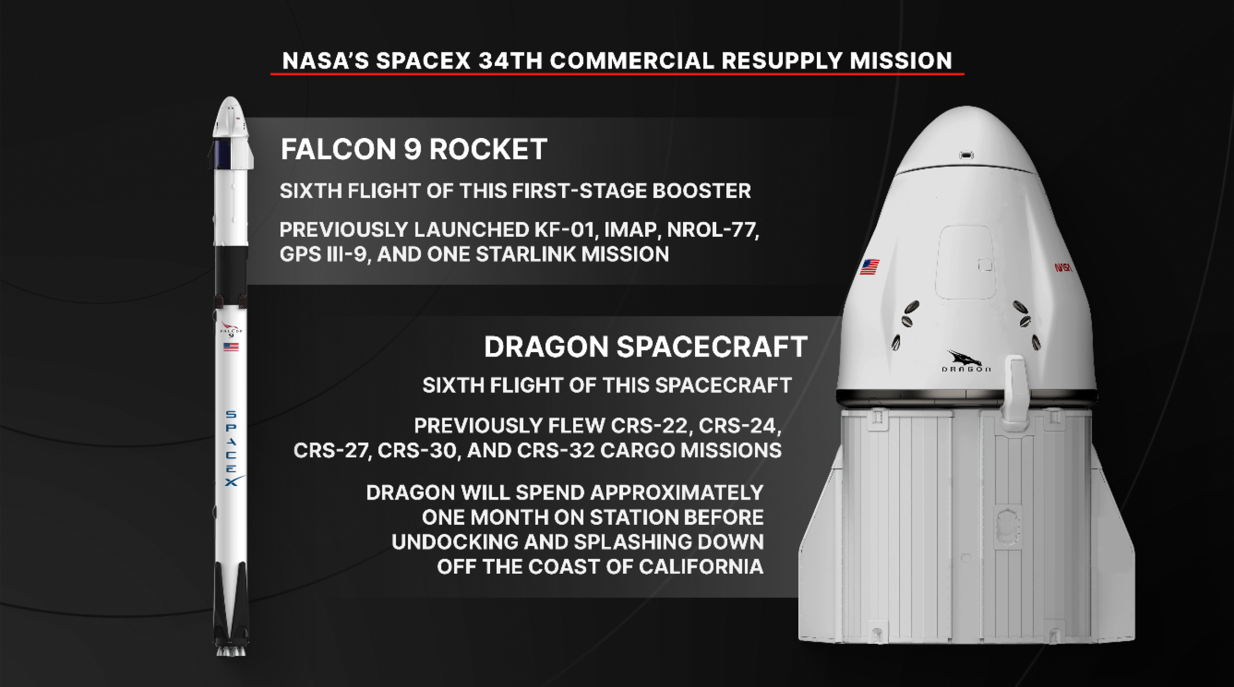
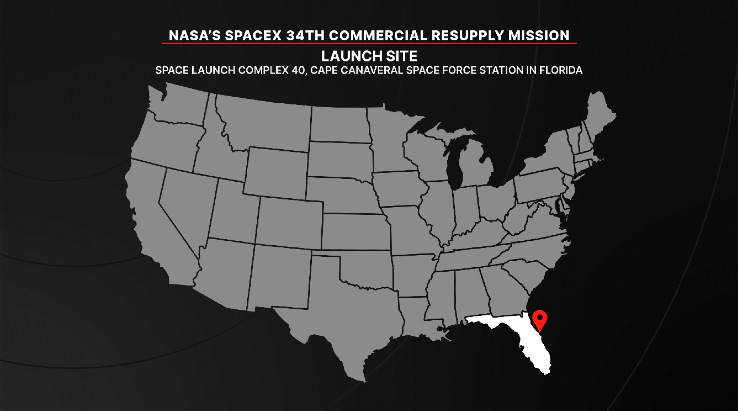
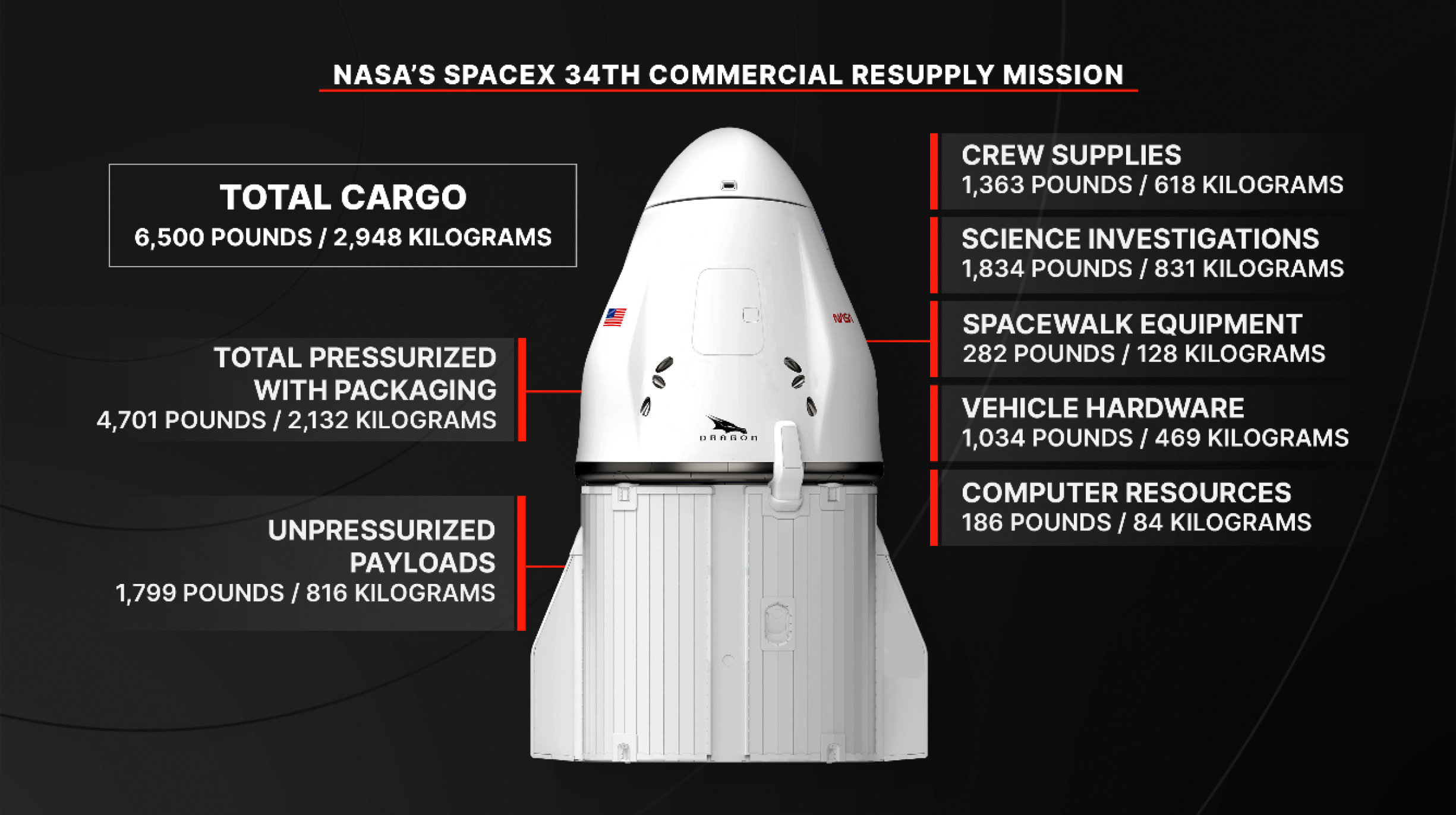
The 34th SpaceX commercial resupply mission under contract with NASA is headed to the International Space Station with new scientific experiments after lifting off at 6:05 p.m. EDT Friday on a Falcon 9 rocket from Space Launch Complex 40 at Cape Canaveral Space Force Station in Florida. The SpaceX spacecraft, loaded with nearly 6,500 pounds […]
Show full content
The SpaceX Falcon 9 rocket, carrying the Dragon cargo spacecraft atop, launched Friday, May 15, 2026, from Space Launch Complex 40 at Cape Canaveral Space Force Station in Florida.Credit: NASA+
The 34th SpaceX commercial resupply mission under contract with NASA is headed to the International Space Station with new scientific experiments after lifting off at 6:05 p.m. EDT Friday on a Falcon 9 rocket from Space Launch Complex 40 at Cape Canaveral Space Force Station in Florida.
The SpaceX spacecraft, loaded with nearly 6,500 pounds of cargo for the space station’s Expedition 74 crew, is scheduled to autonomously dock at about 7 a.m. Sunday, May 17, to the forward port of the station’s Harmony module.
Watch NASA’s live rendezvous and docking coverage beginning at 5:30 a.m. on NASA+, Amazon Prime, and the agency’s YouTube channel. Learn how to watch NASA content through a variety of online platforms, including social media.
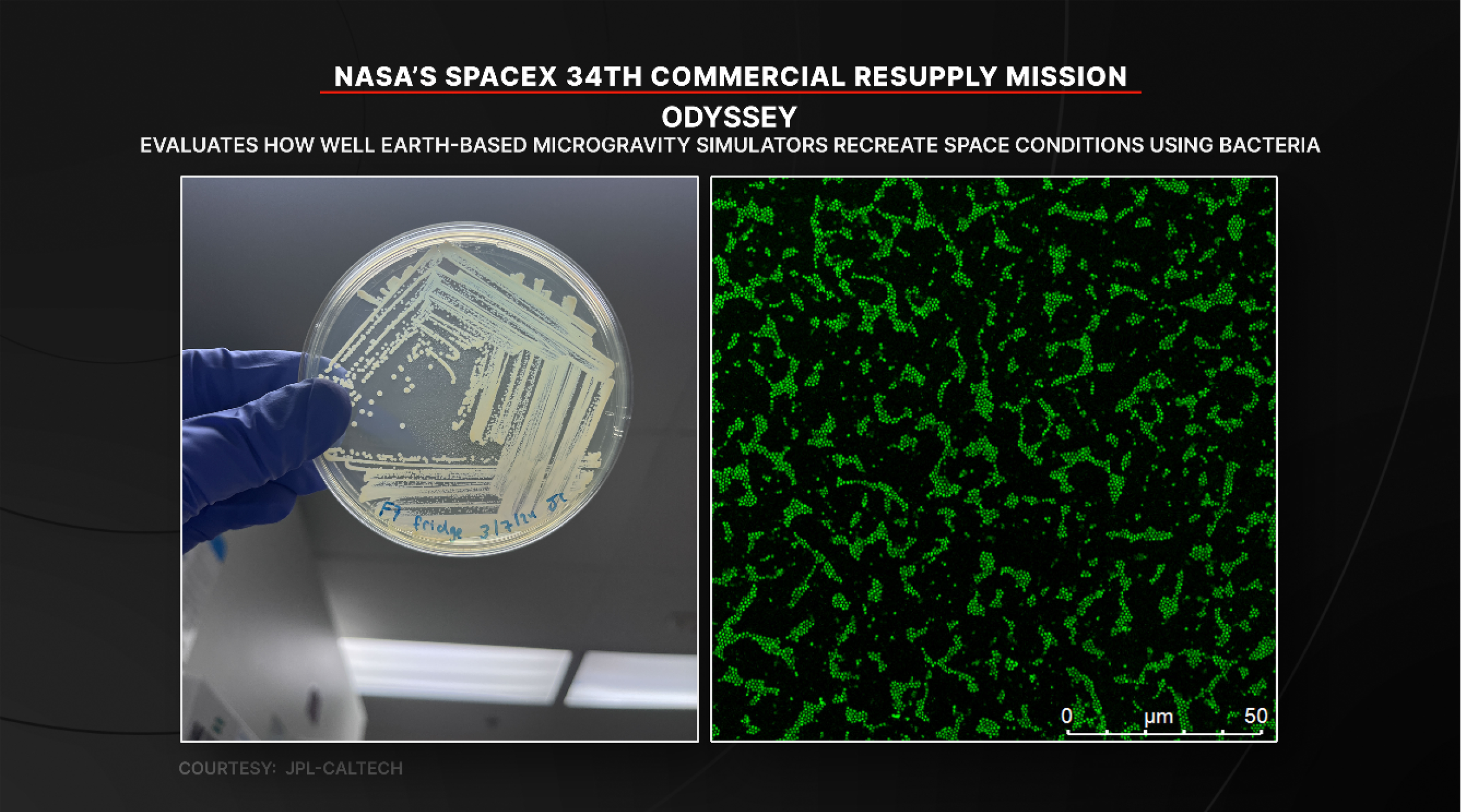
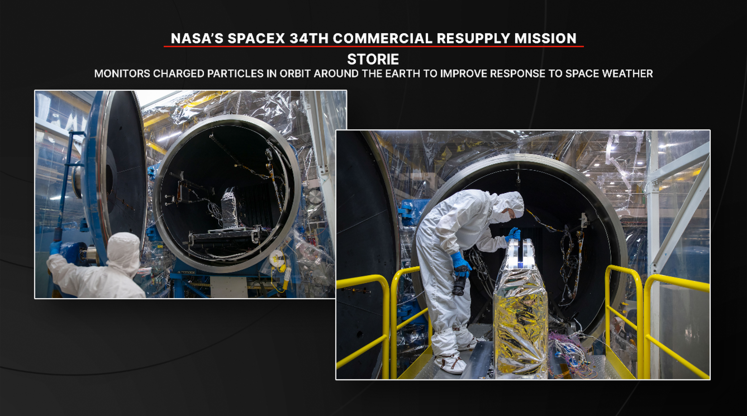
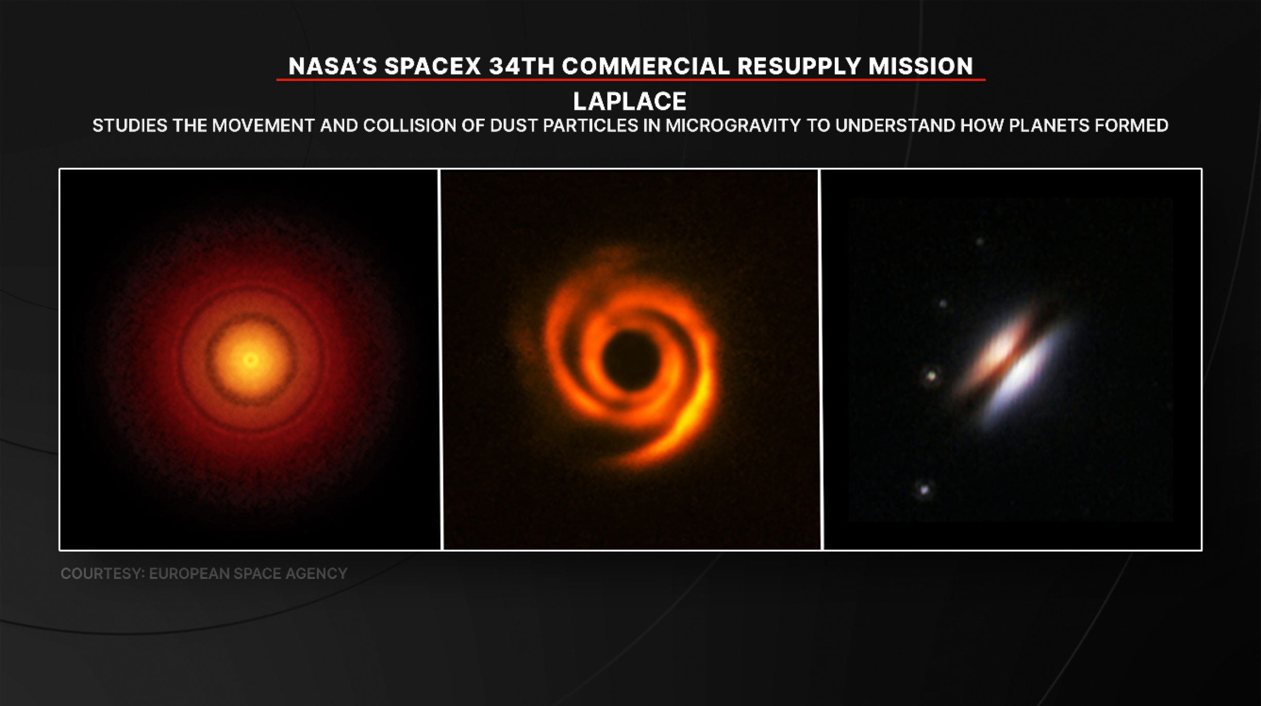
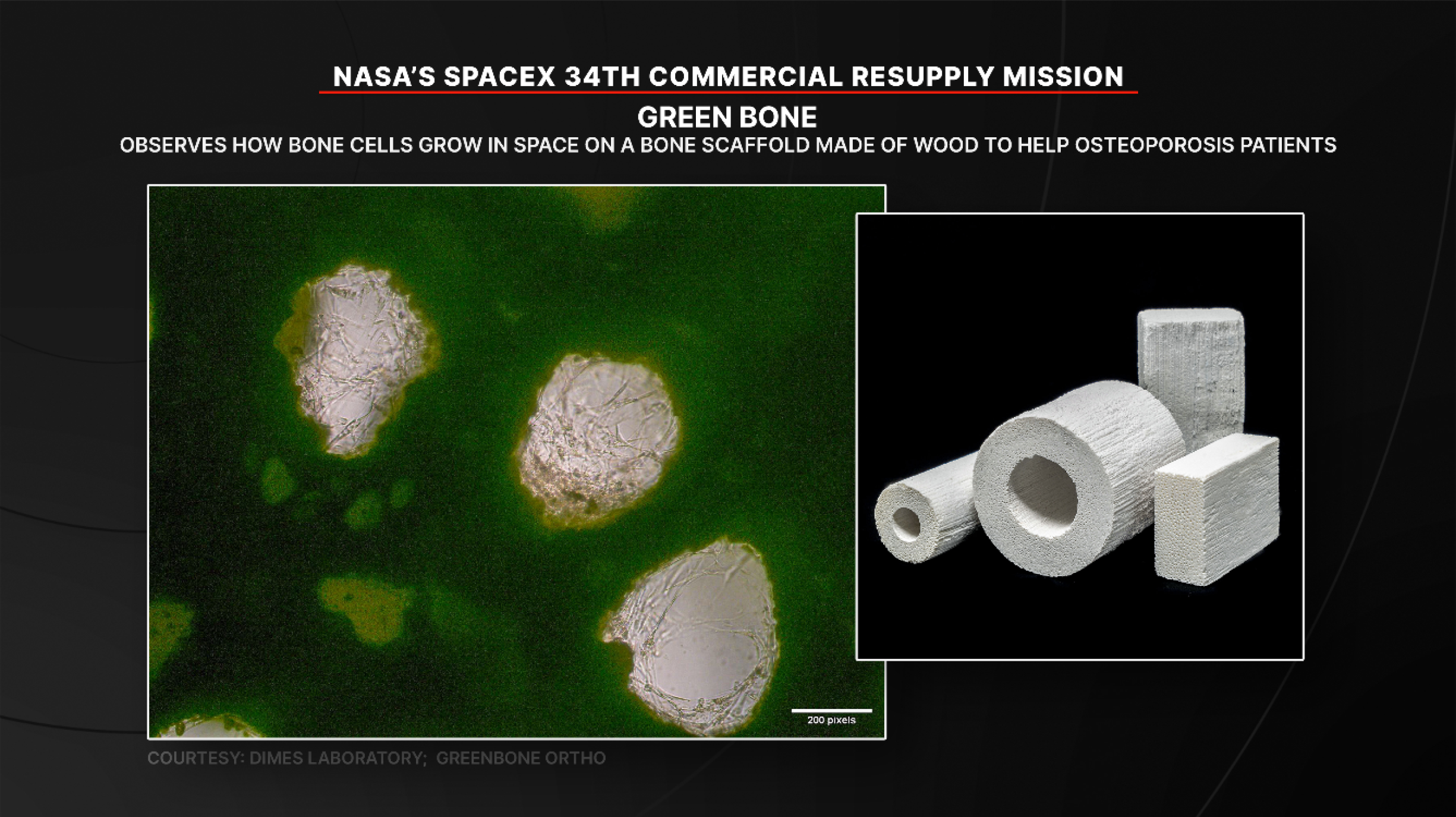
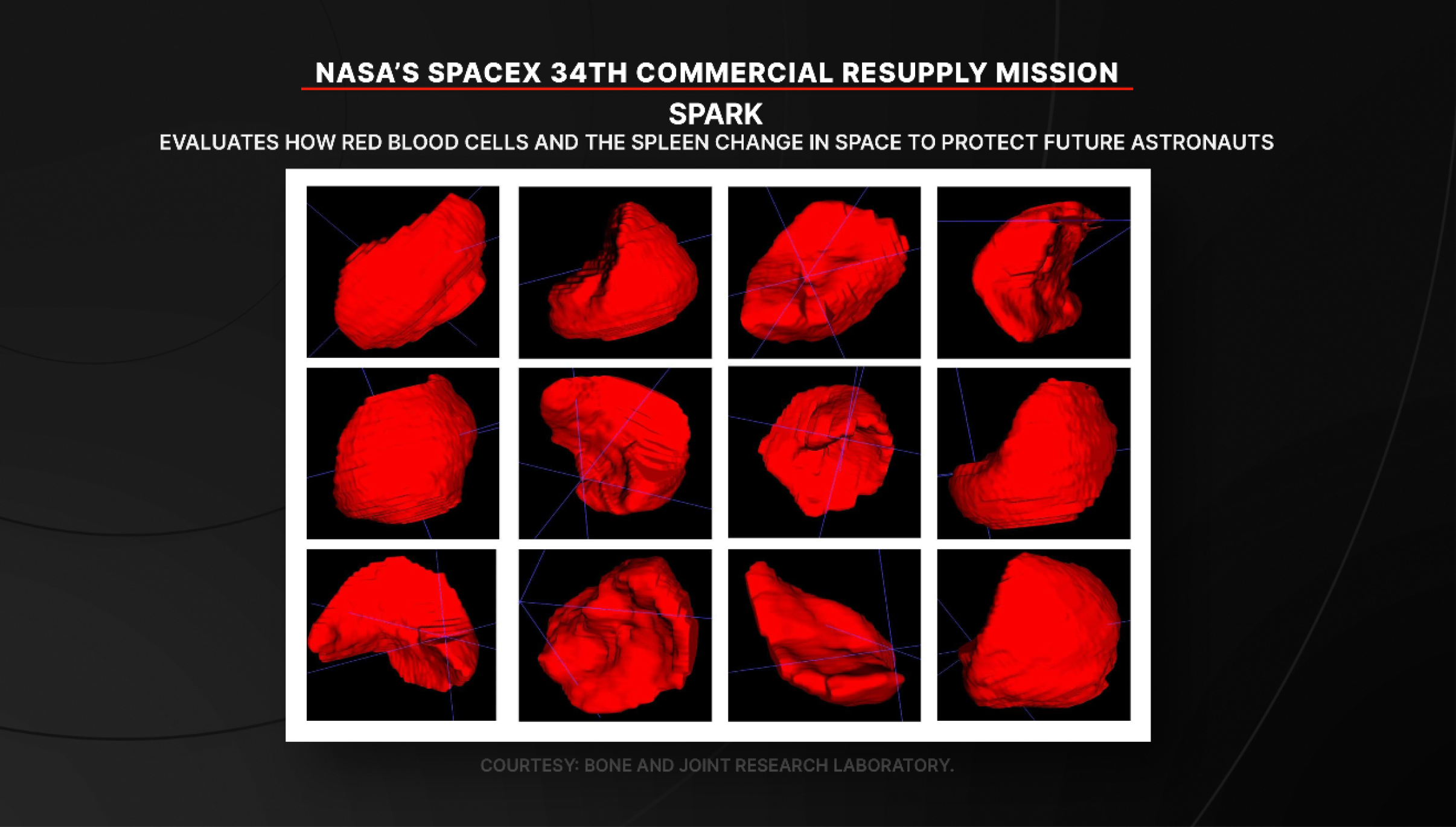
In addition to cargo for the crew aboard the space station, Dragon will deliver several new experiments, including a project to determine how well Earth-based simulators mimic microgravity conditions, a bone scaffold made from wood that could produce new treatments for fragile bone conditions like osteoporosis, and equipment to help researchers evaluate how red blood cells and the spleen change in space. The Dragon spacecraft also will carry a new instrument to study charged particles around Earth that can impact power grids and satellites, an investigation that could provide a fundamental understanding of how planets form, and an instrument designed to take highly accurate measurements of sunlight reflected by Earth and the Moon.
These experiments are just a sample of the hundreds of investigations conducted aboard the orbiting laboratory in the areas of biology and biotechnology, physical sciences, and Earth and space science. For more than 25 years, people have lived and worked continuously aboard the International Space Station, advancing scientific knowledge and making research breakthroughs that aren’t possible on Earth. The space station helps NASA understand and overcome the challenges of human spaceflight, expand commercial opportunities in low Earth orbit, and build on the foundation for long-duration missions to the Moon, as part of the Artemis program, and to Mars.
The Dragon spacecraft is scheduled to remain at the station until mid-June, when it will depart and return to Earth with time-sensitive research and cargo, ahead of splashing down off the coast of California.
Learn more about International Space Station research, operations, and its crews at:
After NASA’s Curiosity Mars rover drilled a sample from this rock on April 25, 2026, it withdrew its robotic arm and pulled the entire rock off the surface with it. Engineers spent several days repositioning the arm and vibrating the drill to try and get the rock loose. When it finally detached on May 1, […]
Show full content
NASA/JPL-Caltech/MSSS
After NASA’s Curiosity Mars rover drilled a sample from this rock on April 25, 2026, it withdrew its robotic arm and pulled the entire rock off the surface with it. Engineers spent several days repositioning the arm and vibrating the drill to try and get the rock loose. When it finally detached on May 1, the rock broke into pieces.
This close-up image of the rock was produced by Curiosity’s Mast Camera, or Mastcam, on May 6. Nicknamed “Atacama,” the rock is estimated to be 1.5 feet in diameter at its base and 6 inches thick. It would weigh roughly 28.6 pounds on Earth (and about a third of that on Mars). The circular hole produced by Curiosity’s drill is visible in the rock.
Active GalaxiesAstrophysicsAstrophysics DivisionGalaxiesGoddard Space Flight CenterHubble Space TelescopeLenticular GalaxiesThe Universe
This NASA Hubble Space Telescope image reveals an enigmatic galaxy with a bright center and a face that hints at spiral structure, yet it holds no obvious spiral arms. Reddish-brown clumps and filaments of dust partially obscure the galaxy’s full face, while red, blue, and orange light from distant galaxies shines through its diffuse outer […]
Hubble Sights Galaxy in Transition
This NASA Hubble Space Telescope images reveals the lenticular galaxy, NGC 1266. This enigmatic post-starburst galaxy has a bright center and a face that hints at spiral structure, yet it holds no discernable spiral arms.
NASA, ESA, K. Alatalo (STScI); Image Processing: G. Kober (NASA/Catholic University of America)
This NASA Hubble Space Telescope image reveals an enigmatic galaxy with a bright center and a face that hints at spiral structure, yet it holds no obvious spiral arms. Reddish-brown clumps and filaments of dust partially obscure the galaxy’s full face, while red, blue, and orange light from distant galaxies shines through its diffuse outer regions and dots the inky-black background.
NGC 1266 is a lenticular galaxy located some 100 million light-years away in the constellation Eridanus (the Celestial River). Astronomers classify lenticulars as transitional galaxies that represent an evolutionary bridge between spirals and ellipticals. Lenticulars are “lens-shaped” and have a bright central bulge and flattened disk like spirals, but they have no spiral arms and little to no star formation like ellipticals.
As interesting as this galaxy’s structure and lenticular classification are, those traits aren’t its most intriguing features. NGC 1266 is a rare post-starburst galaxy that is in transition between a galaxy that experienced a major burst of star formation and a quieter elliptical galaxy. Post-starburst galaxies have a young population of stars but few star-forming regions. Roughly one percent of the local galaxy population is a post-starburst galaxy.
Astronomers think that NGC 1266 had a minor merger with another galaxy some 500 million years ago. The merger spurred the formation of new stars and increased the mass of the galaxy’s central bulge while funneling gas into its supermassive black hole. The additional matter made the black hole much more active, creating an active galactic nucleus or AGN. The black hole’s increased activity would have generated powerful winds and jets of gas along its axis of rotation. Over time, the burst of new stars and the black hole’s powerful jets would deplete the galaxy’s reservoir of star-forming gas, while the turbulence generated in these processes suppressed new stars from forming in the gas that remained.
Observations by Hubble and other observatories reveal a strong outflow of gas from the galaxy and that the space between its stars is shocked or highly disturbed. Researchers found that any remaining stellar nurseries are in the core of the galaxy, and that very little to no star formation happens beyond that core. These observations suggest the supermassive black hole in the galaxy’s heart may be suppressing star birth by stripping or ejecting star-forming gas from the galaxy. The shockwaves from this process would create turbulence that disturbs the gas and dust between stars enough to stop any remaining matter from gravitationally condensing into infant stars.
Post-starburst galaxies like NGC 1266 are ideal subjects for astronomers to study the complex physical processes that suppress star formation. They help us better understand the evolution of galaxies and how supermassive black holes interact with their hosts.
Some parts of the planet are shown to brighten (gold) and some dim (purple) in an analysis of nearly a decade of nighttime lights data from NASA’s Black Marble product.
NASA Earth Observatory/Michala Garrison
Maps can show more than just where things are—they can also show how things change. New maps of artificial light reveal a planet that has been reshaping its nights through patterns of brightening and dimming.
The maps are based on a recent analysis of NASA’s Black Marble data, which found that instead of a gradual increase in artificial light at night over the course of nearly a decade, the patterns are much more nuanced. The analysis portrays a world flickering with industrial booms and busts, construction, and blackouts, as well as more gradual shifts, such as policy-driven retrofits.
NASA’s Black Marble product uses observations from the VIIRS (Visible Infrared Imaging Radiometer Suite) sensors on the Suomi-NPP, NOAA-20, and NOAA-21 satellites to produce records of nighttime lights at daily, monthly, and yearly time scales. The VIIRS day-night band detects nighttime light in a range of wavelengths from green to near-infrared and uses filtering techniques to observe signals such as city lights, reflected moonlight, and auroras.
The map above shows changes in brightness across most of the inhabited world (between 60 degrees south and 70 degrees north). Yellow and gold areas are where there has been more brightening during the study period, from 2014 to 2022, and purple areas are where there has been more dimming.
The visualization below shows the same data for the Eastern Hemisphere. Note that this version includes some artistic touches, such as simulated sunlight and shadows, while the nighttime lights data overlaid on the globe remain grounded in the scientific analysis. The image was featured on the cover of Nature, where the study was published in April 2026.
An analysis of nearly a decade of nighttime lights data (2014-2022) from NASA’s Black Marble product revealed areas of brightening (gold) and dimming (purple) shown here across the Eastern Hemisphere.
NASA Earth Observatory/Michala Garrison
Overall, the researchers found that global radiance increased by 34 percent during the study period, but that surge masks large areas of dimming. Such “bidirectional changes” often happen side by side. In the U.S., for example, West Coast cities grew brighter as their populations increased, while much of the East Coast showed dimming, which the team attributed to the increased use of energy-efficient LEDs and broader economic restructuring.
The authors concluded that internationally, nighttime light surged in China and northern India along with urban development, while LEDs and energy conservation measures coincided with reduced light pollution in Paris and throughout France (a 33 percent dimming), the UK (22 percent dimming), and the Netherlands (21 percent dimming). European nights dimmed sharply in 2022 during a regional energy crisis that followed the outbreak of the Russia-Ukraine conflict.
Large versions of the maps on this page can be downloaded below. Animations showing annual changes in nighttime lights throughout the study period are available from NASA’s Scientific Visualization Studio.
NASA Earth Observatory images by Michala Garrison, using data from Li, T., et al. (2026). Story by Sally Younger adapted for Earth Observatory by Kathryn Hansen.
Exploration Systems Development Mission DirectorateMars
On Thursday, NASA issued a Request for Proposal (RFP), seeking industry collaboration for the Mars Telecommunications Network. Reliable, high bandwidth communications is necessary to relay science data, high-definition imagery, and critical information during Mars missions. The network will use high-performance Mars telecommunications orbiters at the Red Planet to support future surface, orbital, and human exploration. […]
Show full content
NASA’s Perseverance Mars rover used its dual-camera Mastcam-Z imager to capture this image of “Santa Cruz,” a hill about 1.5 miles (2.5 kilometers) away from the rover, on April 29, 2021. Credit: NASA
On Thursday, NASA issued a Request for Proposal (RFP), seeking industry collaboration for the Mars Telecommunications Network.
Reliable, high bandwidth communications is necessary to relay science data, high-definition imagery, and critical information during Mars missions. The network will use high-performance Mars telecommunications orbiters at the Red Planet to support future surface, orbital, and human exploration.
This RFP builds on a draft released April 2, as well as insights gathered during the accompanying industry day at NASA’s Goddard Space Flight Center in Greenbelt, Maryland, where commercial partners provided feedback on agency objectives for the Mars Telecommunications Network.
The request seeks responses that address both current and future operational missions. It also seeks a science payload accommodation that will be selected by NASA’s Science Mission Directorate. Industry is asked to respond within 30 calendar days of the posting, and the network should be ready to operate at Mars no later than 2030.
The Mars Telecommunications Network is part of NASA’s evolving space architecture, extending continuous network services beyond Earth to the Moon and Mars. The Mars Telecommunications Network is part of NASA’s SCaN (Space Communications and Navigation) Program’s Moon to Mars strategy, and is enabled by the direction and funding provided by Congress in the Working Families Tax Cut Act.
To learn more about NASA’s deep space exploration, visit:
Cryogenic Fluid Management (CFM)Marshall Space Flight CenterSpace Technology Mission DirectorateTechnology Demonstration Missions Program
NASA is collaborating with Eta Space of Rockledge, Florida, on an in‑orbit technology demonstration to advance a key capability for future deep space missions. The Liquid Oxygen Flight Demonstration, or LOXSAT, will test cryogenic fluid management technologies necessary for creating in-space propellant depots, essentially gas stations in space, that could support long-term exploration. During a […]
Show full content
2 min read
Preparations for Next Moonwalk Simulations Underway (and Underwater)
NASA is collaborating with Eta Space of Rockledge, Florida, on an in‑orbit technology demonstration to advance a key capability for future deep space missions. The Liquid Oxygen Flight Demonstration, or LOXSAT, will test cryogenic fluid management technologies necessary for creating in-space propellant depots, essentially gas stations in space, that could support long-term exploration.
The LOXSAT payload is displayed inside Rocket Lab’s Spacecraft Production Complex in Long Beach, California. Rocket Lab
During a nine-month mission, LOXSAT will demonstrate 11 cryogenic fluid management technologies. Eta Space built LOXSAT as part of a NASA Tipping Point opportunity, and Rocket Lab is providing spacecraft and launch services to deliver it to low Earth orbit. The LOXSAT payload has been integrated with a Rocket Lab Photon satellite bus and will launch aboard the company’s Electron rocket from Launch Complex 1 on New Zealand’s Mahia Peninsula no earlier than July 17.
The technologies that LOXSAT will demonstrate were selected to address the core challenges of using cryogenic, or super-cold, propellants in microgravity, including reducing boiloff, transferring propellant, maintaining tank pressure, and gauging propellant levels. Data collected from these tests will support development of future in-space propellant depots that could refuel spacecraft as they journey to the Moon, Mars, or other deep space destinations.
Members of NASA’s Cryogenic Fluid Management project tour Rocket Lab’s Spacecraft Production Complex in Long Beach, California, on Thursday, Feb. 12, 2026 . The portfolio project team had the opportunity to view the LOXSAT payload and the setup for vibration testing. CreditRocket Lab
NASA’s LOXSAT team is composed of members of the Cryogenic Fluid Management Portfolio Project from NASA’s Marshall Space Flight Center in Huntsville, Alabama, Glenn Research Center in Cleveland, and Kennedy Space Center in Florida. The cryogenic portfolio’s work is part of NASA’s Space Technology Mission Directorate and includes more than 20 individual technology development activities.
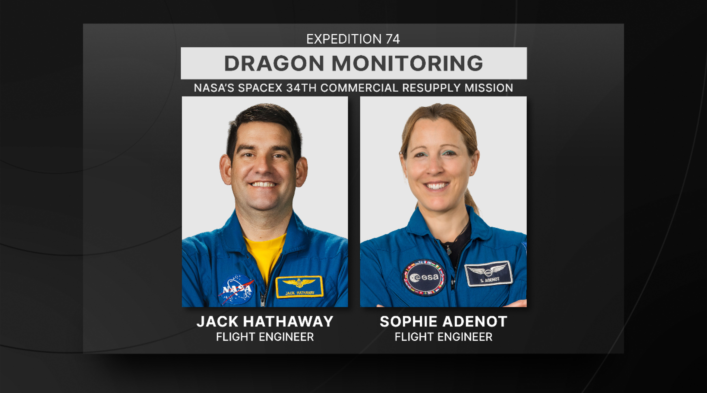
Christopher L. WilliamsInternational Space Station (ISS)Jack HathawayJessica U. Meir
NASA astronauts Jack Hathaway (bottom left), Jessica Meir (middle left), and Chris Williams (bottom right), and ESA (European Space Agency) astronaut Sophie Adenot (top right) have some fun with food and microgravity in this April 19, 2026, photo. Northrop Grumman’s Cygnus XL cargo spacecraft delivered a shipment of fresh food, including oranges, apples, onions, and […]
Show full content
You’re allowed to play with your food when you’re on the International Space Station!NASA/Chris Williams
NASA astronauts Jack Hathaway (bottom left), Jessica Meir (middle left), and Chris Williams (bottom right), and ESA (European Space Agency) astronaut Sophie Adenot (top right) have some fun with food and microgravity in this April 19, 2026, photo.
Northrop Grumman’s Cygnus XL cargo spacecraft delivered a shipment of fresh food, including oranges, apples, onions, and peppers, to the International Space Station. Cygnus XL also brought over 2,300 pounds of new research hardware and science experiments that the space station crew will use to explore blood stem cells to treat cancers and blood disorders and study ways to protect astronaut gut health. Other gear delivered aboard Cygnus XL include an advanced exercise system from ESA, new eye-imaging hardware, oxygen and nitrogen tanks to recharge spacesuits, and more.
A frozen river winds from east to west past Aniak, Alaska. Nearby meandering channels are also frozen, and much of the surrounding land is snow-covered.
NASA Earth Observatory/Michala Garrison
A river winds from east to west past Aniak, Alaska. Some stretches of the wide channel are still frozen over, while others contain broken-up ice. Most of the surrounding land is snow-free.
NASA Earth Observatory/Michala Garrison
April 21, 2026May 7, 2026
A frozen river winds from east to west past Aniak, Alaska. Nearby meandering channels are also frozen, and much of the surrounding land is snow-covered.
NASA Earth Observatory/Michala Garrison
A river winds from east to west past Aniak, Alaska. Some stretches of the wide channel are still frozen over, while others contain broken-up ice. Most of the surrounding land is snow-free.
NASA Earth Observatory/Michala Garrison
April 21, 2026
May 7, 2026
CurtainToggle2-Up
Image Details
The landscape along the Kuskokwim River near Aniak, Alaska, is frozen on April 21, 2026 (left), while spring melt and river ice breakup are evident on May 7, 2026 (right). Both images were acquired with the OLI (Operational Land Imager) on Landsat 9. NASA Earth Observatory images by Michala Garrison.
Thawing may be a welcome sight for Alaskans following a remarkably cold winter and early spring in much of the state. But with melting comes the threat of rapid flooding in low-lying areas as river ice breaks up and periodically jams.
The landscape along the Kuskokwim River appeared frozen in a Landsat 9 image acquired on April 21, 2026 (left). According to observations published by the Alaska-Pacific River Forecast Center, river ice near the town of Aniak was thick and still covered in deep snow as of April 16. The Kuskokwim ice road connecting numerous villages traces a dark line down the river. The thick river ice supported a route that extended about 350 miles (560 kilometers) in winter 2025-2026 and shut down for the season on April 10, according to news reports.
Conditions were changing quickly around May 7, when the right image was acquired. The previous day, the front of the ice breakup had nearly reached Aniak, and a sheet of grounded ice caused a jam that stretched 21 miles (34 kilometers) upstream. News reports showed ice chunks several feet thick piled up on riverbanks around the town. Ice became unstuck by May 7, and the backup, visible above (right), had started to flow downstream.
Aniak remained at risk, however, as ice clogged the river later that night, this time several miles downstream from the community. Waters began to rise, and a flood watch was issued for the town on May 8. Water inundated low-lying areas and encroached on homes and businesses near the east side of the runway, according to reports, before receding two days later.
Flooding caused by spring breakup can be most hazardous when heavy snowpack and thick ice remain in place from the winter and there’s a sudden transition from freezing to warmer temperatures. In what is known as a dynamic breakup, snowmelt encounters intact ice and causes water to back up quickly. On the other hand, if ice weakens before significant snowmelt or ice from upstream arrives, jams are less likely to form.
Forecasters noted that spring 2026 showed warning signs of a dynamic breakup. Snowpack was above average in some major river drainages, and historically low temperatures marked the winter and spring months in many places. For example, the March average temperature in Bethel, downstream of Aniak, was 14 degrees Fahrenheit (8 degrees Celsius) below normal. However, floods had been relatively minor along the large rivers through early May, experts noted, while cautioning that more severe flooding still has the potential to develop quickly.
NASA Earth Observatory images by Michala Garrison, using Landsat data from the U.S. Geological Survey. Story by Lindsey Doermann.
Technology Transfer & SpinoffsSpinoffsTechnology Transfer
An innovative 3D printing process that advanced NASA’s approach to outfitting a lunar habitat is making buildings on Earth beautiful, efficient, and strong. Instead of building structures layer by layer, Branch Technology Inc. of Chattanooga, Tennessee, has developed a process the company calls Freeform 3D Printing, which creates shapes with lightweight lattice structures that can be filled or covered. The company uses the technique to manufacture […]
Show full content
3 min read
Preparations for Next Moonwalk Simulations Underway (and Underwater)
Branch’s work outfitting a prototype of a lunar surface habitat they developed, pictured here, under a cooperative agreement with Marshall Space Flight Center, helped the company evolve its printing processes.Credit: Branch Technology Inc.
An innovative 3D printing process that advanced NASA’s approach to outfitting a lunar habitat is making buildings on Earth beautiful, efficient, and strong.
Instead of building structures layer by layer, Branch Technology Inc. of Chattanooga, Tennessee, has developed a process the company calls Freeform 3D Printing, which creates shapes with lightweight lattice structures that can be filled or covered. The company uses the technique to manufacture visually interesting, modular building elements, such as wall panels and cladding.
“Our process eliminates a ton of material from something that otherwise might be printed solid all the way through,” said David Goodloe, who leads Branch Technology’s Advanced Concepts team, which manages the company’s NASA collaborations.
In 2017, the company won Phase II of NASA’s 3D-Printed Habitat Challenge, a public competition to build a habitat for deep space exploration.
Tracie Prater, a technical manager in the Habitat Systems Development Branch at NASA’s Marshall Spaceflight Center in Huntsville, Alabama, served as a subject matter expert for the challenge and worked with Branch Technology on a cooperative agreement.
“With the 3D-Printed Habitat Challenge, teams were focused on how to build a large habitat structure on a planetary surface,” said Prater. “But once that structure is pressurized and ready for crew occupancy, how do you populate it with systems and supplies? That’s what Branch was looking at through the cooperative agreement — what their on-demand fabrication process enables in terms of novel designs for interior items.”
NASA’s parameters for the habitat challenge led Branch to develop its nozzles to extrude unique lattice structures as well as more traditional layers. The company uses this dual capability frequently in its wall panels where traditionally printed sections offer solid substrates for attaching fasteners.
The polymers Branch extrudes were informed by its materials science research for the 3D-Printed Habitat Challenge, which asked that print material be made of something like the dust and rocks found on the Martian surface and mission recyclables. Branch came up with a basalt fiber-reinforced plastic and from that work went on to develop an optimal loading recipe for its terrestrial “inks.”
These innovations exemplify the purpose of NASA’s Technology Transfer program within the Space Technology Mission Directorate, which uses space-based solutions to improve life on Earth. For 50 years, NASA has documented the everyday benefits of space technology through the agency’s Spinoff publication.
“Rise,” the Artemis II zero gravity indicator, is seen sitting on the dais as NASA astronauts Reid Wiseman, Victor Glover, and Christina Koch, and CSA (Canadian Space Agency) astronaut Jeremy Hansen speak with congressional staff, Tuesday, May 12, 2026, in Washington. NASA’s Artemis II mission took Wiseman, Glover, Koch, and Hansen on a nearly 10-day […]
Show full content
NASA/Joel Kowsky
“Rise,” the Artemis II zero gravity indicator, is seen sitting on the dais as NASA astronauts Reid Wiseman, Victor Glover, and Christina Koch, and CSA (Canadian Space Agency) astronaut Jeremy Hansen speak with congressional staff, Tuesday, May 12, 2026, in Washington.
NASA’s Artemis II mission took Wiseman, Glover, Koch, and Hansen on a nearly 10-day journey around the Moon and back to Earth in April 2026.
Artemis 3ArtemisMissionsOrion Multi-Purpose Crew VehicleSpace Launch System (SLS)
NASA is moving quickly to define next year’s Artemis III mission in Earth orbit, a crewed flight that will test rendezvous and docking capabilities between the agency’s Orion spacecraft and commercial landers from Blue Origin and SpaceX. Since a February announcement adding an Artemis mission ahead of crewed landing missions to the Moon’s South Pole region, […]
Show full content
The Sun rises behind NASA’s Artemis II SLS (Space Launch System) rocket and Orion spacecraft on top of a mobile launcher at Launch Complex 39B at NASA’s Kennedy Space Center in Florida on March 30, 2026.Credit: NASA/Jim Ross
NASA is moving quickly to define next year’s Artemis III mission in Earth orbit, a crewed flight that will test rendezvous and docking capabilities between the agency’s Orion spacecraft and commercial landers from Blue Origin and SpaceX. Since a February announcement adding an Artemis mission ahead of crewed landing missions to the Moon’s South Pole region, engineers have been evaluating mission profile options and operational considerations for Artemis III to ensure the test flight helps the agency and its partners reduce risk ahead of the next Americans landing on the Moon during Artemis IV.
“While this is a mission to Earth orbit, it is an important stepping stone to successfully landing on the Moon with Artemis IV. Artemis III is one of the most highly complex missions NASA has undertaken,” said Jeremy Parsons, Moon to Mars acting assistant deputy administrator, NASA’s Exploration Systems Development Mission Directorate in Washington. “For the first time, NASA will coordinate a launch campaign involving multiple spacecraft integrating new capabilities into Artemis operations. We’re integrating more partners and interrelated operations into this mission by design, which will help us learn how Orion, the crew, and ground teams all interact together with hardware and teams from both providers before we send astronauts to the Moon’s surface and build a Moon Base there.”
The mission is planned to carry out a series of objectives designed to demonstrate critical systems needed for a future lunar landing. During the Artemis III mission, the SLS (Space Launch System) rocket will launch the Orion spacecraft from NASA’s Kennedy Space Center in Florida with four crew members. Instead of using the interim cryogenic propulsion stage as the upper stage of the rocket, NASA will use a “spacer,” a representation of the mass and overall dimensions of an upper stage but without propulsive capabilities. The spacer will maintain the same overall dimensions and interface connection points as the upper stage between the Orion stage adapter and launch vehicle stage adapter.
Design and fabrication activities for the spacer are progressing rapidly at NASA’s Marshall Space Flight Center in Huntsville, Alabama. Material for the barrel section and the upper and lower rings is currently being machined at Marshall in preparation for upcoming welding operations.
The Artemis III core stage sits in High Bay 2 in the Vehicle Assembly Building at NASA Kennedy with the core stage tank attached to its engine section on May 12, 2026.Credit: NASA/Kim Shiflett
After the rocket delivers Orion to orbit, the spacecraft’s European-built service module will provide propulsion to circularize Orion’s orbit around the planet in low Earth orbit. This orbit increases overall mission success by allowing more launch opportunities for each element as compared to a lunar mission — SLS carrying Orion and its crew, SpaceX’s Starship human landing system pathfinder, and Blue Origin’s Blue Moon Mark 2 human landing system pathfinder.
Informed by Blue Origin and SpaceX capabilities, NASA also is defining the concept of operations for the mission. While some decisions are yet to be determined, astronauts could potentially enter at least one lander test article.
The crew will spend more time aboard Orion than during Artemis II, further advancing the evaluation of life support systems, and for the first time will demonstrate the docking system performance. The mission will inform lander rendezvous and habitation concepts and mission operations in preparation for future surface missions. The agency also plans to test an upgraded heat shield during Orion’s return to Earth to enable more flexible and robust reentry profiles for future missions.
The Artemis III Orion service module is pictured ahead of acoustic testing in NASA’s Kennedy Space Center Operations and Checkout Facility on May 7, 2026.NASA/Jess Ruffa
Over the coming weeks, NASA will continue to refine specific plans for the flight, including a timeline for identifying astronauts to train for mission operations, options to evaluate Axiom’s AxEMU spacesuit lander interfaces ahead of lunar surface missions, mission duration, and potential science operations for the flight. NASA has asked for industry input on potential solutions to improve the communications with the ground during the mission since the Deep Space Network will not be used. The agency also is seeking both international and domestic interest in potentially flying CubeSats to deploy in Earth orbit, and may share other opportunities as the concept of operations for the mission is further defined.
As part of the Golden Age of innovation and exploration, NASA will send Artemis astronauts on increasingly difficult missions to explore more of the Moon for scientific discovery, economic benefits, establish an enduring human presence on the lunar surface, and to build on our foundation for the first crewed missions to Mars.
ISS ResearchHumans in SpaceInternational Space Station (ISS)
Expedition 74 astronauts aboard the International Space Station are uncovering how bacteria that causes pneumonia can lead to long-term damage in the heart. Researchers are leveraging the space environment to observe how stem cell derived heart tissues respond to bacterial infections, to discover new methods to manage cardiovascular health and infectious diseases. In space, bacteria […]
Show full content
NASA astronaut Jack Hathaway works on MVP Cell-09 research inside a portable glovebag aboard the International Space Station.ESA/Sophie Adenot
Expedition 74 astronauts aboard the International Space Station are uncovering how bacteria that causes pneumonia can lead to long-term damage in the heart. Researchers are leveraging the space environment to observe how stem cell derived heart tissues respond to bacterial infections, to discover new methods to manage cardiovascular health and infectious diseases.
In space, bacteria tend to be more severe and have enhanced drug resistance. Scientists are harnessing these traits to exaggerate their effect on heart cells and reveal important cellular responses that would be difficult to detect on Earth. Pinpointing the factors that make bacterial infections more severe in space could reveal targets for treatment. Dr. Palaniappan Sethu, professor of Medicine and Biomedical Engineering at the University of Alabama at Birmingham says, “By exacerbating the infection, we anticipate clear separation of the infection and control groups, making it easier to identify subtle factors that promote bacterial virulence”.
Preflight imagery of stem cell derived heart tissue models produced for the MVP Cell-09 investigation.University of Alabama at Birmingham
The Streptococcus pneumoniae bacteria is the leading cause of community-acquired pneumonia (CAP), an infection which causes millions of deaths each year. More than a quarter of adults hospitalized for CAP develop heart disease and patients that survive severe cases have an increased risk even after the pneumonia has been fully eradicated.
This research is also important as humans venture further into space. For over 25 years, researchers have utilized the space station to study how the human body and microbes respond to space, and deep space missions will require the strategies and knowledge we gain. “Addressing these questions is essential for ensuring human health during long duration space travel and for enabling sustainable habitation beyond Earth. Our experiments are expected to generate new insights into how space specific factors influence disease progression”, says Dr. Carlos J. Orihuela, professor of Microbiology at the University of Alabama at Birmingham.
From left to right: Redwire Space researchers Grant Vellinger and Dr. Aaron Rogers, and University of Alabama at Birmingham researchers Dr. Vipin Chembilikand and Dr. Ian Berg prepare MVP Cell-09 ahead of launch to the space station.University of Alabama at Birmingham
The space station allows researchers from around the world to address complex human health problems on Earth and in space. Using the unique environmental factors aboard the space station allows for advanced study of disease formation, testing drugs and diagnostic tools, and more.
NASA’s TESS has released its most complete view of the starry sky to date
Show full content
3 min read
NASA’s Planet-Hunting TESS Reveals Dazzling Night Sky
NASA’s TESS (Transiting Exoplanet Survey Satellite) has released its most complete view of the starry sky to date, filling in gaps from previous observations. Nearly 6,000 colored dots scattered across the image show the locations of either confirmed or candidate exoplanets — worlds beyond our solar system — identified by the mission as of September 2025 at the end of TESS’s second extended mission.
“Over the last eight years, TESS has become a fire hose of exoplanet science,” said Rebekah Hounsell, a TESS associate project scientist at the University of Maryland Baltimore County and NASA’s Goddard Space Flight Center in Greenbelt, Maryland. “It’s helped us find planets of all different sizes, from tiny Mercury-like ones to those larger than Jupiter. Some of them are even in the habitable zone, where liquid water might be possible on the surface, an important factor in our search for life beyond Earth.”
The TESS mission scans a wide swath of the sky, called a sector, for about a month at a time using its four cameras. These long stares allow the spacecraft to track the brightness changes of tens of thousands of stars, looking for variations in their light that might come from orbiting planets.
Researchers assembled an all-sky mosaic made of 96 sectors observed between April 2018, when TESS began its work, and September 2025.
This view of the whole sky was constructed from 96 TESS sectors. By the end of September 2025, when the last image of this mosaic was captured, TESS had discovered 679 exoplanets (blue dots) and 5,165 candidates (orange dots). The glowing arc running through the center is the plane of the Milky Way. The Large Magellanic Cloud can be seen along the bottom edge just left of center. Black areas within the oval indicate regions TESS has not yet imaged.
NASA/MIT/TESS and Veselin Kostov (University of Maryland College Park)
Download high-resolution images from NASA’s Scientific Visualization Studio.
The blue dots in the image mark the locations of nearly 700 confirmed planets, as of September 9. This menagerie includes worlds that may be covered by volcanoes, are being destroyed by their stars, or orbit two stars — experiencing double sunrises and sunsets each day. The orange dots represent more than 5,000 candidate planets that are awaiting verification.
Also captured in the mosaic is the bright plane of our Milky Way galaxy, seen as a glowing arc through the center. The bright white ovals in the lower left are the Large and Small Magellanic Clouds. These satellite galaxies are located 160,000 and 200,000 light-years away, respectively.
“The more we dig into the large TESS dataset, especially using automated algorithms, the more surprises we find,” said Allison Youngblood, the TESS project scientist at NASA Goddard. “In addition to planets, TESS has helped us study rivers of young stars, observe dynamic galactic behavior, and monitor asteroids near Earth. As TESS fills in more of the night sky, there’s no knowing what it might see next.”
You could discover the next exoplanet! Join the Planet Hunters TESS citizen science project, and you’ll learn how to read light curves — plots of light data from distant stars — to find telltale signals from orbiting exoplanets.
In a process that played out over thousands of years, a retreating ice sheet carved, scoured, and shaped the landscape of the present-day Great Lakes. In northern Lake Michigan, this sculpting left distinct ridges and valleys running north-to-south along the lake floor. Some parts of those ridges, made of erosion-resistant rock, have remained above the waves of the big lake, forming the Beaver Archipelago.
The OLI (Operational Land Imager) on Landsat 9 captured this image of several of the archipelago’s islands on August 2, 2024. These patches of land contain upland forests, dunes, wetlands, and marshes—habitats that support rare plant and bird species and provide spawning grounds for fish. The bright, sandy perimeters of the islands are surrounded by shallow, turquoise waters and deeper, dark blue areas, where depths reach up to about 330 feet (100 meters).
This image centers on Beaver Island, the largest island in Lake Michigan at 13 miles (21 kilometers) long and 6 miles (10 kilometers) wide. It is also the only inhabited island of the Beaver Archipelago, and many of its approximately 600 residents are of Irish descent. In the mid-1800s, scores of immigrants from County Donegal, Ireland, and Irish fishermen from nearby islands and ports in Michigan settled on the island, which subsequently took on the moniker of “America’s Emerald Isle.”
The farming and fishing, in particular, were productive for the new arrivals. In the 1880s, Beaver Island became the largest supplier of freshwater fish in the United States. Due to overfishing, however, such abundance would be short-lived.
Ship traffic on the Great Lakes was also increasing during this time. Two lighthouses were constructed on the island to help the growing number of vessels traveling between Chicago and the Straits of Mackinac. The Beaver Head Lighthouse operated from 1852 to 1962 on the southern end of the island. On the northern side, the Beaver Island Harbor Light, pictured below, was first lit in 1870 and remains an active beacon more than 150 years later.
Today, people travel to Beaver Island by boat or plane to explore its history and enjoy activities such as biking, fishing, and kayaking. The island’s remote location and minimal light pollution led to the establishment of the Beaver Island State Wildlife Research Area International Dark Sky Sanctuary in 2024. Sky gazers may be drawn to the sanctuary for a chance to glimpse the aurora borealis and other celestial phenomena.
Neighboring islands in the archipelago are more difficult to access and have remained relatively undisturbed. Perched, or cliff-top, sand dunes are found up to 200 feet (60 meters) above the lake level on the western side of High Island. Unique plant species, including the Pitcher’s thistle and Lake Huron tansy, grow in the island’s dunes. On Hog Island, patches of old-growth northern hardwood forest remain. Wetland communities known as Great Lakes marshes along the shoreline provide spawning grounds for perch and smallmouth bass.
NASA Earth Observatory image by Wanmei Liang, using Landsat data from the U.S. Geological Survey. Photo by Kelcie Herald/Unsplash. Story by Lindsey Doermann.
At a busy airport, every aircraft in the area shares just a handful of radio frequencies. Spectrum and time are constrained and if multiple people speak at once, both messages can get lost. Communications like “clearance delivery,” which require long transmissions and readbacks, are challenging in high-traffic areas, particularly when weather or other factors require […]
Show full content
At a busy airport, every aircraft in the area shares just a handful of radio frequencies. Spectrum and time are constrained and if multiple people speak at once, both messages can get lost. Communications like “clearance delivery,” which require long transmissions and readbacks, are challenging in high-traffic areas, particularly when weather or other factors require many aircraft to communicate with controllers at once. Going digital clears that channel for urgent, time-critical calls, among other things. And it’s the current practice at some airports, where pilots can confirm clearances with the touch of a button, that the response goes directly to the controller’s screen, and the updated information loads into their flight management system.
Will Cummings-Grande, aerospace engineer with the Systems Analysis and Concepts Directorate based at NASA’s Langley Research Center, is leading technical work that centers around Communications Architecture and Performance for Digital Clearance in NASA’s Air Traffic Management and Safety (ATMS) project. He’s researching the next layer of digital clearance, extending that same logic down to taxi instructions on the ground, so that pushback timing, routing, and runway assignments could also arrive digitally rather than over the radio.
He sought out the most current, ground-level knowledge about how digital clearance delivery works in practice — not in a research paper, but in a real tower, on real systems, with the people who run them every day. The Federal Aviation Administration (FAA) offers the training he wanted to air traffic controllers, so he reached out to the FAA Academy “on a hope and a prayer” that they might accept him as a student.
And in early April, Cummings-Grande traveled to the Mike Monroney Aeronautical Center (MMAC) in Oklahoma City to complete the Tower Data Link Services (TDLS) Application Specialist training — the same two-day, hands-on course required of working controllers at the 72 U.S. airports currently equipped with digital clearance delivery capability.
Will Cummings-Grande, aerospace engineer with the Systems Analysis and Concepts Directorate, based at NASA’s Langley Research CenterCredit: NASAThe air traffic control tower at the Mike Monroney Aeronautical Center in Oklahoma City, where Cummings-Grande visited to observe the Tower Data Link Services system in live operation. Credit: Will Cummings-Grande/NASAIn the Classroom
Cumming-Grande shadowed a working controller during exercises, trading off at the terminal during breaks so both got time on the system. His classmates were application specialists from Seattle, Sacramento, San Jose, and Fort Lauderdale, all controllers with day jobs managing high-traffic airspace who were there to become the designated system maintainers at their home airports. During breaks, Cummings-Grande had a luxury: time to test. “I got to bounce some of my ideas and concepts off of controllers who are out there interacting with the TDLS and all of the tools it touches in the current system,” he said. “It was great to have both — here’s what the controller-in-training gets, and here’s what I get as a researcher — kind of lumped into the same experience.”
The FAA Academy also connected him with the systems engineers responsible for developing, testing, and implementing new TDLS hardware and software versions, and arranged a visit to the OKC tower to observe the system in live operation.
What He Found
The TDLS runs on fully air-gapped software, completely isolated from standard operating systems — a deliberate cybersecurity design that made the hands-on experience revelatory in ways a research paper couldn’t replicate. “Interacting with the system was just very eye-opening as to how different these systems are from other computers that we commonly interact with,” he said.
The more significant discovery came from the curriculum itself. Reviewing the FAA’s system architecture during training, Cummings-Grande noticed something he didn’t know to look for: a link between the TDLS and the Terminal Flight Data Manager (TFDM), which does not yet exist operationally. That gap is now the center of his research questions. “I didn’t realize I was missing this piece until I took this course,” he said.
Building on Two Decades of Homework
The research Cummings-Grande is pursuing connects to a long thread of NASA work on surface safety and digital communications, including the Terminal Area Productivity program, the Surface Operation Automation Research (SOAR) project, the Low Visibility Landing and Surface Operations (LVLASO) project, and Surface Trajectory Based Operations (STBO) studies. These efforts kicked off in the mid-90s to inform FAA NextGen and demonstrated digital taxi clearances in a series of simulations at multiple facilities and ultimately flight tests at the Atlanta Airport. Those findings showed meaningful workload reductions, but the cost-benefit case wasn’t there yet, and the technology wasn’t ready in the fleet or in the facilities.
What’s changed, in Cummings-Grande’s view, is the convergence of new infrastructure investments, including the rollout of systems derived from Airspace Technology Demonstration (ATD-2) technologies like the Spot and Runway Departure Advisor and the Precision Departure Release Capability through the TFDM, with renewed industry interest from a partner on the aircraft side. “We have all this homework that people have been doing for the last 20-30 years,” he said. “Can we take advantage of the renewed interest from FAA and industry to enable this safety-enhancement?”
His timeline estimate for a fully implemented system leans somewhere in the range of five to ten years. And the payoff, he says, will be tangible to anyone who flies. “This means that your flight will be safer than ever, and that your pilots will be focused on the right things during taxi. Instead of relying on pilots to write down their taxi clearance correctly or be familiar with the airport, the airplane will know and can double-check what the pilot is doing.”
A Case for Partnership
Cummings-Grande isn’t aware of another NASA researcher having taken this FAA course, and he thinks the model is worth repeating. He pointed to terminal procedures design (TERPS) as another area where FAA Academy training could benefit researchers working on urban air mobility and small UAS integration. “Anytime someone needs to do a deep dive into one of the systems — understanding the current state of practice, here are the buttons you push to make this happen — I think it’d be great to have an ongoing partnership with the FAA Academy and make that possible.”
The FAA Academy team was, by all accounts, a willing partner.
Will Cummings-Grande met an unexpected security detail during his final day at MMAC — a goose standing guard over a vintage Lear Fan 2100 parked outside the Civil Aerospace Medical Institute. “I hear a hiss, and I look down, and there’s a goose who is defending their favorite airplane.”Credit: Will Cummings-Grande/NASA
NASA’s Perseverance rover recently took a self-portrait against a sweeping backdrop of ancient Martian terrain at a location the science team calls “Lac de Charmes.” Assembled from 61 individual images, the selfie shows Perseverance training its mast on a rocky outcrop in the foreground after creating a circular abrasion patch, with the western rim of […]
Show full content
NASA/JPL-Caltech/MSSS
NASA’s Perseverance rover recently took a self-portrait against a sweeping backdrop of ancient Martian terrain at a location the science team calls “Lac de Charmes.” Assembled from 61 individual images, the selfie shows Perseverance training its mast on a rocky outcrop in the foreground after creating a circular abrasion patch, with the western rim of Jezero Crater stretching into the background. During abrading, the rover grinds down a portion of the rock’s surface, allowing the science team to analyze what’s inside. The selfie was captured on March 11, the 1,797th Martian day (or sol) of the mission, during the rover’s deepest push west beyond the crater.
NASA’s Perseverance Mars rover recently took a self-portrait against a sweeping backdrop of ancient Martian terrain at a location the science team calls “Lac de Charmes.” Assembled from 61 individual images, the selfie shows Perseverance training its mast on a rocky outcrop on which it had just made a circular abrasion patch, with the western […]
Show full content
6 min read
Preparations for Next Moonwalk Simulations Underway (and Underwater)
NASA’s Perseverance looks down at a rocky outcrop nicknamed “Arethusa” and then appears to look into the camera in this animated selfie, which is composed of 61 images taken March 11, 2026, during the rover’s deepest push west beyond Jezero Crater. NASA/JPL-Caltech/MSSS
NASA’s Perseverance Mars rover recently took a self-portrait against a sweeping backdrop of ancient Martian terrain at a location the science team calls “Lac de Charmes.” Assembled from 61 individual images, the selfie shows Perseverance training its mast on a rocky outcrop on which it had just made a circular abrasion patch, with the western rim of Jezero Crater stretching into the background. The selfie was captured on March 11, the 1,797th Martian day, or sol, of the mission, during the rover’s deepest push west beyond the crater.
Perseverance is in its fifth science campaign, known as the Northern Rim Campaign, of its mission on the Red Planet. The Lac de Charmes region represents some of the most scientifically compelling terrain the rover has visited.
NASA’s Perseverance captured this enhanced-color panorama of an area nicknamed “Arbot” on April 5, the 1,882nd Martian day, or sol, of the mission. Made of 46 images, the panorama offers one of the richest geological vistas of the rover’s mission, revealing a windswept landscape of diverse rock textures.NASA/JPL-Caltech/ASU/MSSS
“We took this image when the rover was in the ‘Wild West’ beyond the Jezero Crater rim — the farthest west we have been since we landed at Jezero a little over five years ago,” said Katie Stack Morgan, Perseverance’s project scientist at NASA’s Jet Propulsion Laboratory in Southern California. “We had just abraded and analyzed the ‘Arethusa’ outcrop, and the rover was sitting in a spot that provided a great view of both the Jezero Rim and the local terrain outside of the crater.”
During abrading, the rover grinds down a portion of the rock’s surface, allowing the science team to analyze what’s inside. The technique enabled the team to determine that the Arethusa outcrop is composed of igneous minerals that likely predate the formation of Jezero Crater. Igneous rocks with large mineral crystals form underground as molten rock cools and solidifies. Perseverance acquired the selfie — its sixth since landing on Mars in 2021 — using the WATSON (Wide Angle Topographic Sensor for Operations and eNgineering) camera mounted at the end of its robotic arm, which made 62 precision movements over approximately one hour to build the composite image (learn more about how selfies are made).
Significant science
Along with the selfie, Perseverance used Mastcam-Z, located on its mast, to capture a mosaic of the “Arbot” area in Lac de Charmes on April 5, or Sol 1882. Made of 46 images, the panorama offers one of the richest geological vistas of the mission, revealing a windswept landscape of diverse rock textures.
The image provides the team a clear road map for investigating the ridgeline and the area’s ancient rock variety, including what appear to be megabreccia — large fragments (some the size of skyscrapers) hurled by a massive meteorite impact that occurred on the plain called Isidis Planitia about 3.9 billion years ago.
“What I see in this image is excellent exposure of likely the oldest rocks we are going to investigate during this mission,” said Ken Farley, Perseverance’s deputy project scientist at Caltech in Pasadena. “There is a sharp ridgeline visible in the mosaic whose jagged, angular texture contrasts starkly with the rounded boulders in the foreground. We also see a feature that may be a volcanic dike, a vertical intrusion of magma that hardened in place and was left standing as the softer surrounding material eroded away over billions of years.”
The rock color in the mosaic offers less information to the science team than the distinctive textures, which help them differentiate the rock types. Unlike Jezero Crater’s river delta, which is composed of sedimentary rock, some rocks here appear to be extrusive igneous rocks (molten rock that reached the surface as lava flows) and impactites (rocks created or modified by a meteorite impact) believed to have formed before the crater about 4 billion years ago, offering a window into the planet’s deep early crust.
New ballgame, near-marathon distance
“The rover’s study of these really ancient rocks is a whole new ballgame,” said Stack Morgan. “These rocks — especially if they’re from deep in the crust — could give us insights applicable to the entire planet, like whether there was a magma ocean on Mars and what initial conditions eventually made it a habitable planet.”
After studying Arethusa, Perseverance drove northwest to the Arbot area, where it has been analyzing other rocky outcrops. When the team is satisfied with the work accomplished there, the rover will drive south to “Gardevarri,” a site with a notably clear exposure of olivine-bearing rocks. Formed in cooling magma, these types of rocks contain information that can help scientists better understand Mars’ volcanic history and provide context for large-scale geological processes. From there, the rover is expected to head southeast toward a region the team is calling “Singing Canyon” for more insights into the planet’s early crust.
After more than five years of surface operations, Perseverance has abraded 62 rocks, collected 27 rock cores in its sample tubes (25 sealed, 2 unsealed), and traveled almost 26 miles (42 kilometers) — in other words, just shy of a marathon (26.2 miles, or 42.195 kilometers).
“Having the benefit of four previous rover missions, the Perseverance team has always known our mission was a marathon and not a sprint,” said acting Perseverance project manager Steve Lee at JPL. “We’ve almost reached marathon distance. Our selfie may show that the rover is a bit dusty, but its beauty is more than skin deep. Perseverance is in great shape as we continue our explorations and extend into ultramarathon drive distances.”
More about Perseverance
NASA’s Jet Propulsion Laboratory, which is managed for the agency by Caltech, built and manages operations of the Perseverance rover on behalf of NASA’s Science Mission Directorate in Washington, as part of NASA’s Mars Exploration Program portfolio. The WATSON imaging system was built by, and is operated by, Malin Space Science Systems in San Diego.
Description NASA’s Perseverance Mars rover used its Mastcam-Z camera to capture this panorama of an area nicknamed “Arbot” on April 5, 2026, the 1,882nd Martian day, or sol, of the mission, during the rover’s deepest push west beyond Jezero Crater. Made of 46 images, the panorama offers one of the richest geological vistas of the […]
Show full content
1 Min Read
NASA’s Perseverance Captures Panorama at ‘Arbot’
PIA26753
Credits:
NASA/JPL-Caltech/ASU/MSSS
Photojournal Navigation
Downloads
NASA’s Perseverance Captures Panorama at ‘Arbot’
PNG (132.21 MB)
PIA26753 Figure A
PNG (117.68 MB)
PIA26753 Figure B
PNG (67.84 MB)
Description
NASA’s Perseverance Mars rover used its Mastcam-Z camera to capture this panorama of an area nicknamed “Arbot” on April 5, 2026, the 1,882nd Martian day, or sol, of the mission, during the rover’s deepest push west beyond Jezero Crater. Made of 46 images, the panorama offers one of the richest geological vistas of the mission, revealing a windswept landscape of diverse rock textures. This is an enhanced-color version, which had its color bands processed to improve visual contrast and accentuate color differences.
Figure A
Figure A is a natural-color version of the mosaic.
Figure B
Figure B is a 3D anaglyph version designed for use with red-blue glasses. It is composed of 92 images collected by Mastcam-Z.
NASA’s Jet Propulsion Laboratory, which is managed for the agency by Caltech in Pasadena, California, built and manages operations of the Perseverance rover. Arizona State University leads the operations of the Mastcam-Z instrument, working in collaboration with Malin Space Science Systems in San Diego, on the design, fabrication, testing, and operation of the cameras, and in collaboration with the Niels Bohr Institute of the University of Copenhagen on the design, fabrication, and testing of the calibration targets.
Description NASA’s Perseverance Mars rover took this selfie on March 11, 2026, the 1,797th Martian day, or sol, of the mission, during the rover’s deepest push west beyond Jezero Crater. Assembled from 61 individual images, the selfie shows Perseverance training its mast on the “Arethusa” rocky outcrop after creating a whitish circular abrasion patch. The […]
NASA’s Perseverance Mars rover took this selfie on March 11, 2026, the 1,797th Martian day, or sol, of the mission, during the rover’s deepest push west beyond Jezero Crater. Assembled from 61 individual images, the selfie shows Perseverance training its mast on the “Arethusa” rocky outcrop after creating a whitish circular abrasion patch. The crater’s western rim of Jezero Crater is visible in the background.
Figure A
Figure A is a version of the selfie in which the rover appears to be looking at the camera.
Animation (.gif)
Here is a GIF combining the main image and Figure A, in which the rover appears to look up and down.
The selfie is composed of images taken by the WATSON (Wide Angle Topographic Sensor for Operations and eNgineering) camera on the end of the rover’s robotic arm. The images were stitched together after being sent back to Earth.
WATSON is part of an instrument called SHERLOC (Scanning Habitable Environments with Raman & Luminescence for Organics & Chemicals). WATSON was built by Malin Space Science Systems (MSSS) in San Diego and is operated jointly by MSSS and JPL.
The rover’s process for taking a selfie is explained in this video.
NASA’s Jet Propulsion Laboratory, which is managed for the agency by Caltech in Pasadena, California, built and manages operations of the Perseverance rover.
TechnologyGame Changing Development ProgramHigh-Tech ComputingJet Propulsion LaboratorySpace Technology Mission DirectorateTechnology for Space TravelTechnology Transfer
NASA’s High Performance Spaceflight Computing project aims to dramatically improve the computing power of spacecraft. Missions need processors that can withstand the harsh space environment, so they use chips developed years ago that are hardy and reliable. But upgraded chips are needed to enable the development of autonomous spacecraft, accelerate the rate of scientific discovery […]
Show full content
4 min read
Preparations for Next Moonwalk Simulations Underway (and Underwater)
Small enough to fit in the palm of a hand, NASA’s High Performance Spaceflight Computing processor packs the power of a full system-on-a-chip. This next-generation processor is made to survive deep space while delivering a massive leap in computational speed compared to current spacecraft technology.NASA/JPL-Caltech
NASA’s High Performance Spaceflight Computing project aims to dramatically improve the computing power of spacecraft. Missions need processors that can withstand the harsh space environment, so they use chips developed years ago that are hardy and reliable. But upgraded chips are needed to enable the development of autonomous spacecraft, accelerate the rate of scientific discovery through faster data analysis, and support astronauts on missions to the Moon and Mars.
“Building on the legacy of previous space processors, this new multicore system is fault-tolerant, flexible, and extremely high-performing,” said Eugene Schwanbeck, program element manager in NASA’s Game Changing Development program at the agency’s Langley Research Center, in Hampton, Virginia. “NASA’s commitment to advancing spaceflight computing is a triumph of technical achievement and collaboration.”
The centerpiece of the High Performance Spaceflight Computing project is a new radiation-hardened, high-performance processor, designed to provide up to 100 times the computational capacity of current spaceflight computers while enduring a barrage of challenges in space. NASA’s Jet Propulsion Laboratory in Southern California has been conducting various tests that replicate those challenges.
“We are putting these new chips through the wringer by carrying out radiation, thermal, and shock tests while also evaluating their performance through a rigorous functional test campaign,” said Jim Butler, High Performance Space Computing project manager at JPL.
The processor must endure myriad tests to prove it can survive the rigors of spaceflight, including electromagnetic radiation and extreme temperature swings, both of which can degrade electronics. High-energy particles from the Sun and interstellar space can cause errors that send a spacecraft into “safe mode,” where nonessential operations are shut down until mission operators resolve the issue.
There are also unique challenges associated with landing on planetary bodies. “To simulate real-world performance, we are using high-fidelity landing scenarios from real NASA missions that would typically require power-intensive hardware to process huge volumes of landing-sensor data,” said Butler. “This is an exciting time for us to be working on hardware that will enable NASA’s next giant leaps.”
Testing at JPL, which began in February, will continue for several months. Results have been promising: The processor is working as designed and indications show it operating at 500 times the performance of the radiation-hardened chips currently in use. In a symbolic milestone, the team sent an email at the start of testing with the subject line “Hello Universe” — a nod to the test message that was popular in early computer development.
Computing superpowers
Built by Microchip Technology Inc., headquartered in Chandler, Arizona, the High Performance Spaceflight Computing processor is being developed by the company and JPL through a commercial partnership. Samples have been provided to early access partners in the broader defense and commercial aerospace industry. The technology will enable autonomous spacecraft to use artificial intelligence to respond in real time to complex situations and environments where human input isn’t possible. It will help deep space missions analyze, store, and transmit troves of data to Earth, accelerating the rate of science discoveries. It could also support future human missions to the Moon and Mars.
Known as a system-on-a-chip (or SoC), the processor can fit in the palm of a hand and includes all the key components of a computer, such as central processing units, computational offloads, advanced networking units, memory, and input/output interfaces. Compact and energy-efficient, SoCs are commonly found in smartphones and tablets. But only the SoCs JPL is testing are built to survive for years, millions (or even billions) of miles from the nearest repair technician, enduring conditions that even the toughest home user couldn’t replicate.
Once certified for spaceflight, NASA will incorporate the chip into the computing hardware for many of the agency’s Earth orbiters, rovers exploring planetary surfaces, crewed habitats, and deep-space missions. The technology will be adapted by Microchip for Earth-based industries too, such as aviation and automotive manufacturing. The versatility of High Performance Spaceflight Computing supports NASA’s continued advancements in space exploration while providing transformative tools for numerous fields on Earth.
The project is managed by the Space Technology Mission Directorate’s Game Changing Development (GCD) program based at NASA Langley. The GCD program and JPL, a division of Caltech in Pasadena, California, led the end-to-end maturation of the High Performance Spaceflight Computing technology by developing mission requirements, funding industry studies, and guiding the project life cycle to delivery. NASA JPL selected Microchip as a partner in 2022, and the company funded its own research and development of the processor.
For more information about the High Performance Spaceflight Computing project, visit:
I Am ArtemisArtemis 2Communicating and Navigating with MissionsJet Propulsion LaboratorySpace Communications & Navigation Program
Listen to this audio excerpt from Kathleen Harmon, the Artemis II Mission Interface Manager for NASA’s Deep Space Network: Captivated by Apollo launches on her television as a child, Kathleen Harmon now plays a key role in NASA’s Artemis program. Harmon serves as the Artemis II mission interface manager for NASA’s Deep Space Network, an […]
Show full content
3 Min Read
I Am Artemis: Kathleen Harmon
Kathleen Harmon, Artemis II Mission Interface Manager for NASA’s Deep Space Network, in the Charles Elachi Mission Control Center at NASA’s Jet Propulsion Laboratory in Southern California.
Credits:
NASA/JPL-Caltech
Listen to this audio excerpt from Kathleen Harmon, the Artemis II Mission Interface Manager for NASA’s Deep Space Network:
0:00 / 0:00
Captivated by Apollo launches on her television as a child, Kathleen Harmon now plays a key role in NASA’s Artemis program.
Harmon serves as the Artemis II mission interface manager for NASA’s Deep Space Network, an international array of giant radio antennas which are used to communicate with spacecraft. Managed by the agency’s Jet Propulsion Laboratory in Southern California, the Deep Space Network is the largest scientific telecommunications system in the world, supporting more than 40 missions exploring deep space. The network is also a key component of NASA’s Moon-bound Artemis missions.
Kathleen Harmon, Artemis II Mission Interface Manager for NASA’s Deep Space Network, in the Charles Elachi Mission Control Center at NASA’s Jet Propulsion Laboratory in Southern California.NASA/JPL-Caltech
“If you’re in a car and you’re going somewhere and you don’t have GPS or a cellphone, you might get lost, or you might not be able to tell someone that you’re lost,” said Harmon, illustrating how the Deep Space Network “talks” to spacecraft. “The network provides that lifeline to spacecraft across the solar system, and even interstellar space, so that they can talk to Earth and send back amazing science data, images, and videos from Mars rovers, space telescopes, orbiters, and more.”
In her role as a mission interface manager, and with her background as a systems engineer and decades of experience with NASA, Harmon prepares missions for launch and operations. This role requires careful coordination and collaboration across international partners, as the Deep Space Network’s radio antennas are spread around the world. She was responsible for ensuring the Deep Space Network was prepared to support the Artemis II spacecraft before launch.
You could not get any of that information back without the network. It’s a critical asset that also lets spacecraft know where they are.
Kathleen Harmon
Artemis II Mission Interface Manager for NASA's Deep Space Network
“The network has three complexes equally spaced around the world so, as the Earth rotates, one is always in view to communicate with spacecraft wherever they are in the solar system,” said Harmon.
At any given moment, the Deep Space Network complex that is currently experiencing daylight is “in control” of the entire network to ensure consistent spacecraft connectivity, an operational approach the network team calls “follow the Sun.”
While the network supports NASA’s return to the Moon, working in partnership with the Near Space Network, it will continue to maintain a close watch on NASA’s fleet of spacecraft at the Moon and beyond.
“We supported Artemis II 24 hours a day, seven days a week for the entire mission with two antennas — a prime and a backup,” Harmon said. She added that while the network was supporting Artemis II, it also communicated with robotic rovers and spacecraft throughout the solar system.
While Harmon’s work has supported missions from Juno to Voyager, her contributions to the Artemis program remind her of what first inspired her to join to NASA.
“I was a very small child when the Apollo missions happened,” said Harmon. “Apollo was my earliest memory.”
Just thinking that I can be part of not only the Apollo generation but now also the Artemis generation — it’s very exciting to bridge that gap. This is a Golden Age of exploration.
Kathleen Harmon
Artemis II Mission Interface Manager for NASA's Deep Space Network
Share
Details
Last Updated
May 12, 2026
EditorLauren LowContactLauren LowLocationJet Propulsion Laboratory
Related Terms
A recently developed ultra-black coating not only efficiently absorbs light, but is also extremely thin and durable, enabling its potential use on starshades that could someday support the imaging of exoplanets and potentially facilitate the detection of life beyond our solar system.
Show full content
A recently developed ultra-black coating not only efficiently absorbs light, but is also extremely thin and durable, enabling its potential use on starshades that could someday support the imaging of exoplanets and potentially facilitate the detection of life beyond our solar system.
Artist’s conception of a starshade (a disk surrounded by “petals” at the top left) blocking starlight from a star so that a space-based telescope (at right) can image the two planets.
Credit: NASA Exo-S Study Team
What is a Starshade and What Could it Do?
The light emitted by a star can be billions of times brighter than the light reflected from its surrounding planets. This bright starlight makes it very difficult for a space telescope to image an exoplanet — it’s like trying to find the light reflected from a gnat that is flying near a spotlight. In addition, the light from our Sun scatters off spacecraft surfaces and back into the telescope, contributing even more light “pollution” that can easily obscure the dim light reflected from an exoplanet.
A starshade is a giant, flower-shaped spacecraft (roughly half the size of a football field) that is designed to be positioned between a space telescope and a distant star so that it casts a shadow from the distant star onto the telescope. A starshade can block unwanted light from the parent star to the extent that less than one part per billion of the starlight is observable, while allowing the much fainter light from an orbiting exoplanet to pass around the starshade and reach the telescope, thereby enabling its detection. But to enable a telescope to distinguish an exoplanet, a starshade must create an extremely pristine shadow on the telescope. Not only must it block the starlight from the parent star, it must also suppress the stray light from our Sun that scatters from the starshade’s “petal” edges into the telescope.
The Problem of Stray Sunlight
Over the past decade, NASA-sponsored engineers have explored various methods to address the issue of stray sunlight. For example, they developed a way to make a starshade’s edges razor sharp by crafting blades from amorphous metals. The edges of these blades were only 300 nanometers thick, but data showed that even such thin metal edges would still scatter too much sunlight into the telescope.
Researchers also tried applying black coatings to the starshade edges to reduce the reflected light. Unfortunately, the existing black coatings were far too thick; they made the starshade edges thicker (duller), which actually increased the scatter. Carbon nanotube coatings, for instance, are several microns thick — much thicker than the 300-nm starshade edge. Other existing coatings that rely on three-dimensional microstructures to trap light were also too thick.
A New Kind of Black Coating
In 2004, David Sheikh, founder of the small business ZeCoat Corporation, was researching the concept of a “black mirror” — a mirror that absorbs nearly all incident light instead of reflecting it. He came across a methodology used decades ago to make light-absorbing, smooth surfaces.
Sheikh used modern computing techniques and more accurate material property data to improve this methodology, and developed a breakthrough method for manufacturing an ultra-black coating using a unique, motion-controlled, physical vapor deposition process also developed at ZeCoat. The coating design uses extremely thin, partially transparent metal layers that are separated by dielectric glass layers to form multiple light-absorbing, nanoscale cavities. When the thicknesses of the layers are tuned precisely with the aid of a computer, incoming light resonates as a standing wave inside the cavities, where the metals absorb it. The principle is similar to the Fabry–Perot cavity used in lasers — except instead of amplifying light, the light is trapped and absorbed. This new coating turned out to be 100 times thinner than those previously tested for use on starshades.
In 2020, NASA’s Exoplanet Exploration Program at the agency’s Jet Propulsion Laboratory (JPL) in Southern California chartered a Starshade Science and Industry Partnership (SIP) to maximize the technology readiness level of starshades to enable potential future exoplanet science missions. As part of this initiative, the new coating developed by Zecoat was applied to prototype starshade edges, and engineers at JPL used a custom-built laser scatterometer to measure scatter from coated and uncoated 50-cm long amorphous metal blades. These tests demonstrated that the new coating reduced the reflected light by a factor of about 20 — enough to enable a telescope to image an exoplanet. (The results of this effort were published here in the SPIE digital Library).
Beyond the Edge: Coating Starshade Membranes
Building on the success of the edge coating demonstration and supported by a 2021 NASA Small Business Innovative Research (SBIR) contract, ZeCoat developed a novel thin film deposition process to coat large sheets of polyimide film with a similar ultra-black finish. The process uses multiple electron beam evaporators to apply thin, uniform films to a moving membrane substrate in a roll-to-roll coating process. These large coated membranes (~ 1-meter wide and many meters long) could be patched together to form a starshade’s central disk section, as well as its petal surfaces, which would remove even more stray light and further improve the quality of images a space telescope could produce. (For additional details, see the entry for this project on NASA TechPort and this article in the SPIE digital Library.)
Black coating applied to a thin plastic membrane at ZeCoat coating laboratory.
Credit: David Sheikh
Additional Applications
Besides use on starshades, durable black coatings have a wide variety of science, military, and commercial applications. For example, they could be used to darken constellations of satellites so they are less visible from the ground, or to darken surfaces near the camera on a cell phone.
In addition, ZeCoat recently was awarded a NASA SBIR Phase I contract and is applying the thin-film roll-to-roll coating process described above to develop thermal control coatings that are resilient enough to mitigate damage from micrometeorite strikes. These coatings could be potentially used on future space vehicles such as the Habitable Worlds Observatory.
Fog fills networks of river valleys in eastern Victoria in an image captured by the MODIS (Moderate Resolution Imaging Spectroradiometer) on NASA’s Terra satellite at 8:19 a.m. local time (22:19 Universal Time) on May 11, 2026.
NASA Earth Observatory / Lauren Dauphin
It’s autumn in the Southern Hemisphere, which means it’s fog season in the Victorian Alps. NASA’s Terra satellite captured this view of morning fog filling valleys in several national parks across the mountains of eastern Victoria in May.
As nights lengthen with the season, the atmosphere has more time to cool and approach the dew point—the temperature at which the air becomes saturated and water vapor can condense into radiation fog. Because cold air is denser than warm air, it sinks and drains into valleys, allowing fog to develop there first. In low-elevation areas, radiation fog usually fades as the Sun warms the ground, but it tends to linger in mountain valleys because they remain shaded longer. On this day, geostationary satellite imagery shows the fog persisting for about two hours.
Fog is a low-lying type of cloud composed of tiny water droplets suspended in the air. The main difference between a cloud and fog is that the base of fog reaches the ground, while the base of a cloud is generally well above the surface. Radiation fog forms in clear, calm conditions at night. In this case, a blast of cold, soggy weather primed the region by moistening land surfaces a few days prior to the arrival of a slow-moving high that brought calmer, warmer conditions that were conducive to fog formation.
Many valleys in the mountains also have rivers, streams, and lakes, which amplified the process by providing a ready supply of water vapor. In the image above, zones of fog have formed along several water bodies, including the Mitta Mitta River, Buffalo River, Livingston Creek, Lake Dartmouth, and Snowy River.
An arch-shaped cloud drifts over Port Phillip Bay in this image captured by the MODIS (Moderate Resolution Imaging Spectroradiometer) on NASA’s Terra satellite at 8:19 a.m. local time (22:19 Universal Time) on May 11, 2026.
NASA Earth Observatory / Lauren Dauphin
The same conditions fueled another noteworthy cloud a few hundred kilometers to the southwest. At about 8:19 a.m. local time (22:19 Universal Time), the Terra satellite captured an arch-shaped cloud over Port Phillip Bay, roughly stretching from St. Leonards on the bay’s western shore to Mount Eliza on the eastern side.
The feature likely formed as converging land and sea breezes interacted with the horseshoe-shaped terrain that defines the bay. Geostationary satellite imagery shows the arch-shaped cloud moving southward across the bay as the valley fog to the northeast faded.
NASA Earth Observatory image by Lauren Dauphin, using MODIS data from NASA EOSDIS LANCE and GIBS/Worldview. Story by Adam Voiland.
Downloads
May 11, 2026
JPEG (15.72 MB)
References & Resources
Bureau of Meteorology, via Instagram (2026, April 26) What is fog? Accessed May 11, 2026.
Written by Michelle Minitti, MAHLI Deputy Principal Investigator Earth planning date: Friday, May 8, 2026 While we know the monikers Ingenuity and Perseverance are attached to our sister helicopter and rover on the Mars 2020 mission, those characteristics were in full force with Curiosity over the past week. The science we achieved this week was […]
Curiosity Blog, Sols 4886-4892: Ingenuity and Perseverance, Curiosity Style
NASA’s Mars rover Curiosity acquired this image showing an oblique view into the “Atacama” drill hole, where the rover’s drill was briefly lodged. Curiosity created the image using its Mars Hand Lens Imager (MAHLI), a close-up camera located on the turret at the end of the rover’s robotic arm, and an onboard focusing process that merges multiple images of the same target at different focus positions, creating a composite that brings as many features into focus as possible. Curiosity performed the focus merge on May 6, 2026 — Sol 4887, or Martian day 4,887 of the Mars Science Laboratory Mission — at 01:39:34 UTC.
NASA/JPL-Caltech/MSSS
Written by Michelle Minitti, MAHLI Deputy Principal Investigator
Earth planning date: Friday, May 8, 2026
While we know the monikers Ingenuity and Perseverance are attached to our sister helicopter and rover on the Mars 2020 mission, those characteristics were in full force with Curiosity over the past week. The science we achieved this week was enabled by the ingenuity of the Curiosity engineers and scientists manifested in this extraordinary time lapse. It demonstrates the careful dance of arm motions employed — each one diligently planned by the team — to free Curiosity’s drill from the “Atacama” target. Watch the arm twist, bend, and turn with a rock slab attached, and be amazed.
The highest-priority activities after liberating the drill included imaging the drill with Mastcam and ChemCam RMI, and imaging into the now-empty drill hole with MAHLI (the image above). The science team made the most of the freshly-broken surfaces created when Atacama fell back to Mars, and the freshly-exposed sand once hidden underneath Atacama. ChemCam targeted one of the clean fracture faces with two LIBS rasters at “Tamarugal” and “Tamarugo,” and followed with another raster on a light-toned patch of bedrock formerly under Atacama at “Colchane.” MAHLI and APXS analyzed sand near Colchane at the target “Yerba Loca.” Beyond Atacama, Mastcam and ChemCam imaged the large buttes towering above our current and future drive paths. Mastcam also imaged two exposures of the polygonal fractures present in this area (targets “Cerro Elefantes” and “Azul Pampa”) and looked for wind-induced changes in the sand (“Playa los Metales”). ChemCam planned a passive spectroscopy observation of light-toned features on the “Paniri” butte and checked out a potential meteorite with a LIBS raster at “Isla Mocha.”
As engineering assessments continued, Curiosity drove uphill to study a contact between two different rock types, which can indicate a change in formation conditions, a break in time, or both. MAHLI, APXS, and ChemCam teamed up to study both rock types at the lighter-toned, layered “Toro” target and the darker, flaky “Inca de Oro” target. Mastcam planned multiple mosaics capturing different structures and transitions exposed along the contact. Across the plans during the week, REMS, RAD, and DAN regularly measured the environment above and below the rover, and Navcam and Mastcam teamed up to look for clouds, dust devils, and dust in the atmosphere.
With the health of the drill and arm confirmed by the engineers, Curiosity exhibited perseverance by heading toward a new workspace with a promising (larger) block for a new drill attempt. Our Martian exploration continues undaunted.
Description NASA’s Curiosity Mars rover used its Mast Camera, or Mastcam, to capture this view of a rock nicknamed “Atacama” on May 6, 2026, the 4,877th Martian day, or sol, of the mission. The rock had gotten stuck to the drill on the end of Curiosity’s robotic arm on April 25. Engineers spent several days […]
Show full content
2 Min Read
NASA’s Curiosity Takes Close Look at Rock That Got Stuck on Drill
PIA26724
Credits:
NASA/JPL-Caltech/MSSS
Photojournal Navigation
Downloads
NASA’s Curiosity Takes Close Look at Rock That Got Stuck on Drill
PNG (20.94 MB)
Description
NASA’s Curiosity Mars rover used its Mast Camera, or Mastcam, to capture this view of a rock nicknamed “Atacama” on May 6, 2026, the 4,877th Martian day, or sol, of the mission. The rock had gotten stuck to the drill on the end of Curiosity’s robotic arm on April 25. Engineers spent several days repositioning the arm and vibrating the drill to try and get the rock loose, finally detaching the rock on May 1.
Atacama is estimated to be 1.5 feet in diameter at its base and 6 inches thick. It would weigh roughly 28.6 pounds (13 kilograms) on Earth (and about a third of that on Mars). The circular hole produced by Curiosity’s drill is visible in the rock.
This mosaic is made up of eight images that were stitched together after being sent back to Earth. The color has been approximately white-balanced to resemble how the scene would appear under daytime lighting conditions on Earth.
Curiosity was built by NASA’s Jet Propulsion Laboratory, which is managed by Caltech in Pasadena, California. JPL leads the mission on behalf of NASA’s Science Mission Directorate in Washington as part of NASA’s Mars Exploration Program portfolio. Malin Space Science Systems in San Diego built and operates Mastcam.
Every month, NASA Earth Observatory features a puzzling satellite image. The May 2026 puzzler appears above.
Your Challenge Identify the location shown in this satellite image. Share what clues you see, where you think it is, and what makes this place interesting or unique to you.
How to Answer Submit your response using this form and select “Puzzler Answer” as the topic. Please include your preferred name or alias.
You can keep it simple and just guess the location. Want to impress us? Tell us which satellite and instrument captured the image, which spectral bands were used, or point out a subtle detail about the geology or history of the area. If something catches your eye, or if this is your home or means something to you, we’d love to hear about it.
The Prize We can’t offer prize money or a trip to space to see Earth like satellites and astronauts do. But we can offer something almost as rewarding: puzzler bragging rights.
About a week after the challenge, we’ll post the answer at the top of this page, along with a link to an Earth Observatory Image of the Day story that explains the image in more detail. We’ll recognize the first person who correctly guesses the location, and we may also highlight readers who share especially thoughtful or interesting answers. By submitting a response, you acknowledge that your comments may be edited, excerpted, and published on this page.
Until then, zoom in, look closely, and enjoy the challenge. See you at the reveal!
Johnson Space CenterArtemisArtemis 2Orion ProgramPeople of Johnson
Nicholas Houghton always dreamed of working at NASA and one day becoming an astronaut. Today, he helps design systems that keep crews safe during missions aboard NASA’s Orion spacecraft, including the successful Artemis II mission around the Moon. After joining NASA as a Pathways intern, Houghton later became a full-time engineer on the Orion Crew Survival Systems (OCSS) […]
Show full content
2 Min Read
Nicholas Houghton: Engineering Crew Safety for NASA’s Artemis Missions
Nicholas Houghton, right, supports crew suit-up operations during Underway Recovery Training 12, an end-to-end practice recovery run conducted at sea to prepare for Artemis II.
Nicholas Houghton always dreamed of working at NASA and one day becoming an astronaut. Today, he helps design systems that keep crews safe during missions aboard NASA’s Orion spacecraft, including the successful Artemis II mission around the Moon.
Nicholas Houghton in NASA’s Orion Crew Survival System Spacesuit.
I hope someday people look back at Artemis and marvel at the technological achievement and collective dedication that it took to carry out these missions, just like we do now for Apollo.
Nicholas Houghton
Orion Crew Survival Systems Engineer
After joining NASA as a Pathways intern, Houghton later became a full-time engineer on the Orion Crew Survival Systems (OCSS) team at NASA’s Johnson Space Center in Houston. The OCSS team designs and certifies the orange pressure suits that were worn by astronauts inside Orion during Artemis II, along with the survival hardware integrated into each suit system.
Houghton manages key pieces of flight hardware that keep crew members safe during contingency scenarios before launch, in flight, and after landing, including the Orion Crew Survival Kits, Suit-Worn Survival Suite, and Life Preserver Units. He guides each system from design through testing and final certification to ensure it performs as required in flight.
Nicholas Houghton, left, and two other suited subjects participate in Human Vacuum Chamber Testing at NASA’s Johnson Space Center to help certify Orion’s environmental control and life support system (ECLSS) for Artemis II. The test lasts about 12 hours while fully suited.
Like many complex engineering efforts at NASA, the work relies on close collaboration across disciplines. Houghton works alongside experts in electromagnetic interference, radiation, stress and loads, and materials to evaluate and refine each system. He also helps lead development of water survival and post-landing hardware, writing manufacturing and assembly procedures and troubleshooting issues during integration and testing.
Nicholas Houghton gives U.S. Navy medical personnel space suit training aboard amphibious transport dock USS Somerset (LPD 25) during NASA Underway Recovery Test 12 in the Pacific Ocean, March 26, 2025.
Beyond hardware development, Houghton prepares astronauts and recovery teams for real-world operations. He supports suit-up activities, helps train Department of Defense recovery forces, and participates in Underway Recovery Training alongside the U.S. Navy to rehearse post-splashdown operations.
Ground testing plays a critical role in that preparation. During these tests, systems are pushed to their limits to uncover potential issues before flight.
I have had my hardware fail during ground testing. It takes teamwork, quick thinking, technical understanding, and a willingness to dig into every detail to solve these kinds of problems.
Nicholas Houghton
Orion Crew Survival Systems Engineer
Nicholas Houghton, right, supports crew suit-up operations during Underway Recovery Training 12, an end-to-end practice recovery run conducted at sea to prepare for Artemis II.
Outside of his NASA career, Houghton gives back by volunteering as a firefighter and emergency medical technician. “Serving my community is something that I have always been passionate about,” he said. “I am thankful to have the opportunity to support those around me.”
STEM Engagement at NASAAeromechanics Research FacilitiesFind Your PlaceFor Colleges & UniversitiesKennedy Space CenterLearning ResourcesNext Gen STEMPartner with NASA STEM
NASA will hold its 2026 Lunabotics Challenge Tuesday, May 19, to Thursday, May 21, at the Astronauts Memorial Foundation’s Center for Space Education at the Kennedy Space Center Visitor Complex in Florida. Links to view the Lunabotics competition live can be found on the agency’s Lunabotics page. The competition is slated to run between 8 a.m. and 6 p.m. each day. Media are invited to attend the […]
Show full content
Students from the United States Military Academy (West Point), dressed in safety gear, prepare to enter the mining arena with their robotic miner during NASA’s LUNABOTICS competition on May 24, 2022, at the Center for Space Education near the Kennedy Space Center Visitor Complex in Florida. More than 35 teams from around the U.S. have designed and built remote-controlled robots for the mining competition. NASA/Kim Shiflett
NASA will hold its 2026 Lunabotics Challenge Tuesday, May 19, to Thursday, May 21, at the Astronauts Memorial Foundation’s Center for Space Education at the Kennedy Space Center Visitor Complex in Florida.
Links to view the Lunabotics competition live can be found on the agency’s Lunabotics page. The competition is slated to run between 8 a.m. and 6 p.m. each day.
Media are invited to attend the competition event on Wednesday, May 20, and should RSVP by 4 p.m. EDT on Monday, May 18, to the Kennedy newsroom at: ksc-newsroom@mail.nasa.gov.
For this challenge, 50 college teams from across the country will convene to design, build, and operate their own lunar robot prototypes.
The teams’ self-driving rovers must be capable of building a berm, a protective barrier, from soil and other material simulating lunar regolith to safeguard Artemis infrastructure on the Moon. In space, such berms could protect equipment from debris during lunar landings and launches, shade cryogenic propellant tank farms, help shield a nuclear power plant from space radiation, and serve other purposes.
“The task of robotically building berm structures will be important for preparation and support of crewed lunar missions,” said Kurt Leucht, NASA software developer, In-Situ Resource Utilization researcher, and Lunabotics commentator located at Kennedy. “These competing teams are not only building critical engineering skills that will assist their future careers, but they are literally helping NASA prepare for our future Artemis missions to the Moon.”
NASA’s Lunabotics Challenge was established in 2010. As one of the agency’s Artemis Student Challenges, the competition is designed to engage and retain students in STEM fields by expanding opportunities for student research and design in science, technology, engineering, and mathematics.
The Optical Guidelines document provides standardized, transparent, and repeatable process for assessing the quality of optical data from commercial Earth Observation missions.
Joint Earth Observation Mission Quality Assessment Framework – Optical Guidelines Documents Released
Released on April 26, 2026, the Optical Guidelines document provides specific guidelines for the mission quality assessment of optical sensors as part of the implementation of the generic Earth observation mission quality assessment for the optical domain.
Released on April 26, 2026, the Optical Guidelines document provides specific guidelines for the mission quality assessment of optical sensors as part of the implementation of the generic Earth Observation (EO) mission quality assessment for the optical domain. This document summarizes the goals of the Joint Earth Observation Mission Quality Assessment Framework, reviews how optical mission quality is demonstrated through documentation, outlines guidelines for verifying that a mission’s data quality aligns with stated sensor performance, and provides appendices containing information on common radiometric and geometric calibration and validation practices.
“The release of these joint guidelines for EO data from optical missions both documents the rigorous standards we have for commercial data and bolsters the confidence of the user community in the CSDA’s commercial data acquisitions,” said CSDA Project Manager Dana Ostrenga. “By releasing this document to the public, we’re giving end-users the opportunity to review the approach for verifying whether the quality of commercial EO data is consistent with the stated performance of the mission.”
The Joint Earth Observation Mission Quality Assessment Framework was produced as part of an ESA and NASA partnership supporting Earthnet Data Assessment Project (EDAP) and CSDA activities, the document details the methodology used to assess the quality of data from commercial satellite data providers. This framework provides standardized, transparent, and repeatable data quality assessment processes and outputs to support mission selection, data integration, and the trusted use of commercial EO data for science and applications. Furthermore, the agencies intend to update the guidelines in step with the evolution of the market and the advancement of Earth sciences and applications of EO data products.
About the Joint EO Mission Quality Assessment Framework
The expanding range of applications for EO data products and the availability of low-cost launch services have resulted in a growing number of commercial EO satellite systems. This growth in the marketplace has prompted space agencies like NASA, ESA, and others to explore the acquisition of commercial EO data products and their potential to complement the capabilities and services currently available for scientific and operational purposes.
To ensure that decisions regarding the acquisition of commercial data can be made with confidence, ESA, NASA, and other stakeholders agreed there was a need for an objective framework to assess the quality of data from commercial sources. To that end, ESA established the EDAP, which performs early assessments of EO mission data to evaluate their quality and the potential integration of these missions as third-party missions within ESA’s Earthnet program. The development of EDAP led to the Joint Earth Observation Mission Quality Assessment Framework, which was later customized for the different types of sensors used in atmospheric, synthetic aperture radar, thermal infrared, and now, optical EO missions.
This joint framework serves as the foundation for the CSDA program’s comprehensive evaluation process to ensure the quality of commercial EO data. The process focuses on assessing geometric and radiometric quality, validating data against trusted reference datasets, ensuring completeness and traceability of dataset documentation, and evaluating data accessibility and utility. Together, these rigorous evaluation efforts help build trust in commercial partnerships, ensure scientific integrity and interoperability, and foster innovation within the EO community.
AstrophysicsAstrophysics DivisionExoplanetsGoddard Space Flight CenterGravitational LensingHubble Space TelescopeNancy Grace Roman Space TelescopeStarsThe Milky Way
The Milky Way’s galactic bulge, the bulbous region that surrounds the galactic center, contains a dense collection of stars, planets, and other free-floating objects. This region has been studied for decades with numerous ground-based and space-based telescopes, including NASA’s Hubble and James Webb space telescopes. Soon, NASA’s Nancy Grace Roman Space Telescope will be the […]
Hubble Survey Sets Up Roman’s Future Look Near Milky Way’s Center
This VISTA VVV Survey image shows the galactic bulge near Sagittarius A*, the supermassive black hole at the Milky Way’s center. A region planned for observation by NASA’s Nancy Grace Roman Space Telescope is outlined. This area has been observed by NASA’s Hubble Space Telescope.
Image: NASA, Alyssa Pagan (STScI); Acknowledgment: VISTA, Dante Minniti (UNAB), Ignacio Toledo (ALMA), Martin Kornmesser (ESO)
The Milky Way’s galactic bulge, the bulbous region that surrounds the galactic center, contains a dense collection of stars, planets, and other free-floating objects. This region has been studied for decades with numerous ground-based and space-based telescopes, including NASA’s Hubble and James Webb space telescopes. Soon, NASA’s Nancy Grace Roman Space Telescope will be the first to make studying the galactic bulge a part of its core science objectives, building on the data collected from all observatories before it. Roman’s field of view will cover more area at a far faster cadence than previous space telescopes, allowing it to survey millions of stars and find thousands of new exoplanets.
To support Roman in characterizing numerous stars and planets, astronomers sought to use Hubble to observe many of the same areas of the galactic bulge that Roman will observe in its core Galactic Bulge Time-Domain Survey. By comparing Hubble data taken months or years earlier to new Roman data, astronomers will be better able to interpret Roman’s forthcoming observations. The Roman telescope team is targeting as soon as early September 2026 for launch.
“A top priority of our Hubble survey is to cover as much sky area as possible,” said Sean Terry, project lead and assistant research scientist from the University of Maryland, College Park and NASA’s Goddard Space Flight Center in Greenbelt.
Many planetary systems within the Milky Way evolve much like our solar system did, beginning with the collapse of a cosmic gas cloud, the growth of a star, and the formation of surrounding planets. However, in some systems, different events can result in a planet being ejected from the system where it formed. Hundreds of these “rogue planets” will be detected by Roman’s Galactic Bulge Time-Domain Survey, in addition to previously unseen, isolated neutron stars, and even black holes with masses similar to our Sun.
This survey consists of six 72-day observing seasons during which Roman will take a snapshot every 12 minutes of a large portion of the bulge (approximately 1.7 square degrees of the region, or the area of 8.5 full moons). While it will detect a variety of targets, the survey is optimized to look for a specific type of event known as microlensing.
Microlensing events, a type of gravitational lensing event, occur when the light from a more distant object is warped by the mass of a closer object along the line of sight. These events occur on a much smaller scale than larger lensing events (on the order of individual stars instead of galaxies or galaxy clusters) and allow us to search for exoplanets between us and the densely packed stars within the galactic bulge.
“The great thing about microlensing is that we’ll be able to do a complete census of objects as small as Mars that are moving between us and these fields in the bulge, no matter what it is,” said co-author Jay Anderson of the Space Telescope Science Institute in Baltimore.
For Roman, from Hubble
When a telescope observes a lensing object, such as a bright star, aligning with a star in the galactic bulge, it can be difficult for astronomers to decipher which of the two the starlight comes from. Therefore, timing is a key consideration. If astronomers can identify light sources separately before a microlensing event occurs, it becomes far easier to disentangle them.
To collect this pre-Roman data, astronomers used the Hubble Space Telescope to conduct a large-scale survey, which began in the spring of 2025, covering much of the same area that Roman will observe in the Galactic Bulge Time-Domain Survey. The size of this program is even larger than two previous surveys (each around 0.5 square degrees) that led to Hubble’s largest mosaic, that of our neighboring Andromeda galaxy, which took over 10 years to assemble.
“The main goal of these observations is to be able to identify objects that participate in lensing events during the Roman survey, catching them before they undergo the lensing event,” said Anderson. “When, in a couple of years, an event happens during Roman’s long stare at the field, we can go back and say, ‘This was a red star, this was a blue star, and the event happened when the red star went in front of the blue star.’”
The data from Hubble also will help shape the analysis of the lensing objects themselves. The microlensing event itself measures only a ratio of the masses of a host star and its planet. With data from stars before or after their microlensing events, however, scientists would be able to measure the stars’ individual masses, echoing the way Hubble previously determined the mass of a star and its planet in the Milky Way. This method turns a more opaque measurement of the relationship between a star and its planet into one far more certain.
“Instead of estimating a mass ratio of a planet that’s orbiting a star, we can say that we’re confident it’s a Saturn-mass planet orbiting a star that’s 0.8 solar masses, for example,” Terry said. “So with the help of precursor imaging from Hubble you can hope to get direct measurements of the masses as opposed to indirect mass ratios.”
Next leap in magnitude
While exoplanet discovery is a large part of Roman’s Galactic Bulge Time-Domain Survey, observing such a large area with Hubble also can help identify areas of extinction, dense pockets of dust and gas that absorb or scatter light, allowing us to create maps detailing where we can see stars and where we can’t.
Hubble’s survey also has provided the crucial beginning of a brand-new catalog of stars, which will help astronomers characterize the host stars of exoplanets discovered by Roman. The research team predicts Roman will add to Hubble’s star catalog by an order of magnitude.
“This Hubble survey will build a catalog of 20 to 30 million point sources,” said Terry. “But, by the end of the Galactic Bulge Time-Domain Survey, Roman may measure about 200 to 300 million, and it will produce, essentially, some of the deepest images ever taken of any part of the sky.”
The Hubble Space Telescope has been operating for over three decades and continues to make ground-breaking discoveries that shape our fundamental understanding of the universe. Hubble is a project of international cooperation between NASA and ESA (European Space Agency). NASA Goddard manages the telescope and mission operations. Lockheed Martin Space, based in Denver, also supports mission operations at Goddard. The Space Telescope Science Institute in Baltimore, which is operated by the Association of Universities for Research in Astronomy, conducts Hubble science operations for NASA.
The Nancy Grace Roman Space Telescope is managed at NASA Goddard with participation by NASA’s Jet Propulsion Laboratory in Southern California; Caltech/IPAC in Pasadena, California; the Space Telescope Science Institute; and a science team comprising scientists from various research institutions. The primary industrial partners are BAE Systems, Inc. in Boulder, Colorado; L3Harris Technologies in Melbourne, Florida; and Teledyne Scientific & Imaging in Thousand Oaks, California.
Related Images & Videos
Hubble/Roman Galactic Bulge Survey Region (VISTA VVV Survey)
This VISTA VVV Survey image shows the galactic bulge near Sagittarius A*, the supermassive black hole at the Milky Way’s center. A region planned for observation by NASA’s Nancy Grace Roman Space Telescope is outlined. This area has been observed by NASA’s Hubble Space Telescope.
Microlensing Event at OGLE-2013-BLG-0341 (Hubble Image)
A follow-up observation by NASA’s Hubble Space Telescope shows a region containing a microlensing event captured by the Optical Gravitational Lensing Experiment (OGLE) in 2013. Hubble was able to separate the foreground lens from the background star.
Microlensing Infographic
This graphic illustrates a microlensing event, which occurs when the light from a distant object warps as a mass, such as a foreground star, precisely aligns in front of that object. This causes the more distant background star to increase in apparent brightness.
Zoom Into the Milky Way’s Galactic Bulge – Hubble/Roman Survey Regions
This video shows a zoom into the Milky Way’s galactic bulge near the galactic center. As it zooms in, the view changes from the near-infrared 2MASS survey to the VISTA VVV survey (both ground-based).
NASA Astronaut Jessica Meir sits for a portrait at NASA’s Johnson Space Center in Houston on Sept. 23, 2025. This photo was chosen as one of the 2025 NASA Photographer of the Year finalists. Meir launched on NASA’s SpaceX Crew-12 mission to the International Space Station in February 2026 with fellow NASA astronaut Jack Hathaway, […]
Meir launched on NASA’s SpaceX Crew-12 mission to the International Space Station in February 2026 with fellow NASA astronaut Jack Hathaway, ESA (European Space Agency) astronaut Sophie Adenot, and Roscosmos cosmonaut Andrey Fedyaev.
Meir was selected by NASA in 2013. Prior to becoming an astronaut, her career as a scientist focused on the physiology of animals in extreme environments. Meir served as flight engineer on the International Space Station for Expedition 61 and 62 and participated in the first all-female spacewalks.
GeneralCommercial ResupplyInternational Space Station (ISS)SpaceX Commercial Resupply
NASA and SpaceX are targeting a mid-May launch to deliver scientific investigations, supplies, and equipment to the International Space Station. Loaded with about 6,500 pounds of supplies, the SpaceX Dragon spacecraft will lift off aboard the company’s Falcon 9 rocket from Launch Complex 40 at Cape Canaveral Space Force Station in Florida. Following its arrival to the orbital complex, Dragon will dock autonomously to the forward port of […]
Show full content
NASA’s SpaceX 34th commercial resupply mission will launch on the company’s Dragon spacecraft on the SpaceX Falcon 9 rocket to deliver research and supplies to the International Space Station.NASA
NASA and SpaceX are targeting a mid-May launch to deliver scientific investigations, supplies, and equipment to the International Space Station.
Loaded with about 6,500 pounds of supplies, the SpaceX Dragon spacecraft will lift off aboard the company’s Falcon 9 rocket from Launch Complex 40 at Cape Canaveral Space Force Station in Florida. Following its arrival to the orbital complex, Dragon will dock autonomously to the forward port of the space station’s Harmony module.
Watch agency launch and arrival coverage on NASA+, Amazon Prime, and NASA’s YouTube channel. Learn how to watch NASA content through a variety of online platforms, including social media.
NASA’s SpaceX 34th commercial resupply mission will launch from Launch Complex 40 at Cape Canaveral Space Force Station in Florida.NASA
For more than 25 years, the International Space Station has provided research capabilities used by scientists from more than 110 countries to conduct more than 4,000 experiments in microgravity. Research conducted aboard the station helps advance long-duration missions to the Moon as part of the Artemis program and to Mars, while providing multiple benefits to humanity.
Science highlights:
In addition to cargo for the crew aboard the space station, Dragon will deliver several new science experiments, including:
ODYSSEY will evaluate how well Earth-based microgravity simulators recreate space conditions.NASA
ODYSSEY will evaluate how well Earth-based microgravity simulators recreate space conditions. Researchers will examine bacterial behavior in space and compares the results to experiments conducted in microgravity simulators on Earth.
STORIE will monitor charged particles in orbit around the Earth, which respond to space weather and can affect assets like power grids and satellites.NASA
STORIE will monitor charged particles in orbit around the Earth, which respond to space weather and can affect assets like power grids and satellites. The instrument could help researchers gain knowledge to better predict and respond to these changes.
Laplace will study the movement and collision of dust particles in microgravity to understand particle motion in space.NASA
Laplace will study the movement and collision of dust particles in microgravity to understand particle motion in space. Researchers hope to learn more about Earth’s origins and provide fundamental understanding of how planets in our solar system and beyond came into existence.
Green Bone will observe how bone cells grow and develop in space on a bone scaffold made from wood. NASA
Green Bone will observe how bone cells grow and develop in space on a bone scaffold made from wood. Microgravity results could help researchers improve products that treat fragile bone conditions such as osteoporosis.
SPARK will evaluate how red blood cells and the spleen change in space for future astronauts.NASA
SPARK will evaluate how red blood cells and the spleen change in space for future astronauts. Researchers will observe human samples and imagery taken before, during, and after spaceflight to identify ways to protect astronaut health during long-duration space missions.
Arrival and return:NASA astronaut Jack Hathaway and ESA (European Space Agency) astronaut Sophie Adenot will monitor the arrival of the SpaceX Dragon cargo spacecraft from the International Space Station.
NASA astronaut Jack Hathaway and ESA (European Space Agency) astronaut Sophie Adenot will monitor the spacecraft’s arrival. Dragon will remain docked to the orbiting laboratory for about a month before splashing down in the Pacific Ocean, returning critical science and hardware to teams on Earth.
Cargo highlights:NASA’s SpaceX 34th commercial resupply mission will launch on the company’s Dragon spacecraft on the SpaceX Falcon 9 rocket to deliver research and supplies to the International Space Station
Launch
European Enhanced Exploration Exercise Device Power Cable – A replacement power cable is launching for installation on the European Enhanced Exploration Exercise Device.
Catalytic Reactor – A vital component of the Water Recovery and Management System, the catalytic reactor oxidizes volatile organics from wastewater that are removed by the Gas Separator and Ion Exchange Bed orbital replacement units. This part is launching to maintain on orbit sparing.
Universal Pretreat Concentrate Tank – This is a passive tank to provide alternate pretreat concentrate to the Universal Waste Management System (UWMS) and Waste Hygiene Compartment (WHC). Two units are launching to maintain this hardware, in tandem with Russian pretreat tanks currently used. A universal pretreat concentrate tank adapter will accompany the tanks to connect with the Russian hose.
Additional equipment launching includes an Ultraprobe to replace a worn ultrasonic inspection tool, a Remote Sensor Unit to restore spares for the station’s vibration monitoring system, and flexible repair patches for sealing the pressure hull if needed. The mission also will deliver an updated ARMADILLO (AOGA ReMediation, Advanced DeIonization and Limited Life Optimization) cartridge and hose assemblies to improve water processing for oxygen generation, along with a nitrogen recharge tank assembly to help maintain the station’s gas reserves.
Return
When Dragon returns in mid‑June, it will bring back an ocular imaging device used to monitor crew eye health, a sorbent bed that filters trace contaminants from cabin air, and a separator pump from the Waste and Hygiene Compartment. The Advanced Plant Habitat, which supported long-duration plant biology studies, also will return for eventual museum display. A pressure management device that recovers vestibule air during depressurization will come back for repair and storage as a ground spare.
Description This colorized image of Mars was captured by NASA’s Psyche mission on May 3, 2026, about 3 million miles (4.8 million kilometers) from the planet. The spacecraft is approaching the planet for a gravity assist on May 15 that will give it a boost in speed and adjust its trajectory toward asteroid Psyche for […]
Show full content
2 Min Read
NASA’s Psyche Mission Captures Mars During Gravity Assist Approach
PIA26750
Credits:
NASA/JPL-Caltech/ASU
Photojournal Navigation
Downloads
NASA’s Psyche Mission Captures Mars During Gravity Assist Approach
JPEG (132.38 KB)
PIA26750 Figure A
JPEG (105.92 KB)
Description
This colorized image of Mars was captured by NASA’s Psyche mission on May 3, 2026, about 3 million miles (4.8 million kilometers) from the planet. The spacecraft is approaching the planet for a gravity assist on May 15 that will give it a boost in speed and adjust its trajectory toward asteroid Psyche for eventual arrival in 2029.
The spacecraft is approaching Mars from a high-phase angle, meaning that the planet appears only as a thin crescent, like our own crescent Moon seen around its new Moon phase. From this viewing geometry, the Sun is out of frame and “above” both Mars and Psyche.
Figure A
Figure A is a zoomed-out view from the imager. No stars are visible in the background since they are much dimmer than the sunlight being reflected by Mars.
The observation was acquired by the multispectral imager instrument’s panchromatic or broadband filter, with an exposure time of just 2 milliseconds. Even with this very short exposure time, the crescent is extremely bright and parts of the image are oversaturated. The light seen here is sunlight reflected off the surface of Mars and also scattered by dust particles in its atmosphere. Because the quantity of dust in the atmosphere can vary rapidly over time, the anticipated brightness of the crescent was hard to predict before this early image was acquired.
The dustiness of Mars leads to sunlight being scattered by its atmosphere, making the crescent appear to extend farther around the planet than if it had no atmosphere (as with our Moon).Of note, on the right side of the extended crescent, there appears to be a gap, which coincides with the planet’s icy north polar cap. The cap is currently in winter and mission specialists hypothesize that seasonal clouds and hazes may be forming in that region, possibly blocking the atmospheric dust’s ability to scatter sunlight like it does elsewhere around the planet.
The Psyche mission’s imager team will be acquiring, processing, and interpreting similar images in the lead-up to the close approach on May 15. The images are primarily designed to calibrate the cameras and to characterize their performance in flight as a practice run for the approach to asteroid Psyche in 2029.
ArtemisArtemis 1Artemis 2Exploration Ground SystemsI Am ArtemisKennedy Space Center
Listen to this audio excerpt from Anton Kiriwas, senior technical integration manager for NASA’s Exploration Ground Systems Program: When Anton Kiriwas first spotted an image of the Moon and Mars hanging over a job fair booth while in college, it captured his imagination, yet felt like a dream too distant to chase. He had no […]
Show full content
3 Min Read
I Am Artemis: Anton Kiriwas
Listen to this audio excerpt from Anton Kiriwas, senior technical integration manager for NASA’s Exploration Ground Systems Program:
0:00 / 0:00
When Anton Kiriwas first spotted an image of the Moon and Mars hanging over a job fair booth while in college, it captured his imagination, yet felt like a dream too distant to chase. He had no way of knowing that years later he would play a critical role in NASA’s Artemis missions, helping launch humans back to the Moon for the first time in more than half a century.
Kiriwas’ journey to NASA began during the Space Shuttle Program, while he was working for United Launch Alliance, the same organization behind the memorable Moon and Mars booth that he passed by in college. Not long after, he joined NASA as a civil servant, designing electrical systems that set him on a path toward his current role with Exploration Ground Systems as senior technical integration manager. In simpler terms, Kiriwas is a problem solver.
My official title is way too long – what I do is pretty simple: I solve problems for the ground systems. Our goal is to process, launch, and recover the spacecraft. There are a lot of ground systems that are used to go do that and a lot of people involved. A big part of my job is to go solve all the problems that come.
Anton Kiriwas
Senior Technical Integration Manager, Exploration Ground Systems Program
A core part of Kiriwas’s role is to serve as a launch project engineer. Strategically positioned at the integration console in the center of Firing Room 1 of the Launch Control Center at the agency’s Kennedy Space Center in Florida, he acts as a bridge for the test management and engineering teams. Kiriwas, along with the other launch project engineers, reports directly to the launch director, making the final technical recommendation on any issues that may arise during launch countdown. From this seat, he works across all engineering disciplines, united under one mission: launch the spacecraft and crew safely.
Anton Kiriwas, senior technical integration manager and senior launch project engineer with NASA’s Exploration Ground Systems Program participates in an Artemis II launch countdown simulation inside Firing Room 1 in the Launch Control Center at the agency’s Kennedy Space Center in Florida on Wednesday, Oct. 8, 2025. The simulations go through launch day scenarios to help launch team members test software and make adjustments if needed during countdown operations. NASA/Glenn Benson
Despite the intensity of launch day, Kiriwas describes it can often feel easier than the hundreds of rehearsals and simulations leading up to it. The team trains rigorously, preparing for every scenario imaginable. The ideal day is smooth and uneventful, but when it’s not, he and the team are ready.
I’m in my element when there is a problem.
Anton Kiriwas
Senior Technical Integration Manager, Exploration Ground Systems Program
When an issue arises, Kiriwas and his team begin asking the basic questions: ‘What are the requirements? Which systems are affected? Who needs to be involved?’ He pulls the technical community together to work through the situation, come up with any troubleshooting, and ultimately give the recommendation for a “go” or “no-go” for launch. It takes clarity, experience, and discipline, especially in moments when excitement is running high.
“There is adrenaline to get to launch, but you want to be careful to never let that turn into ‘launch fever,’” said Kiriwas. “We need to launch exactly when we’re ready and not a moment before.”
Anton Kiriwas, a launch project engineer for the Artemis I mission, monitors operations from his position in Firing Room 1 as Artemis teams conduct a launch simulation for the Artemis I launch inside the Rocco A. Petrone Launch Control Center at NASA’s Kennedy Space Center in Florida on Oct. 27, 2022. NASA/Ben Smegelsky
With Artemis II complete, Kiriwas continues applying his problem‑solving expertise, analyzing lessons learned, and shaping future mission requirements. Artemis III hardware is currently being processed at NASA Kennedy, and the teams are carefully preparing the next steps of NASA’s return to the lunar surface.
“There’s a million little pieces that go into this, and I get to be a part of it,” said Kiriwas.
About the AuthorLaura SasaninejadStrategic Communications Specialist
Share
Details
Last Updated
May 08, 2026
EditorJason CostaLocationKennedy Space Center
Related Terms
Space Technology Mission DirectorateGame Changing Development ProgramHigh-Tech ComputingJet Propulsion LaboratoryLangley Research CenterTechnologyTechnology for Space Travel
For decades, NASA has advanced on-board spacecraft computer processors that coordinate and execute the functions needed to support mission success. Space computing originated in the 1960s with the Apollo Guidance Computers, which were pivotal for guidance, navigation, and control computations during NASA’s first Moon missions. For decades, radiation-hardened processors have been the backbone of the […]
Show full content
3 min read
Preparations for Next Moonwalk Simulations Underway (and Underwater)
High Performance Spaceflight Computing System on ChipNASA/Ryan Lannom
For decades, NASA has advanced on-board spacecraft computer processors that coordinate and execute the functions needed to support mission success.
Space computing originated in the 1960s with the Apollo Guidance Computers, which were pivotal for guidance, navigation, and control computations during NASA’s first Moon missions. For decades, radiation-hardened processors have been the backbone of the agency’s space exploration missions.
NASA has landed computers on other planets and operated them for years in extreme conditions, as demonstrated by the Mars rovers. These computer processors have also powered several NASA orbiters, capsules, and space telescopes.
While legacy processors have enabled some of NASA’s greatest achievements, the next generation of space missions will increase in complexity and length, which will benefit from greater computing power, autonomy, and resilience. To meet the needs of this challenge, NASA and industry leader Microchip Technology Inc. entered a public, private partnership combining agency and commercial investments to develop a new solution: High-Performance Spaceflight Computing.
Advanced Computing
The High-Performance Spaceflight Computing project is a next-generation system-on-chip that delivers over 100 times the computing capability of current space processors. By integrating computing and networking into a single device, this technology significantly reduces system cost and power consumption. Its scalable architecture allows unused functions to power down, optimizing energy efficiency for critical operations.
The High-Performance Spaceflight Computing family of processors includes multiple distinct but compatible technologies for scalable mission needs. The radiation-hardened version of the processor is built for geosynchronous, deep-space, and long-duration missions to the Moon, Mars, and beyond, capable of operating in harsh environments while supporting real-time autonomous tasks. Tailored for the commercial space sector, the radiation-tolerant version of the processor provides fault tolerance and cybersecurity for low Earth orbit satellites.
High Performance Spaceflight Computing System on ChipNASA/Ryan Lannom
Using advanced Ethernet to connect multiple sensors or cluster several chips, High-Performance Spaceflight Computing technology allows spacecraft to process massive amounts of data onboard and autonomously make real-time decisions, such as driving rovers at high speeds or filtering scientific images. Continuous system health monitoring and an integrated security controller ensure these complex operations remain safe and reliable.
Computing power for Golden Age of Exploration
The High-Performance Spaceflight Computing technology is a nationwide, public-private development effort anchored by NASA, Microchip, and a broad ecosystem of academic and industry partners. This collaboration reinforces U.S. leadership in spaceflight computing, strengthens supply chain resilience and security, stimulates regional economies, and drives innovation and high-tech workforce development across the nation.
This new technology has the potential for use on all future space missions, but unlike traditional space-specific chips, High-Performance Spaceflight Computing has a design platform for other Earth-based uses.
Adopting the same high-performance computing, network switching, high-reliability and cybersecurity technologies, the company’s processors enable mission-critical edge computing for Earth-based industries such as automotive, aviation, consumer electronics, industrial systems, and aerospace. These potential applications include drones, energy grids, medical equipment, communication services, artificial intelligence, and data transmission.
By leveraging a common technology base across space and terrestrial markets, High-Performance Spaceflight Computing helps strengthen domestic industrial capabilities and reduce risk and cost for both government and commercial users.
The Space Technology Mission Directorate’s Game Changing Development program based at NASA’s Langley Research Center in Hampton, Virginia, and NASA’s Jet Propulsion Laboratory led the end-to-end maturation of NASA’s High-Performance Spaceflight Computing by developing mission requirements, funding competitive industry studies, selecting and contracting with Microchip, and guiding the project through design reviews and the project life cycle to delivery.
NASA astronaut Chris Williams captured the Milky Way rising above Earth’s atmospheric glow on April 13, 2026, while aboard a SpaceX Dragon docked to the International Space Station. This atmospheric glow is also called airglow. It occurs when atoms and molecules in the upper atmosphere, excited by sunlight, emit light to shed their excess energy. […]
Show full content
NASA/Chris Williams
NASA astronaut Chris Williams captured the Milky Way rising above Earth’s atmospheric glow on April 13, 2026, while aboard a SpaceX Dragon docked to the International Space Station.
This atmospheric glow is also called airglow. It occurs when atoms and molecules in the upper atmosphere, excited by sunlight, emit light to shed their excess energy. Alternatively, it can happen when atoms and molecules that have been ionized by sunlight collide with and capture a free electron. In both cases, they eject a particle of light — called a photon — in order to relax again. The phenomenon is similar to auroras, but where auroras are driven by high-energy particles originating from the solar wind, airglow is energized by ordinary, day-to-day solar radiation.


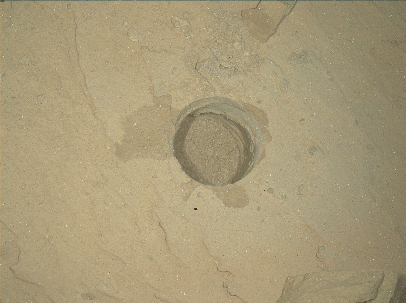


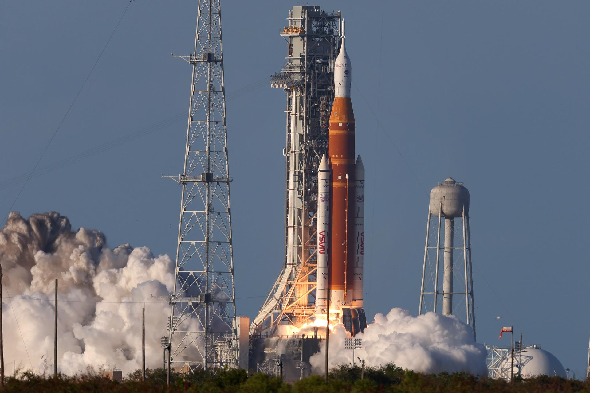
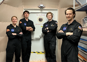
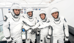
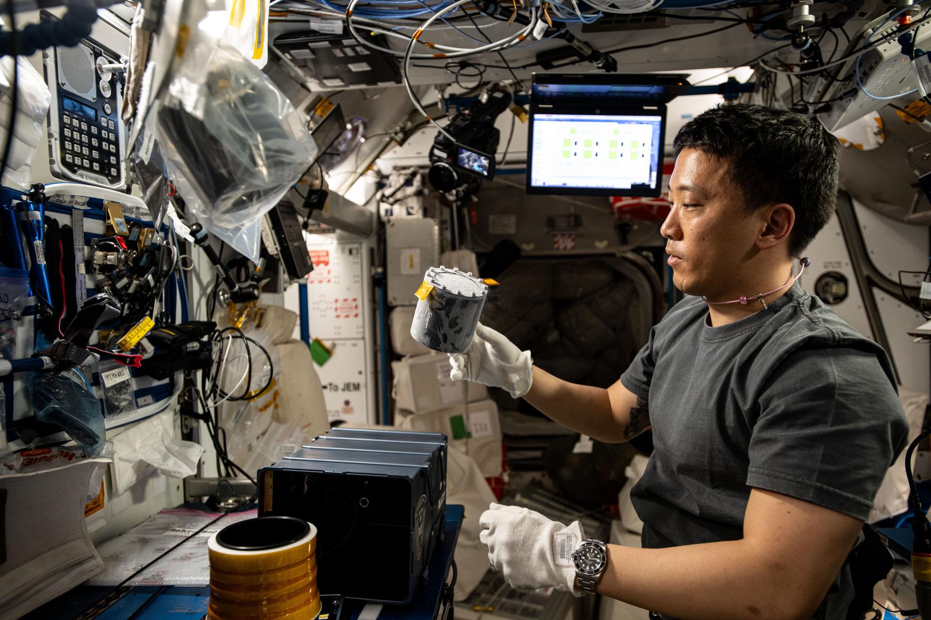

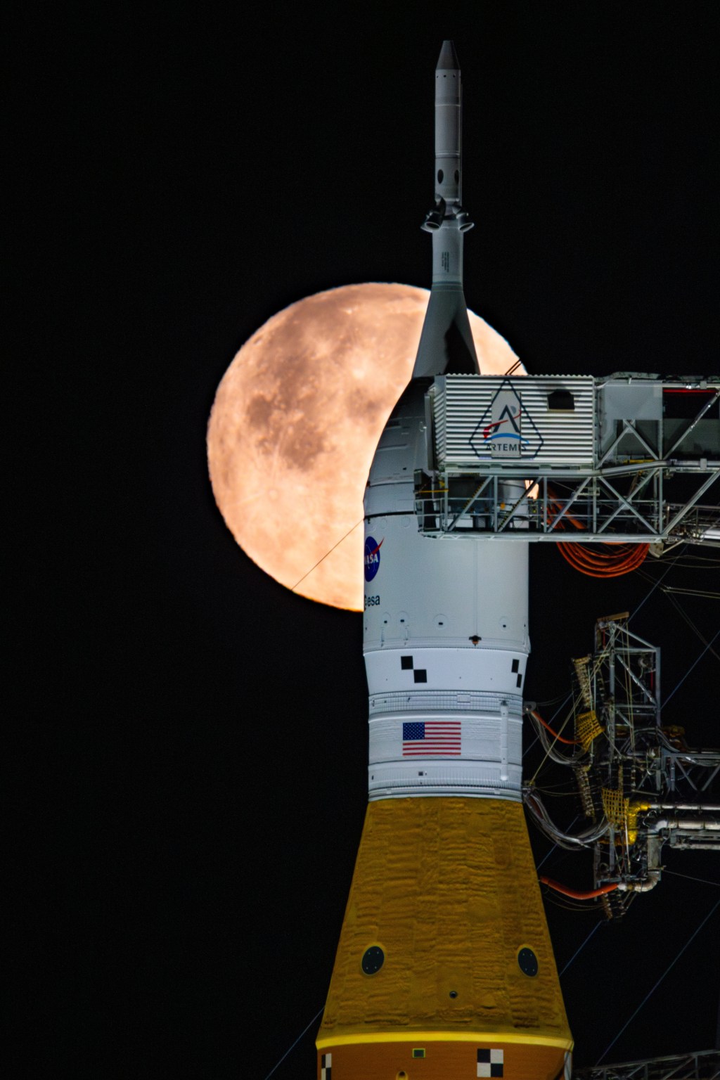
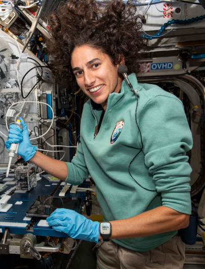
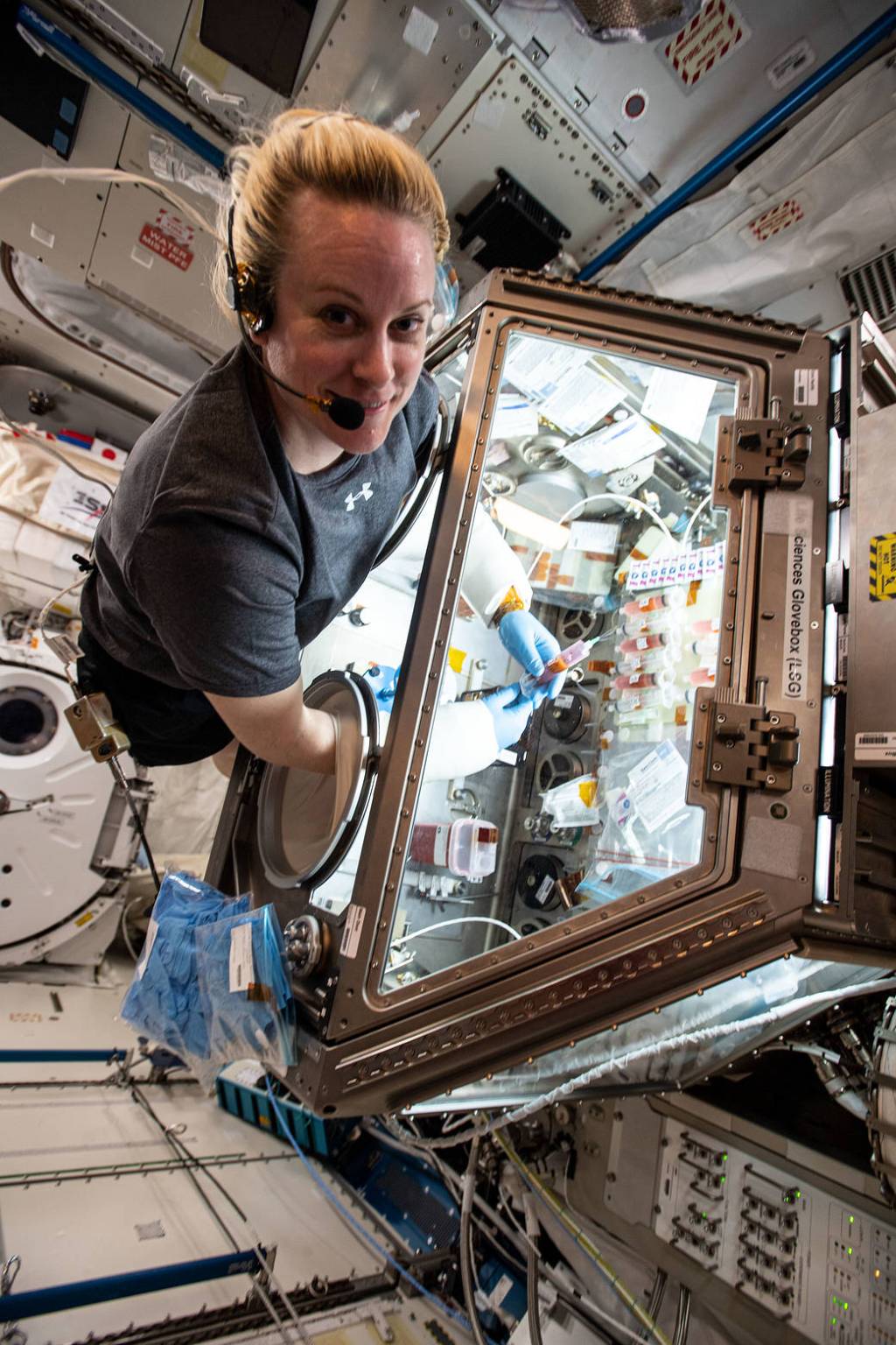

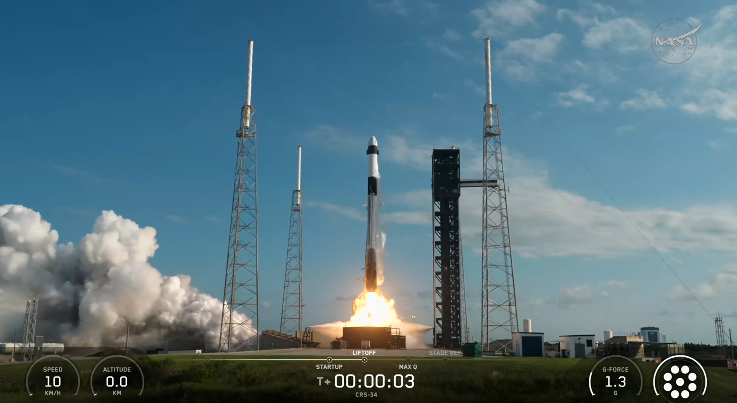
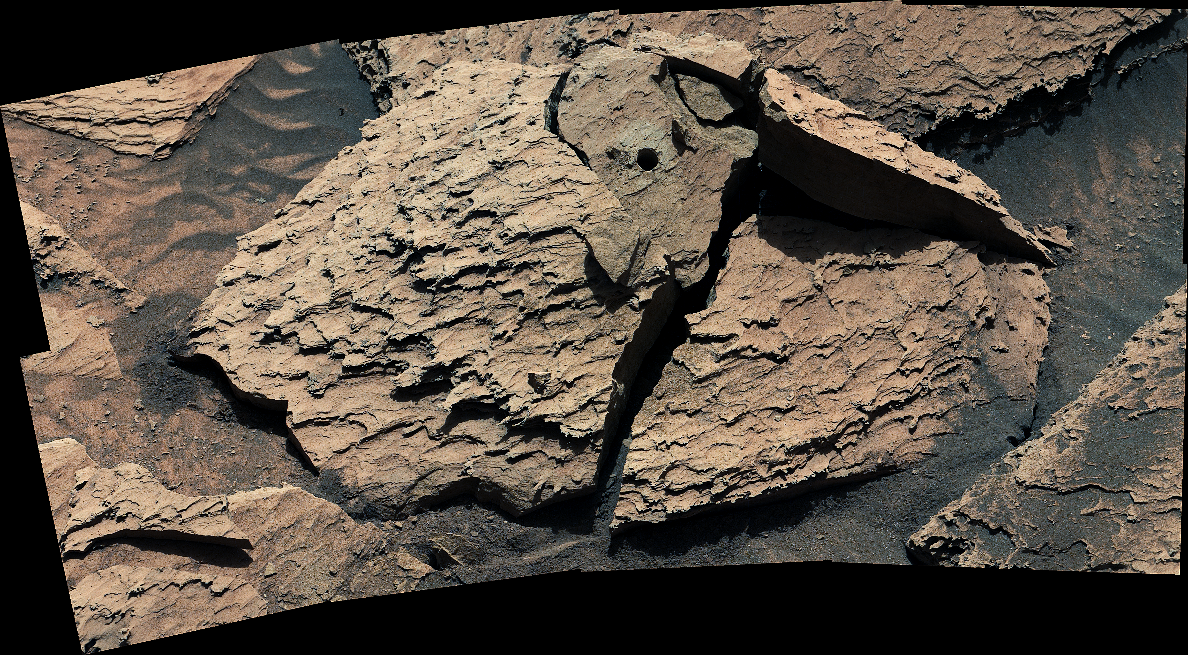


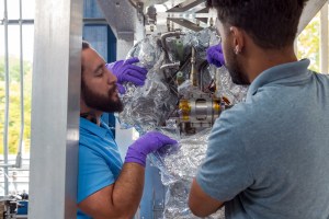


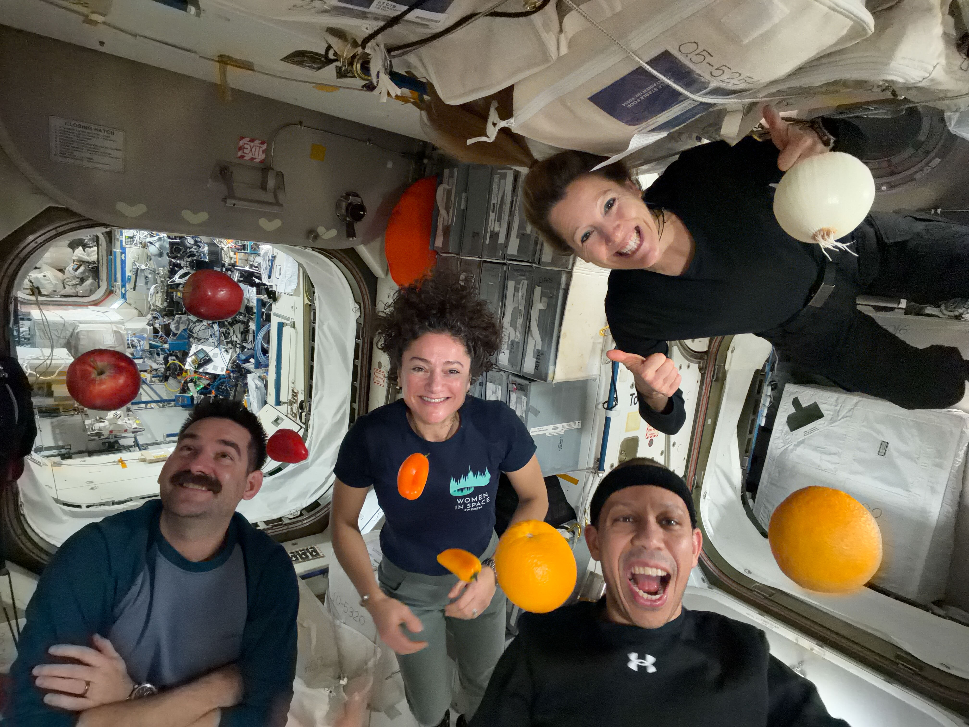


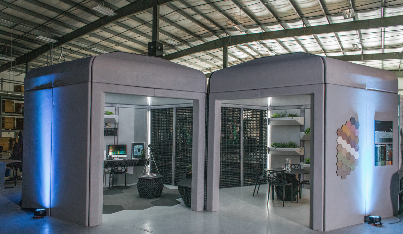


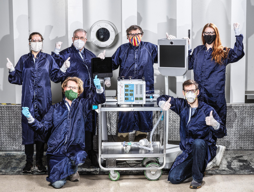
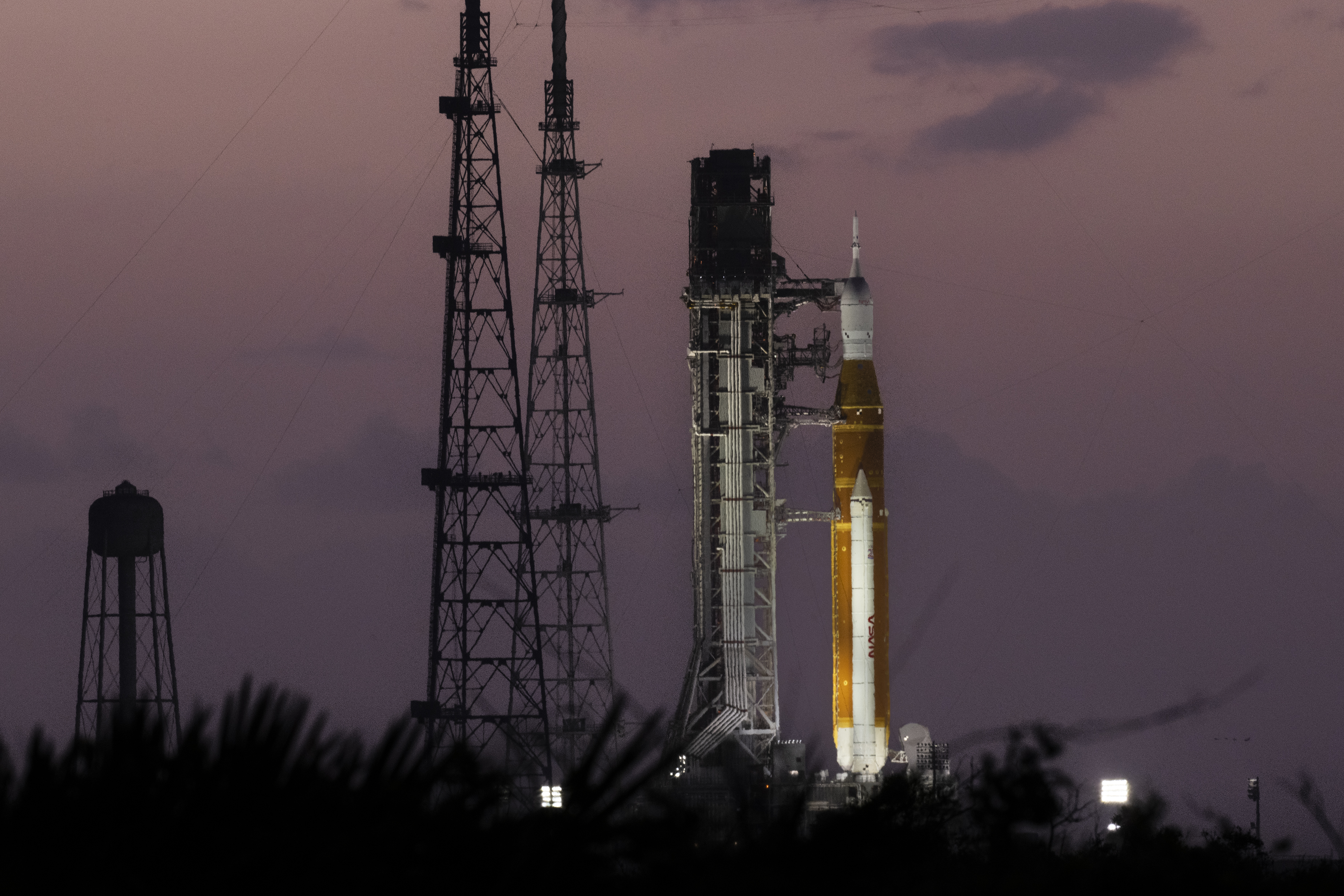
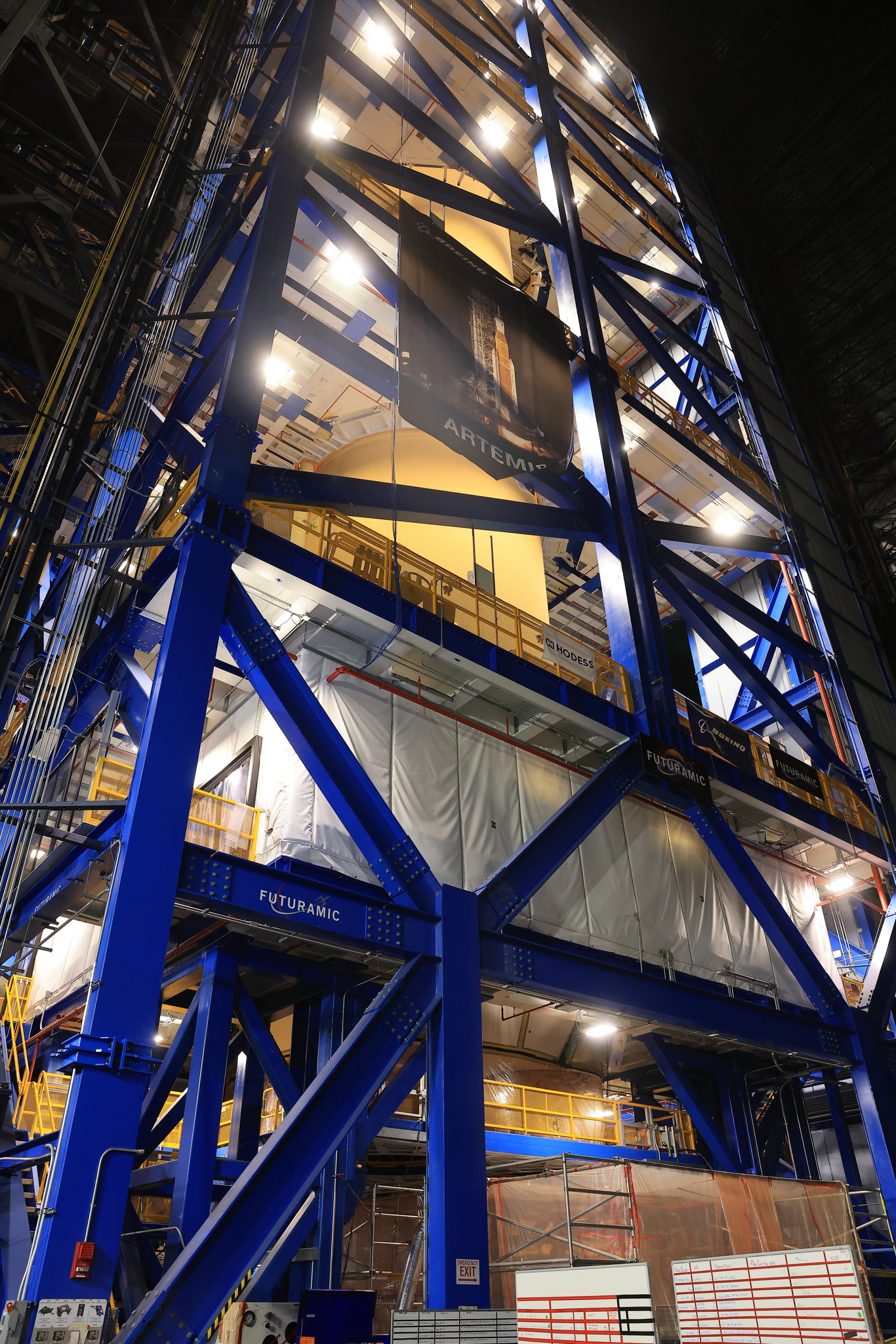
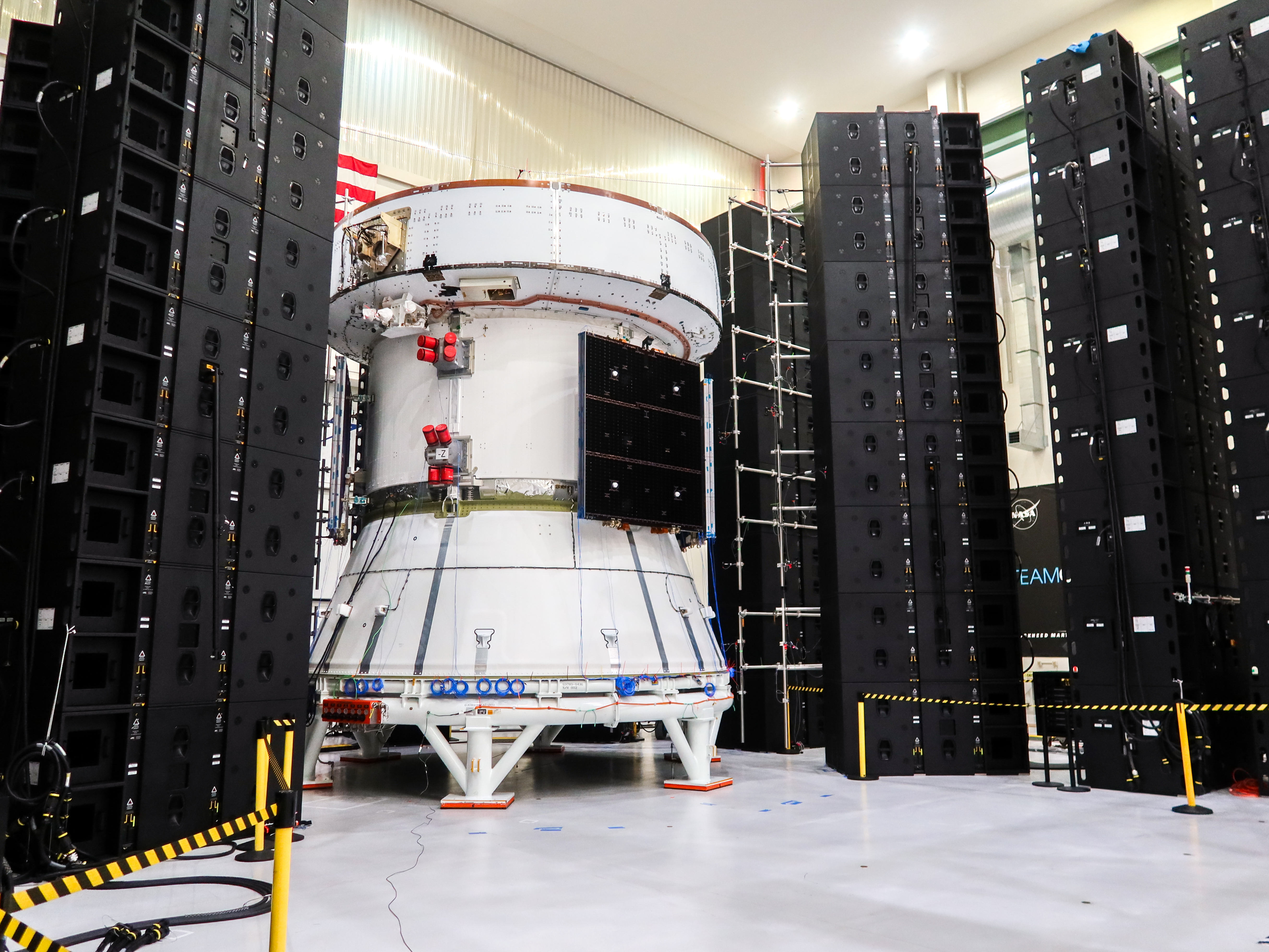

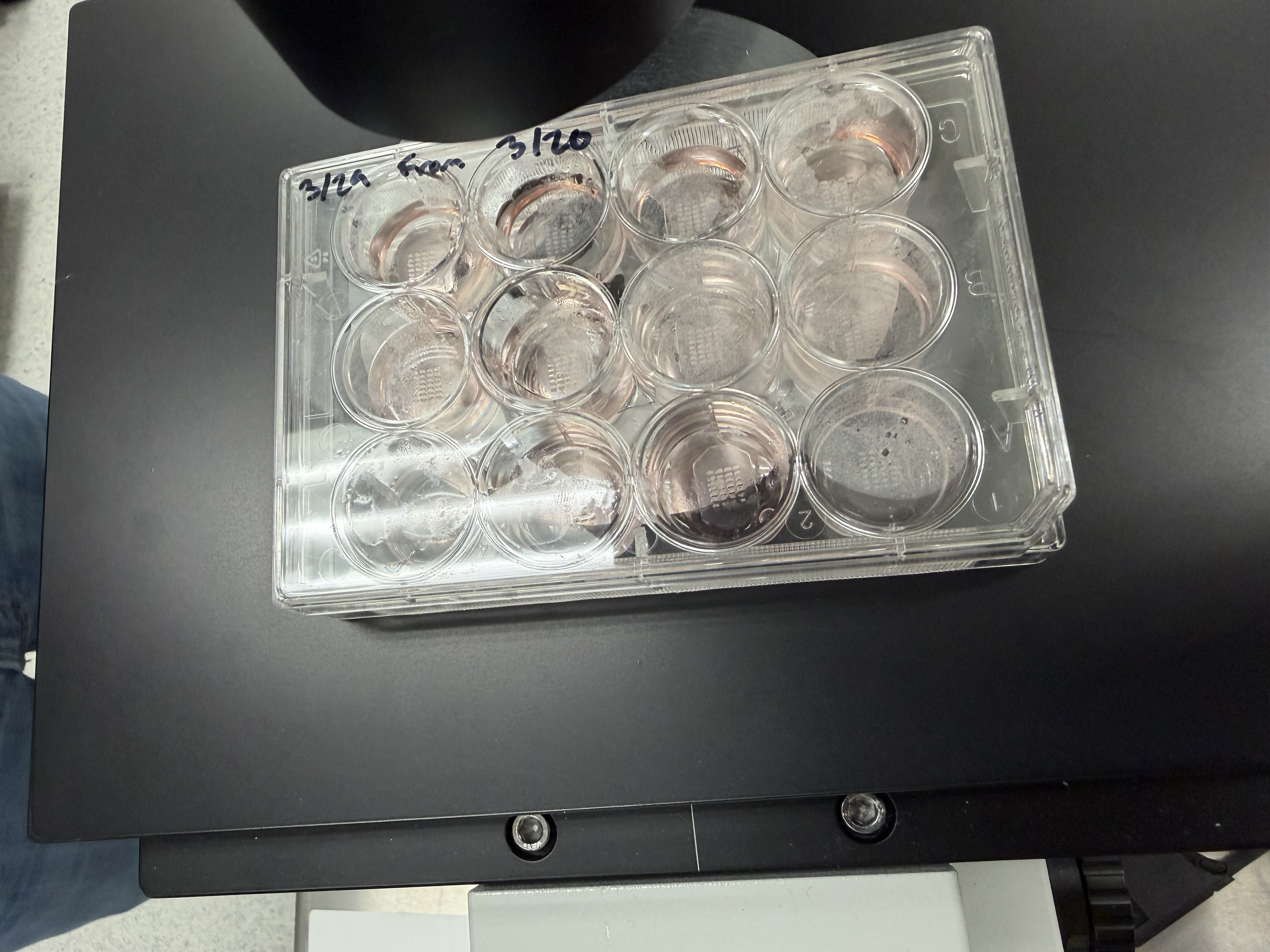
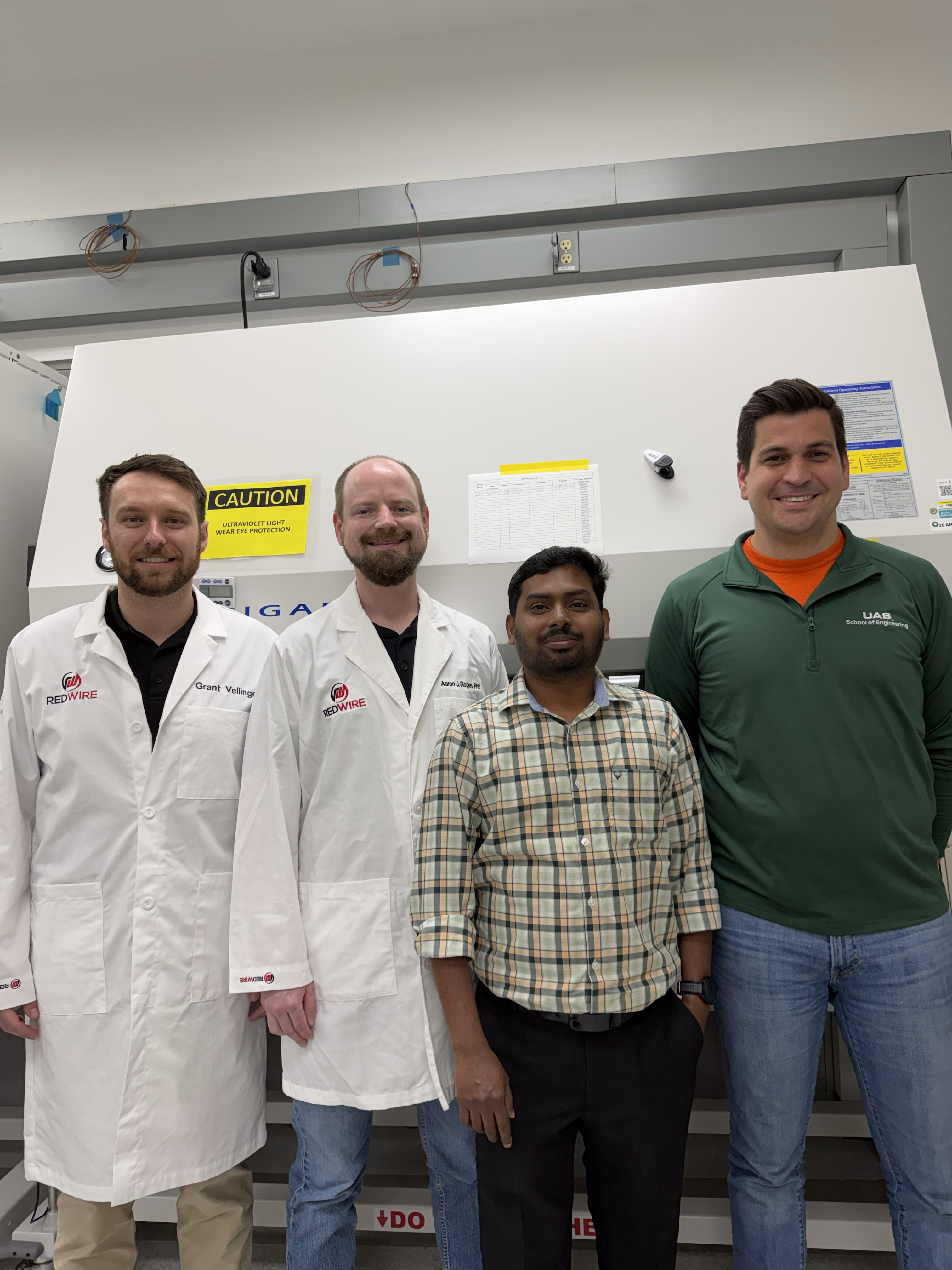
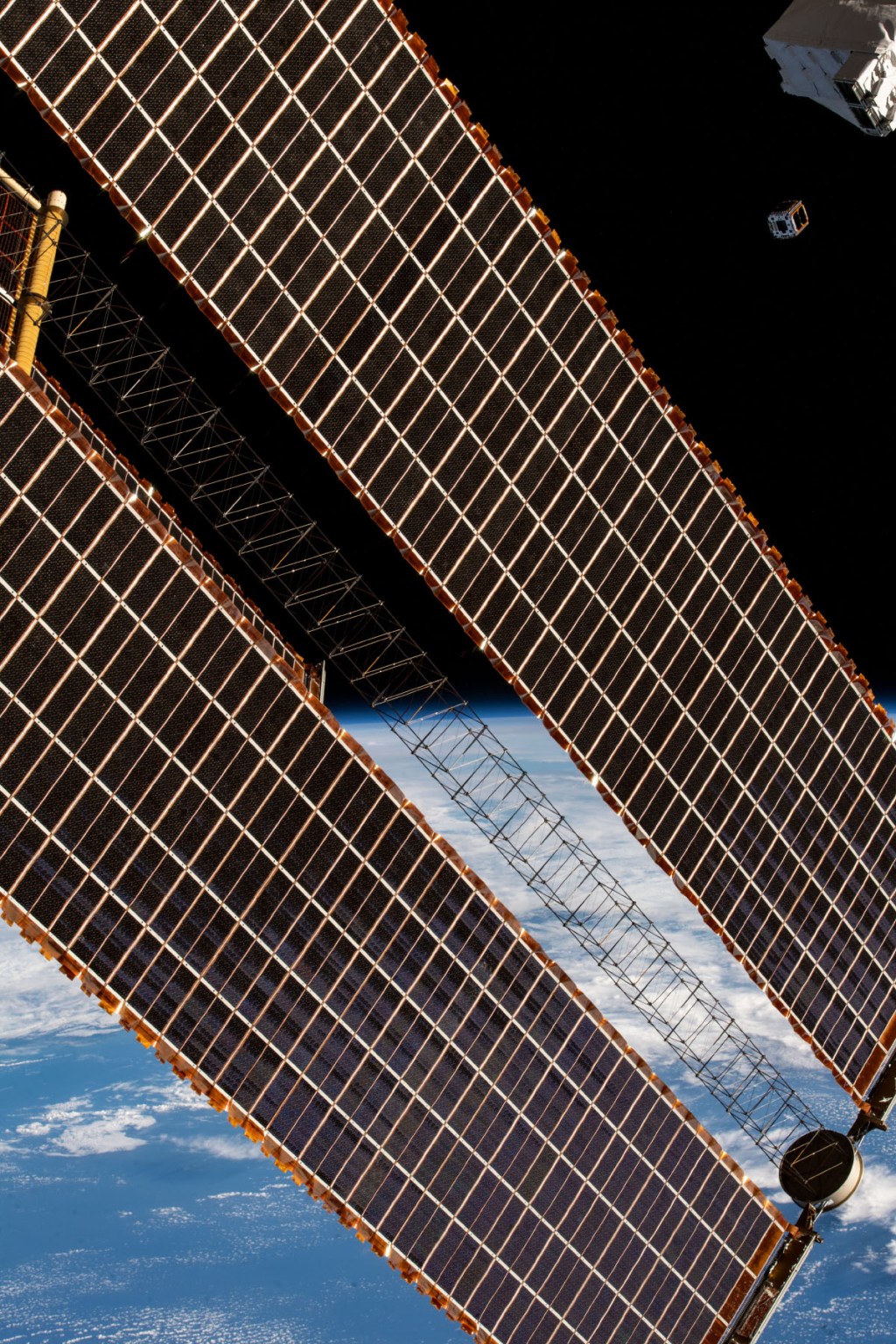
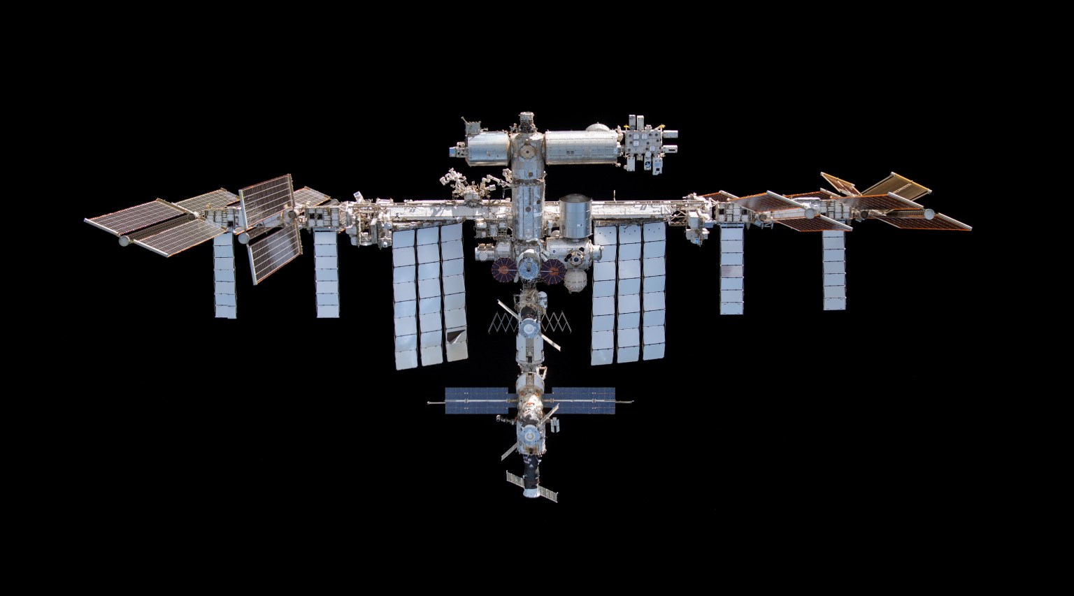
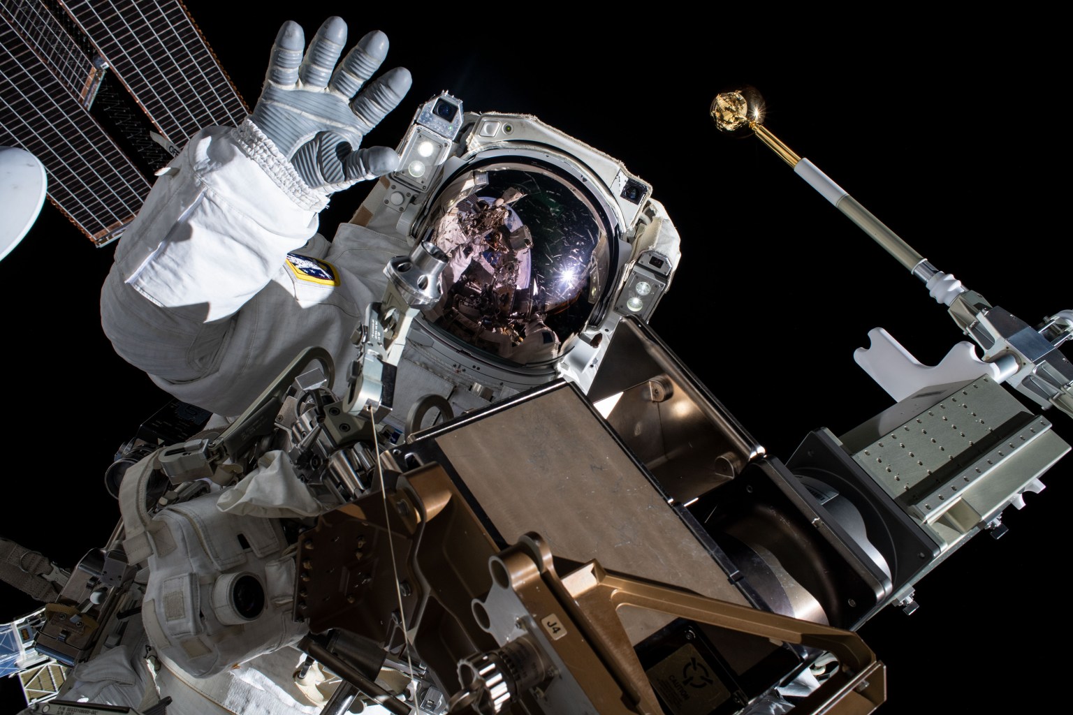
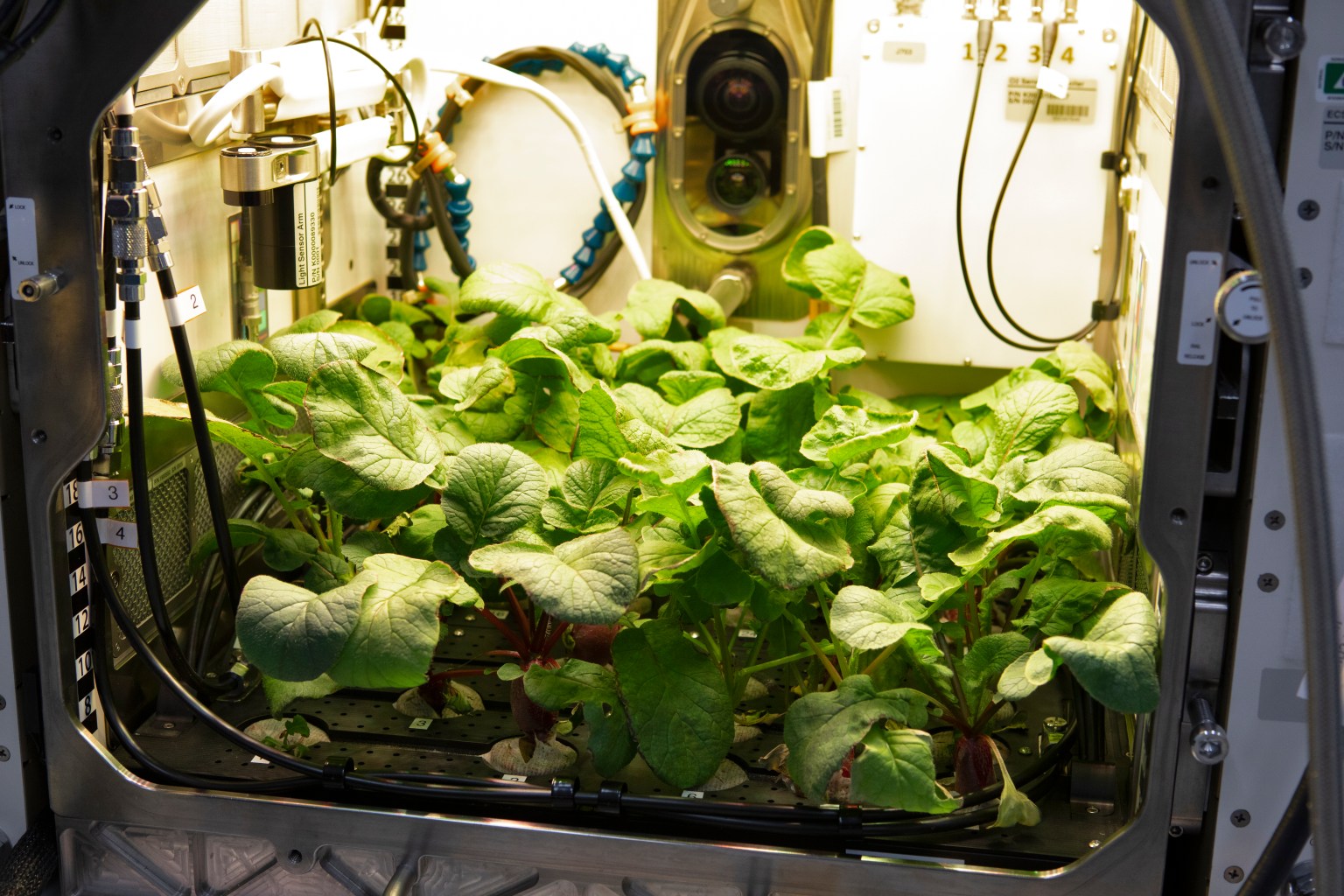


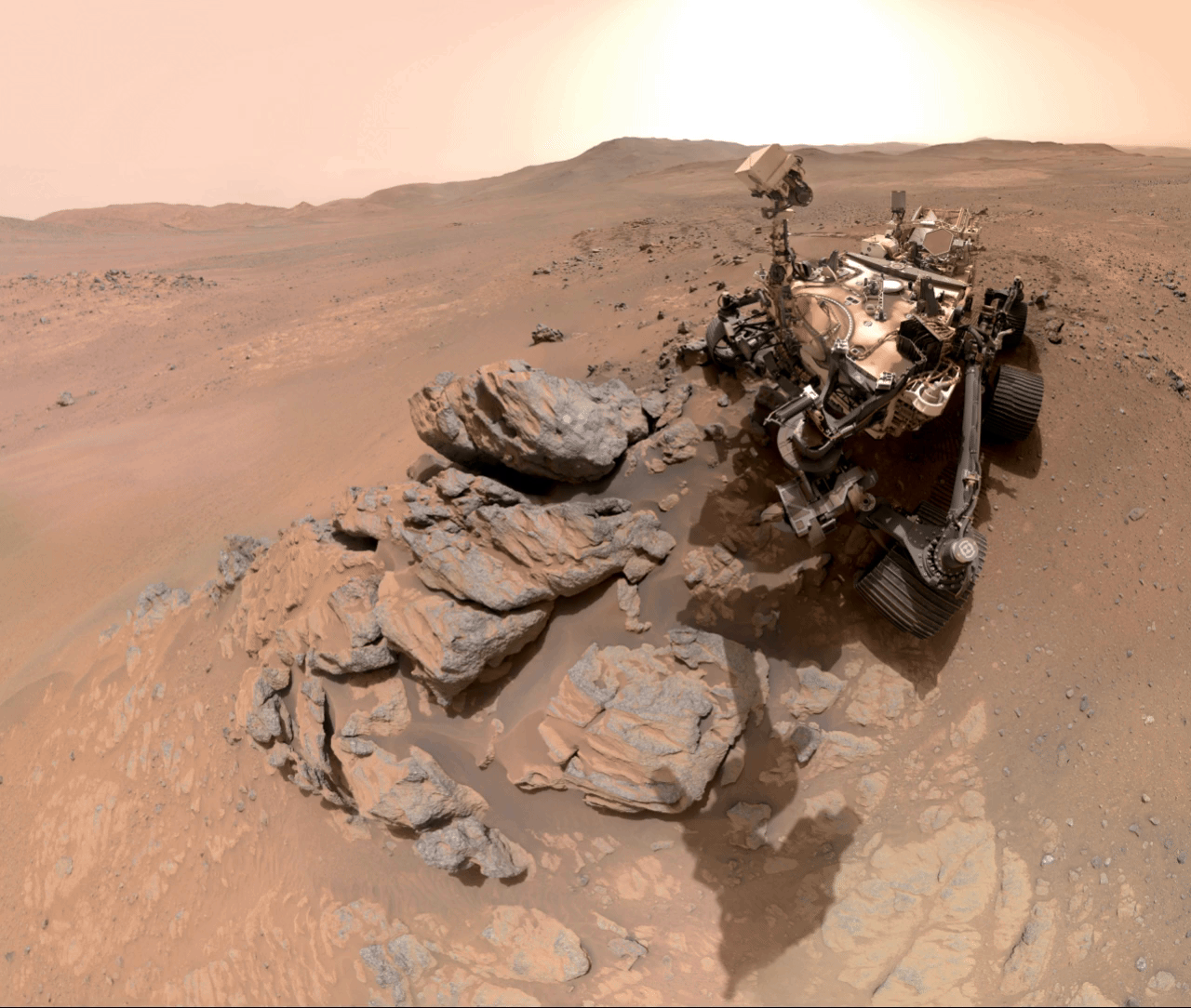


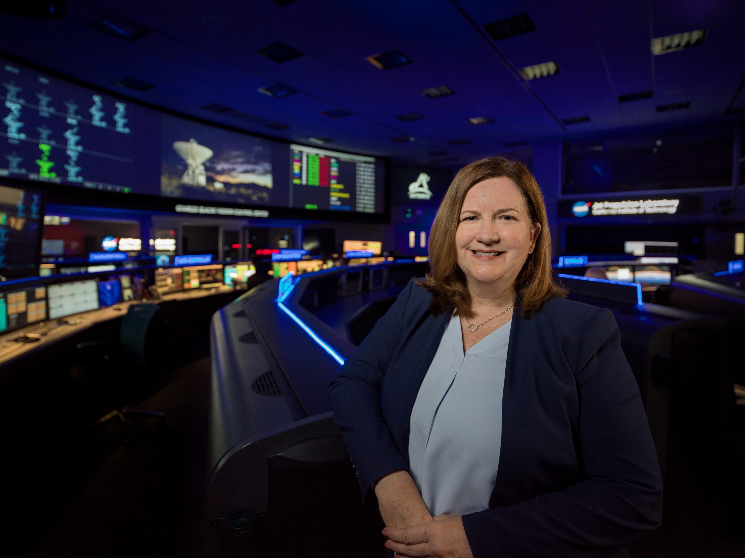


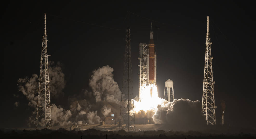
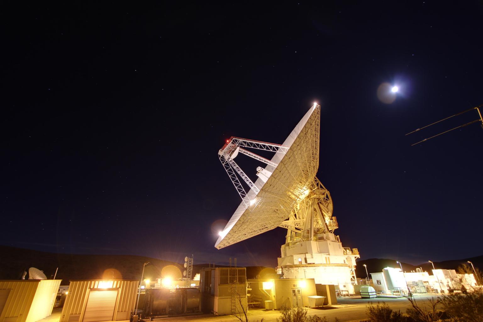

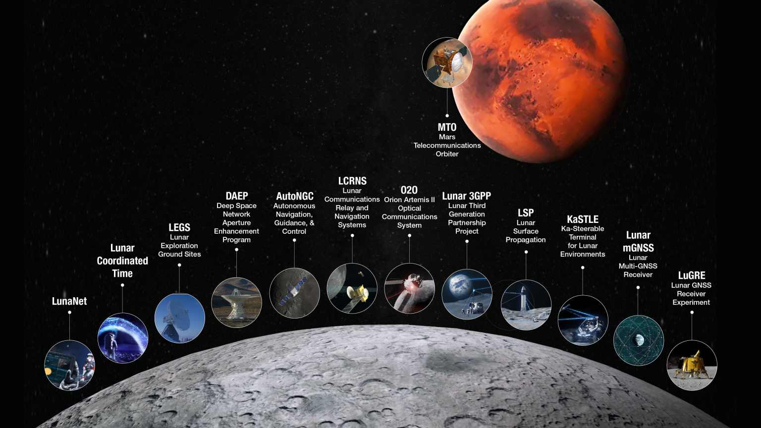


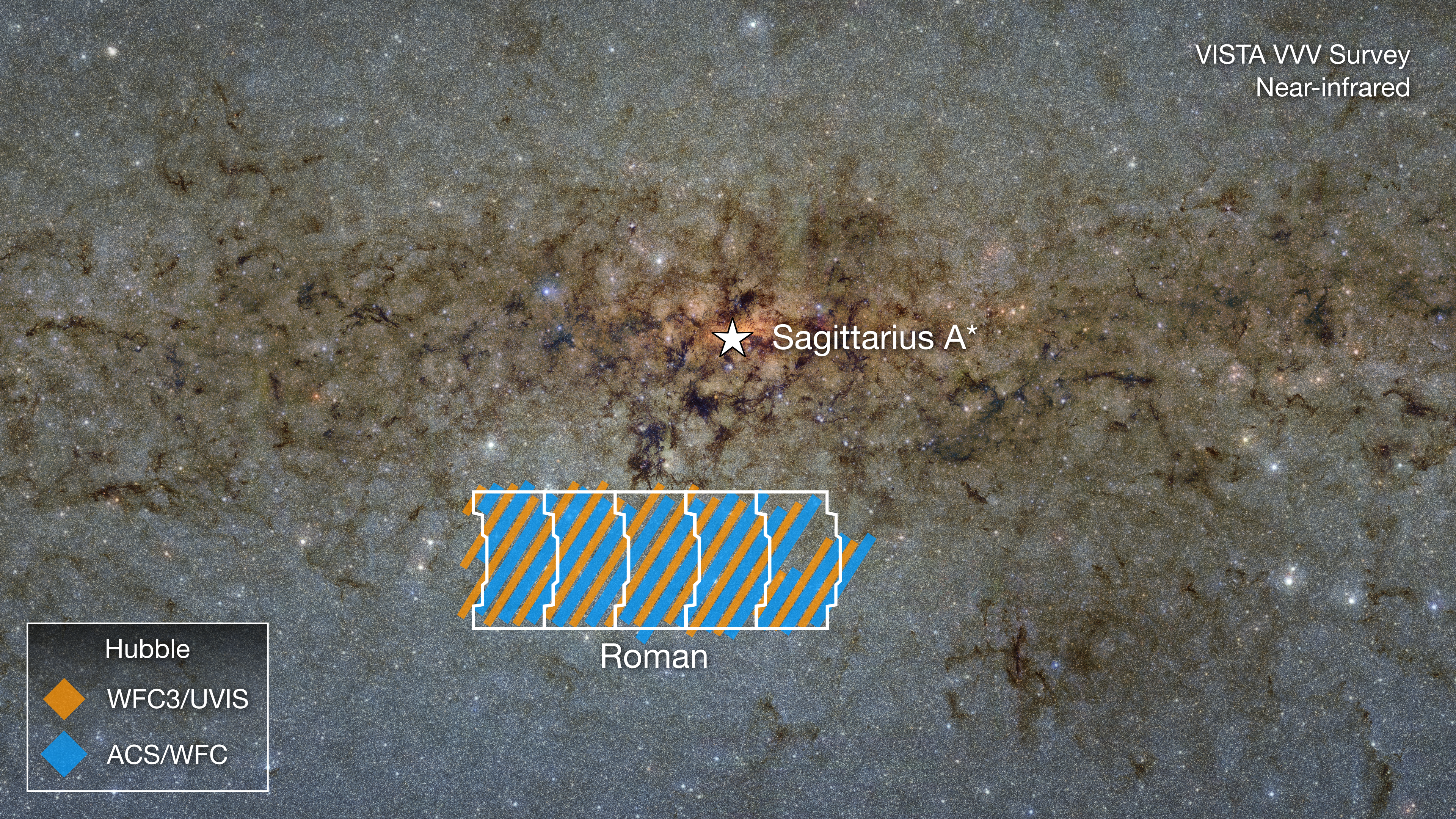


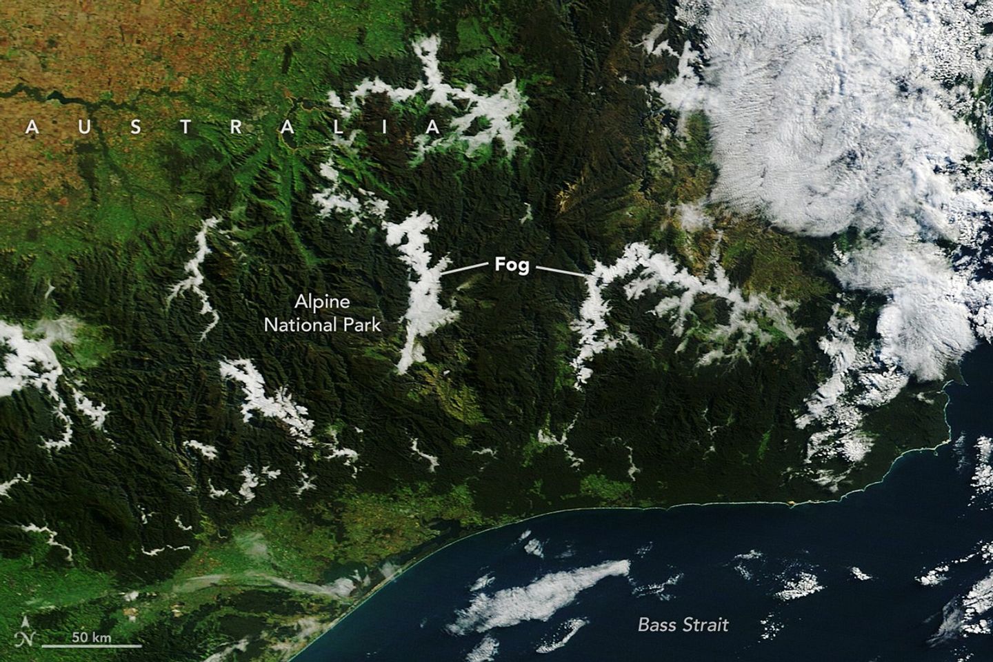


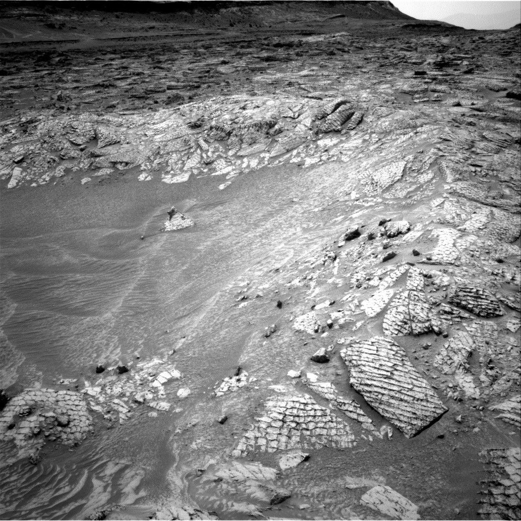


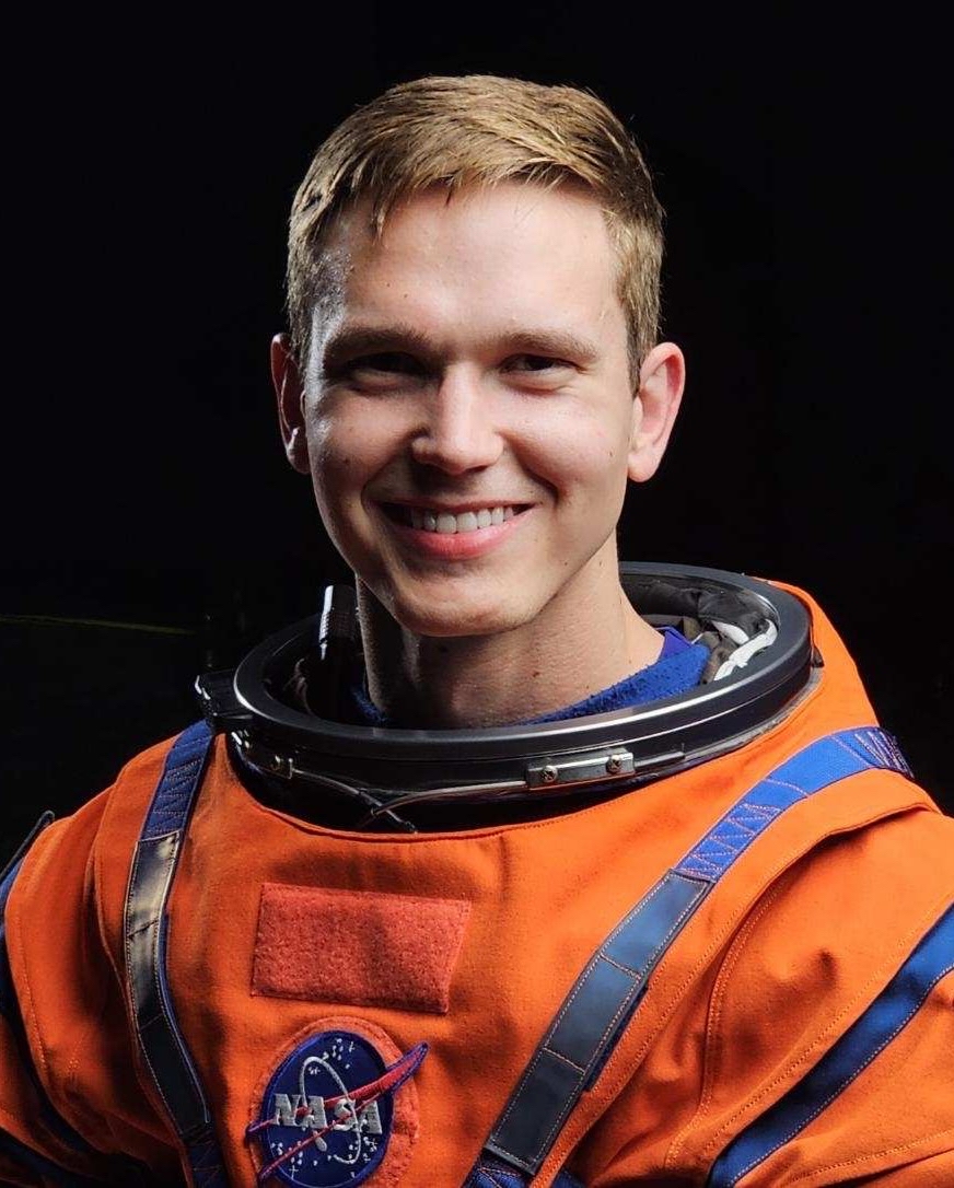

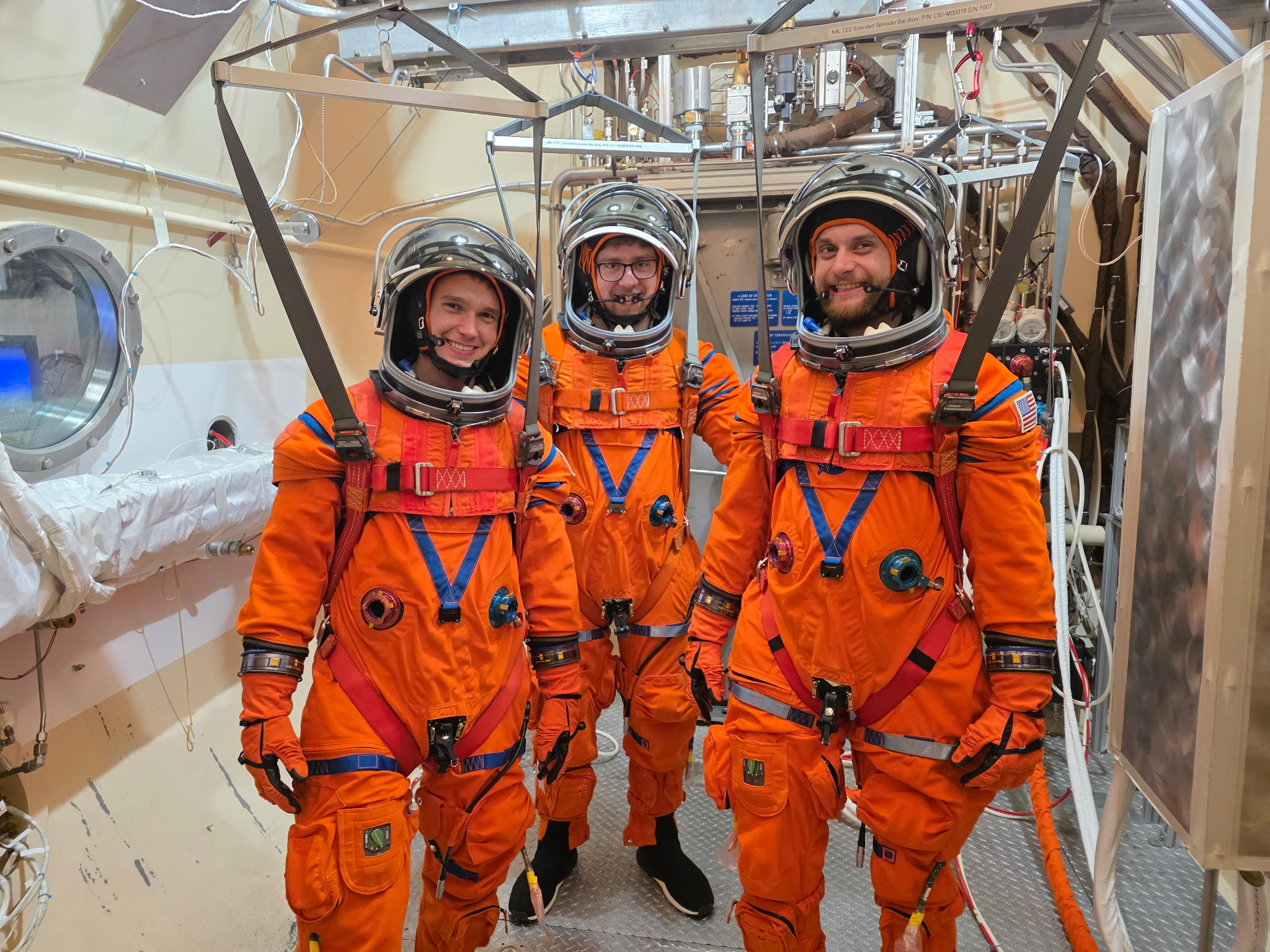
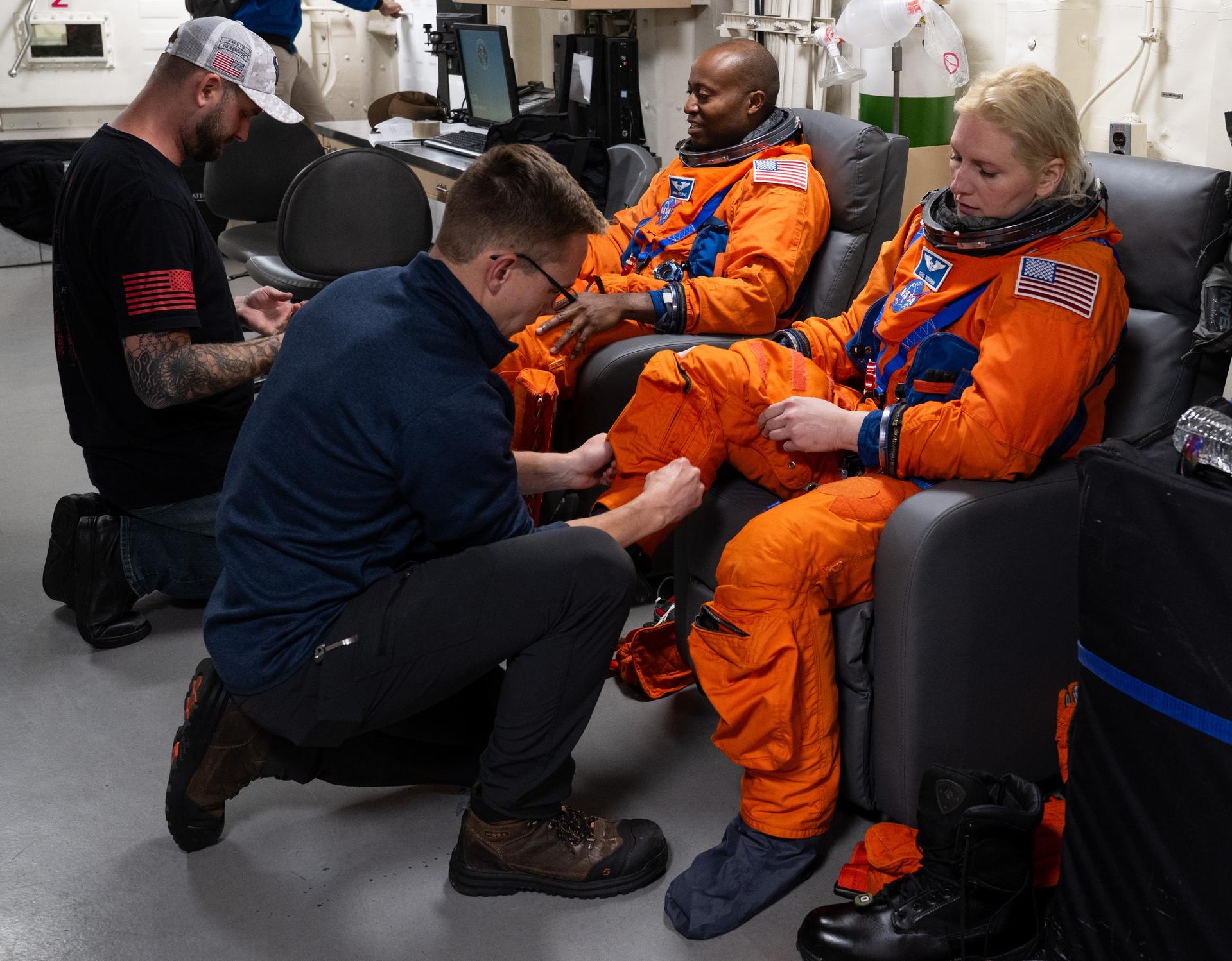
 Sumer Loggins
Share
Sumer Loggins
Share