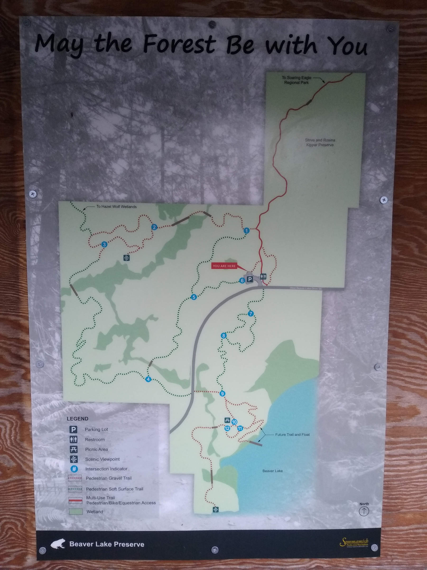
Distance
17.4 km / 10.81 miles
Elevation gain
684 m / 2244 ft
Duration
7h
Moving
4h
Ascent to Wansfell Pike
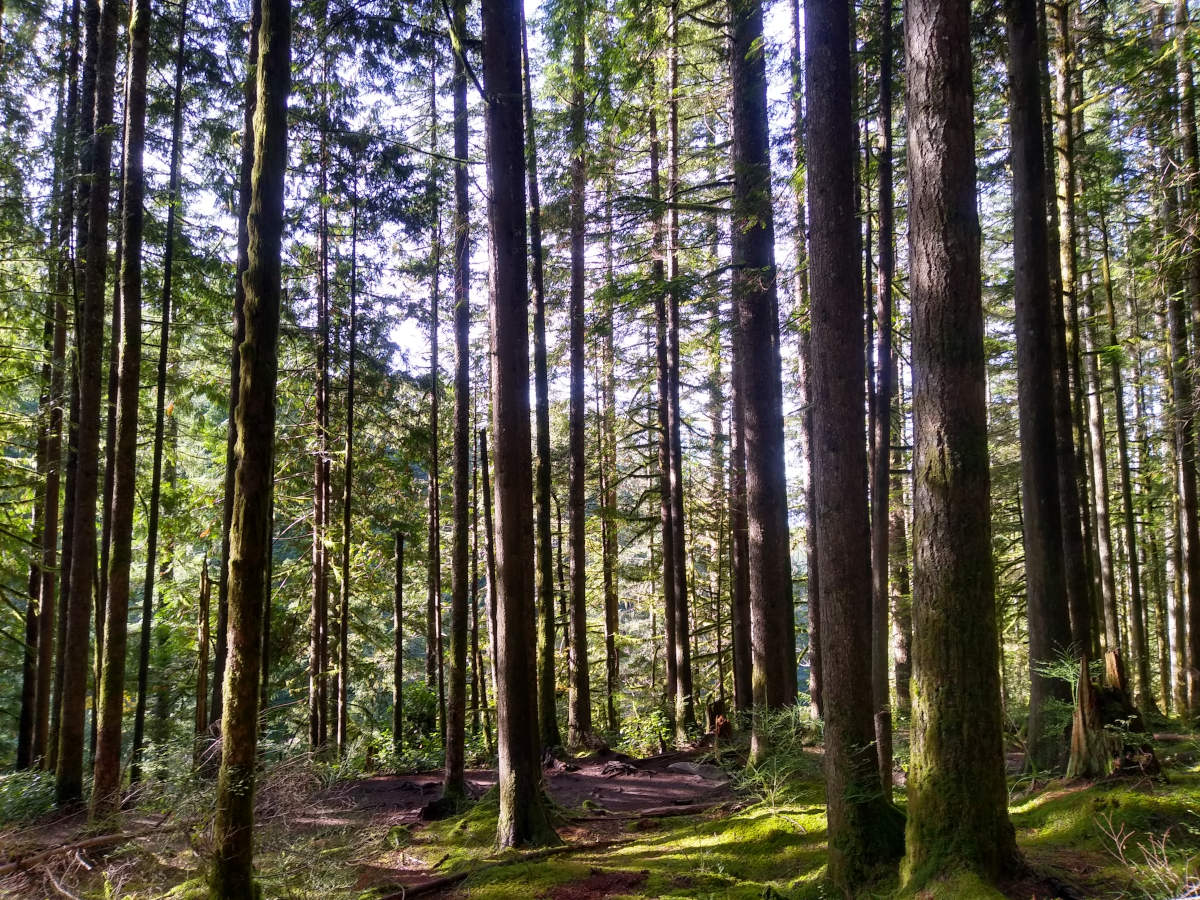
We set off from our cottage in Blue Hill Road at 8:50am. The road quickly turns into an old track with stone walls on either side. While it was technically after sunrise, and Ambleside itself was in sunlight, the lofty heights of Wansfell Pike cast our hillside into shade. This provided quite a stark contrast between the bright scenery and the dark vicinity.
Distance
6.74 km / 4.19 miles
Elevation gain
387 m / 1270 ft
Duration
3h40m
Moving
1h45m
First leg of ascent
The ascent begins straight away, with a gravel path the zig-zags its way upwards.
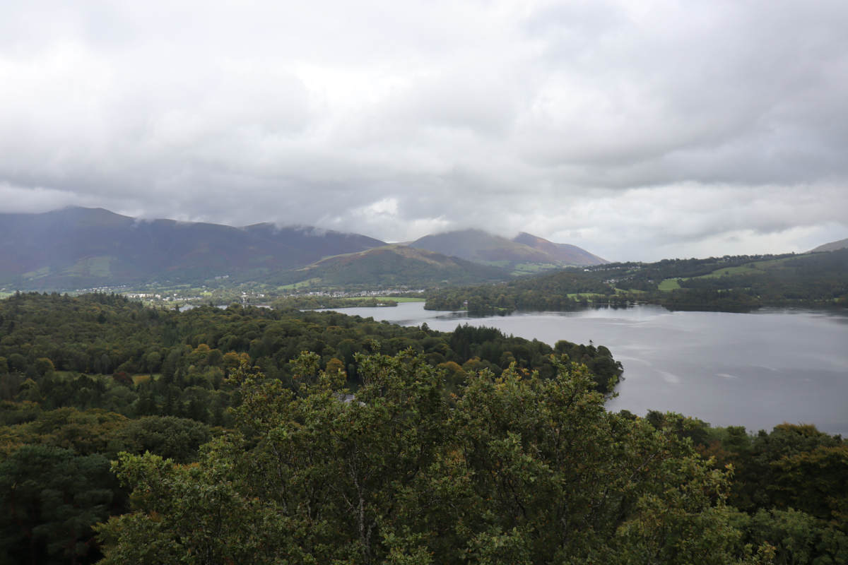
Looking back from the first corner towards the car park.
Looking towards Keswick from the first corner. We’ve only just begun and the view is already pretty good!
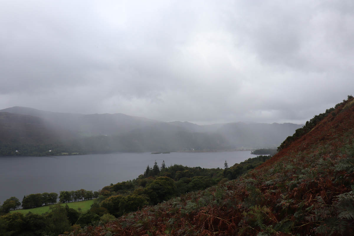
At the switchbacks and the rain is coming down over Derwent Water.
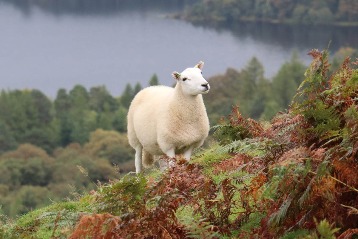
A happy sheep.
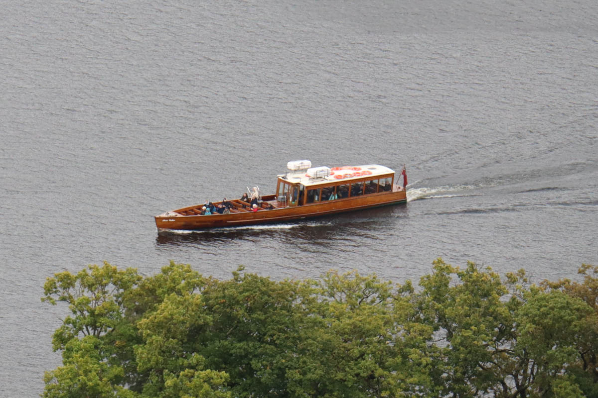
A distant launch on Derwant Water. Due to high water levels from all the rain, they were only doing scenic tours from Keswick, not stopping at Cat Bells. Otherwise this would have been how we reached Cat Bells.
Distance
3.59 km / 2.23 miles
Elevation gain
144 m / 472 ft
Duration
2h25m
Moving
1h
A walk around Aira Force in hopes of spotting a red squirrel. While no red squirrels were sighted that day, the scenery was still as pleasant as ever.
Ascent
A channel near the start.
Stone steps winding up the trail.
An oak tree catching the sunlight.
Water flowing around rocks.
A dipper bobbing about on a rock in the stream.
Distance
9.59 km / 5.96 miles
Elevation gain
246 m / 807 ft
Duration
3h20m
Moving
2h10m
A walk around Grasmere and Rydal Water, nipping into Rydal Cave on the way.
Grasmere to Rydal Cave
We began at Grasmere, heading anti-clockwise around Grasmere and Rydal Water. The route follows the main road through Grasmere initially, then goes past Dove Cottage and ascends up through the woods, following the “Corpse Road” to Rydal. Before Whitemass Tarn the road levels out. Keep right to avoid going onto private property, and soon the road turns into a gravel path. When Rydal Water becomes visible, you can see across to the ominous Rydal Cave.
Distance
3.11 km / 1.93 miles
Elevation gain
145 m / 476 ft
Duration
1h25m
Moving
50m
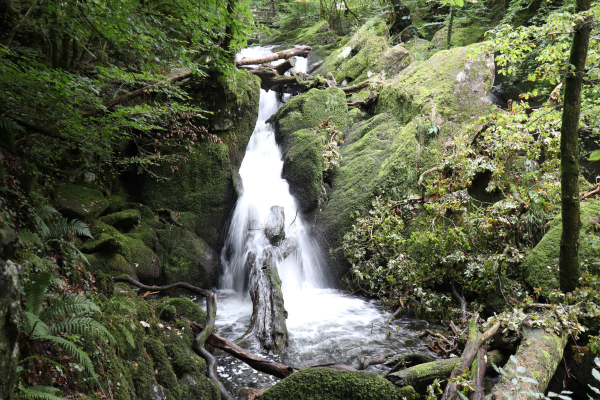
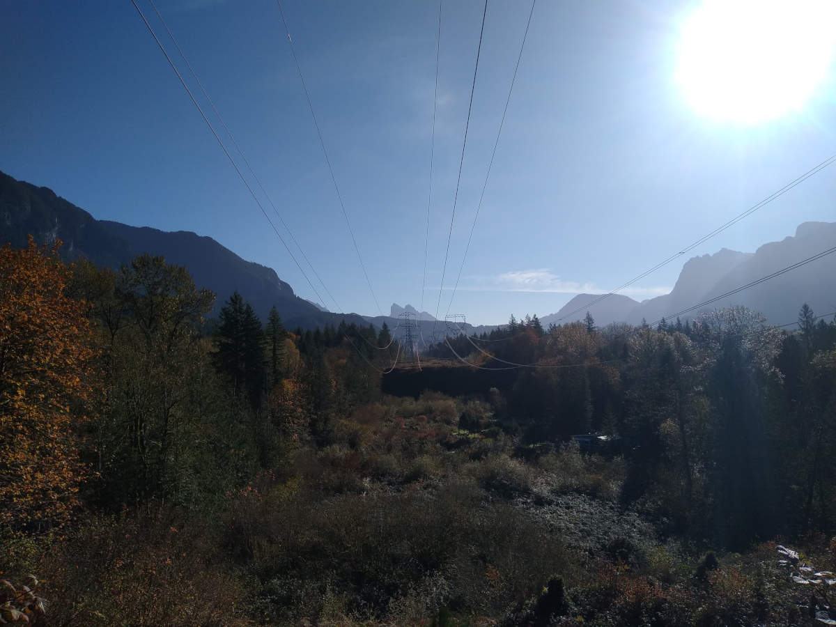
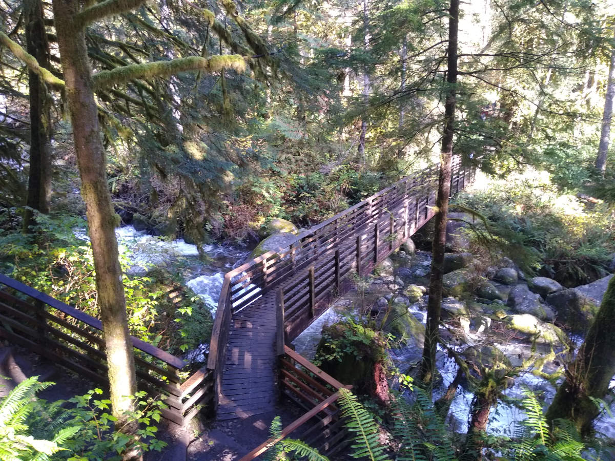
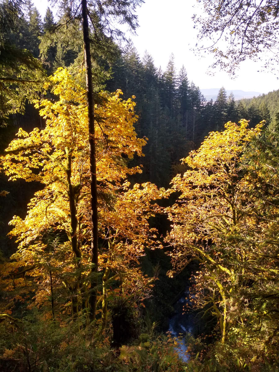
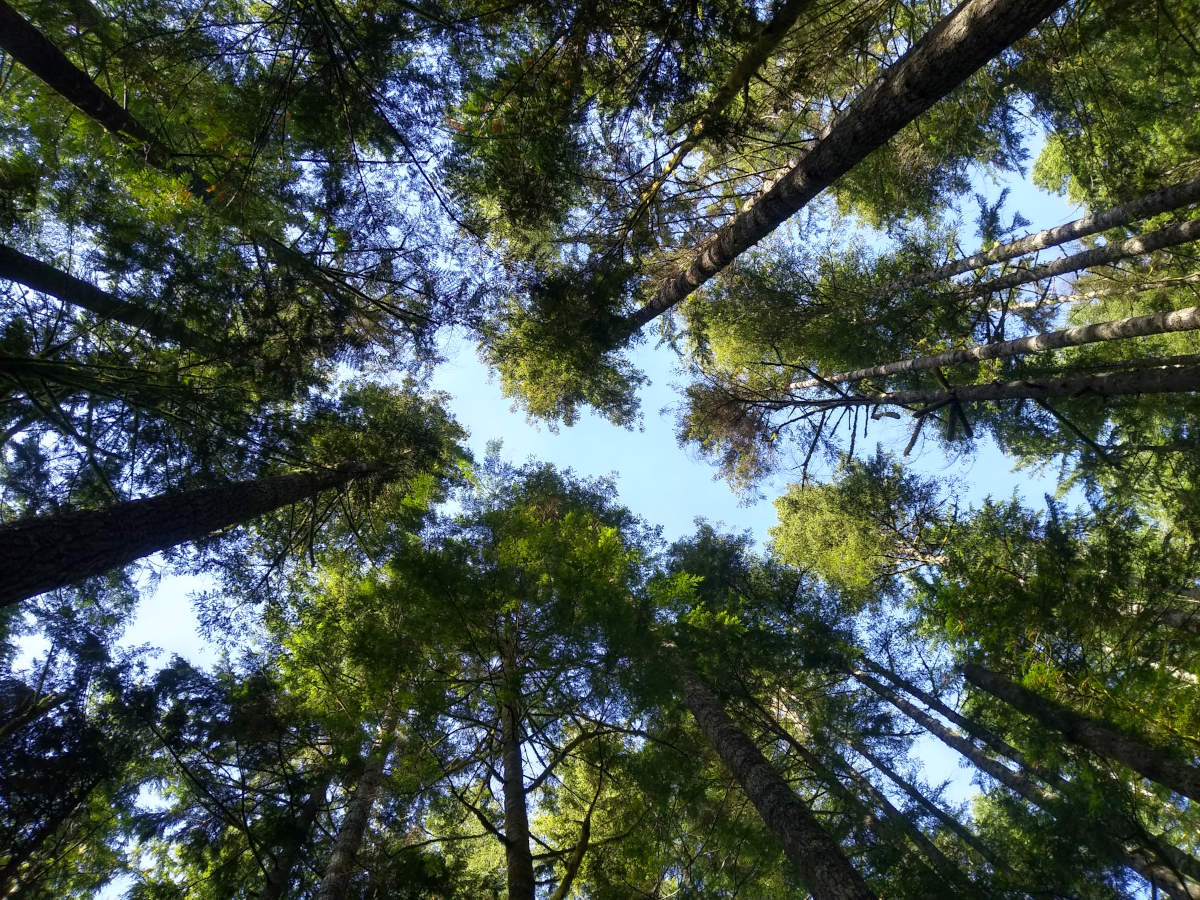
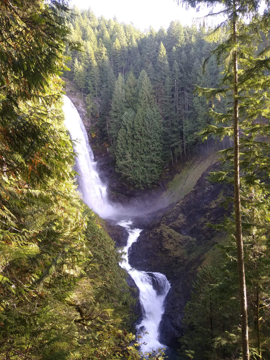
A short walk from our cottage through Ambleside, Stock Ghyll Force and back again.
Ambleside to the waterfalls
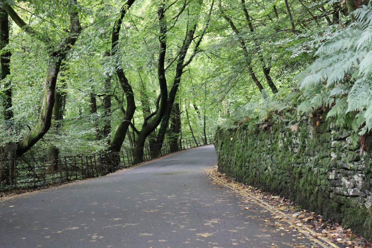
We began at our cottage in Blue Hill Road, walked down to Ambleside and then up towards Stock Ghyll Woods.
The road from Ambleside up to Stock Ghyll Force.
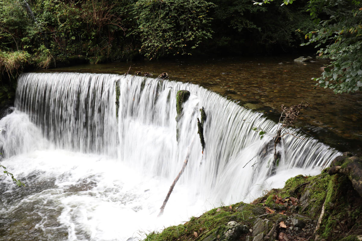
The first of several waterfalls.
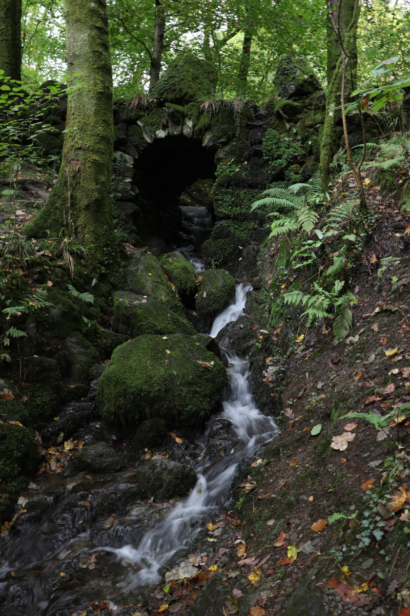
A trickle under a small bridge.
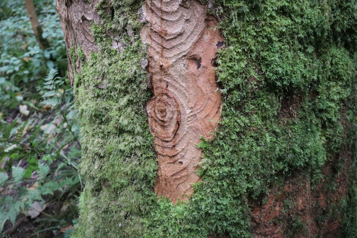
An interesting pattern on a tree.
The main waterfall.
Somehow, we had already got further than planned. We had made it past Reading, got through 22 locks, and only had four left before Abingdon. However, today I needed to get back to Cambridge, and wanted to be at a train station for 3pm, so we only had half a day left to work with. We wasted no time in leaving early, and were underway just after 7am.
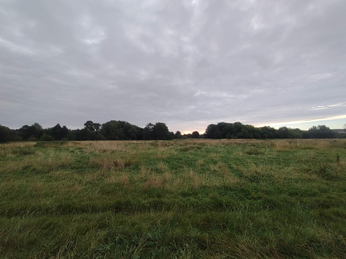
(7:00am) A view of the field we moored against near South Stoke.
This was perhaps the longest stretch without a lock. We moored next to the high street bridge in Wallingford to grab some pastries for breakfast, then carried on to (L23) Benson Lock, and after another long stretch to (L24) Day’s Lock. Then was a long, tedious gentle bend to the left which curved all the way around to Clifton Hampden.
We lost a few hours yesterday through the combination of a late start, stopping for diesel, topping up our water tank, and the engine trouble. It was looking unlikely that we would even reach Reading, let alone Abingdon. We set off in good time before 8am with the plan of finding a boat yard to try and get a professional to take a look at our engine.
(7:24am) Not an ideal mooring spot, but given the engine failure, it was the best we could do.
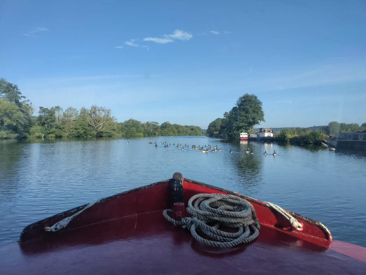
(8:00am) Getting underway. Watch out geese!
When we reached our first lock of the day, (L14) Hambleden Lock, I was little nervous that the engine would fail to start again. Fortunately we made it through without issue.
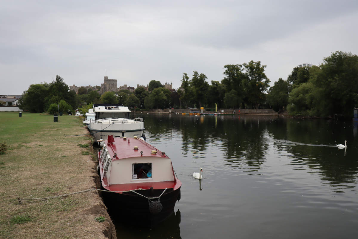
We woke up to a magnificant view of Windor Castle from our boat. We had used stakes hammer into the ground to moor up, since there were no bollards. Since many others had staked here before, it easy quite easy to make use of a pre-existing hole. The river bank was a straight and sheer vertical drop, which made it easy to moor very close to the bank.
(8:15am) Looking towards Windsor from our mooring spot.
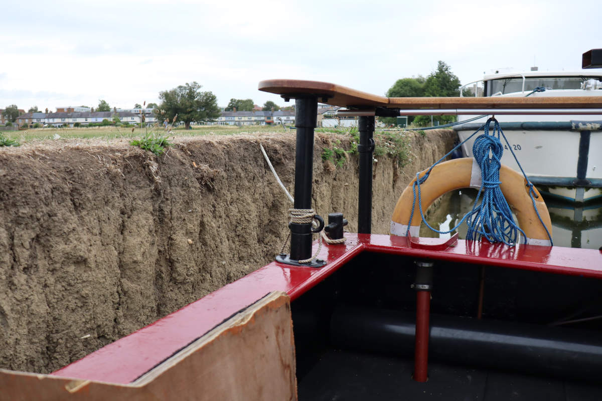
(8:30am) A closer view of the dirt bank.
We picked up a canal boat at Weybridge. Our goal was to take it 63 miles up the Thames, all the way to Abingdon, but given we only had four days (and two of them half-days), it was looking like realistically we’d only make it to Reading.
Leaving Thames Lock at 13:09, where the River Wey joins the River Thames, we navigated to what would be the first of 26 locks: (L01) Shepperton Lock. The lock was manned and, surprisingly, completely empty. We went straight on in and the lock keeper kindly showed us the ropes, then we pulled the slack in as our little vessle bobbed upwards for the first time.
SITE 1.ADMINISTRATIONCambridge RoadWimpoleRoadHaslingfieldRoadBarton RoadLord's BridgeStationAMI Small ArrayCOASTAMI Large Array†Pulsar Array4C Array†Half-Mile Telescope (small) & †One-Mile Telescope (large)†One-MileTelescopeTrack continues 1km eastwardse-MERLIN†CLFST†CATUnknown?Unknown?†SKA†HERAUnknown?†SKAPrototypearrayPrototypeindividualPrototypeRyle ControlRoomOne-MileControlRoom(Previously site of †Ryle Telescope)(Track is shared)Name†NameLong BrookBourn Brook𝕳𝖊𝖞 𝕳𝖎𝖑𝖑𝕽𝖔𝖒𝖆𝖓𝕭𝖆𝖗𝖗𝖔𝖜NSITE 6.SEWAGE DISPOSALSITE 2.BOMB STORESSITE 4.F.F.D.4.050403_AMI01_arrival02_station1 Mile1 Kilometerhttps://sam.hooke.me/mraoJune 2024Mullard Radio AstronomyObservatory (MRAO)KeyFormer railwayTelescope railwayMain roadMRAO tarmac roadMRAO trackTelescope (static)Telescope (on track)Telescope (approx. area)Telescope (active)Telescope (inactive)MRAO (approx. area)
After visiting the Mullard Radio Astronomy Observatory (MRAO) in June 2024, I was surprised to find that there is no comprehensive map available online which displays the locations of all the telescopes. So, using photos and notes from my visit, combined with research online, I created the above map. The MRAO was formerly site of the Lord’s Bridge railway station, and during WWI the sidings served as a mustard gas factory. During my visit I found a map1 of these old facilities, so I have overlaid some of them (such as the location of the railway line), as they help explain the seemingly unusual layout.2
Coming many years from now… the even more confusing sequel to Iteration II and Hovertank!
Unit of Time takes a more advanced approach than Iteration II. You’re always free to rewind time, and everything is completely deterministic in all directions and dimensions. Time travel events fork a new timeline, which may have their own surprises. Paradoxes can be made, broken and fixed again. Oh, and you’re not the only agent able to manipulate time.
100ml milk (both cow or oat milk work well, though oat may fizz a little when baking).
Oil (avocado or sunflower).
Equipment:
Muffin tray with 8-12 holes.
Pouring jug.
Whisk or fork.
Plate with paper towel.
Method
Make the mixture
Pre-heat oven to 210°C fan (230°C without).
Put flour in bowl, beat in eggs until smooth.
Gradually mix in milk.
Transfer the mixture into a pouring jug.
Heat up the muffin tray
Fill each hole in the muffin tray with just enough oil to fill the circle without needing to swish the tray about (typically half a tablespoon).
Place the tray in the oven until the oil is very hot, about 5 minutes.
Pour the mixture
Take the muffin tray with the hot oil out of the oven.
Quickly and smoothly, in one continuous pouring motion, use the jug to fill each muffin tray hole. Aim for the center of each hole, so that the batter radiates out in all directions towards the edge of the circle. Some mixture will inevitably land on the tray as you move from one hole to the next, but this is okay because speed is of the essence.
Once all the mixture is used (you may need to go back and top some up to even them all out), place the muffin tray back in the oven1.
Bake
Allow to bake without opening the door until risen and golden, 10-12 minutes.
When done, remove from the oven, and transfer the yorkshires out of the tray onto a plate lined with paper towel, which will help soak any excess oil. The yorkshires should pop out without much trouble. If they are left to cool for too long, or the ratio of oil to batter was wrong, they may need help from utensil to be removed.
Ideally, use top shelf of oven. If using two trays across different shelves, take the top one out first and give the bottom one another minute or so. ↩︎
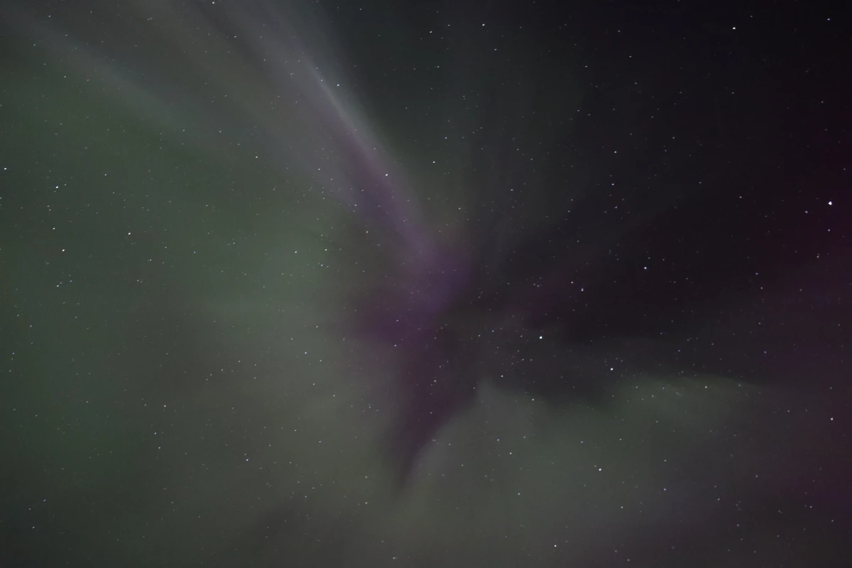
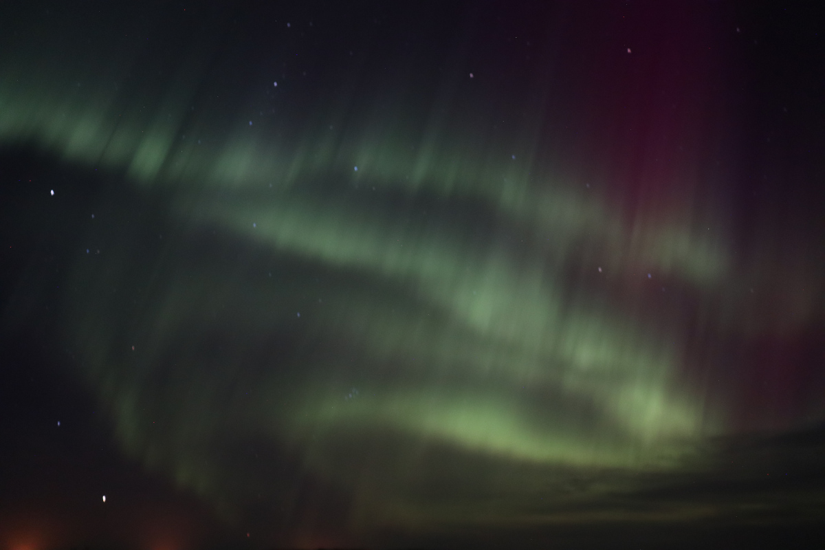
Less than a month after seeing the Aurora Borealis for the first time during a holiday in Iceland, we saw them from our own back garden in the Fens. This time the lights were more of a blurry glow without any defining shapes, but they were quite bright at times, with a strong red hue easily visible to the naked eye. As best I can tell, the Kp-index was about 7 or 8 out of 9.
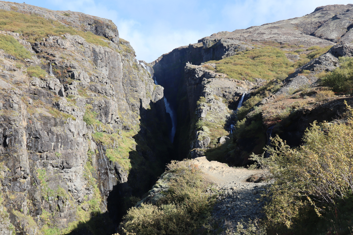
Glymur Falls is a popular day hike with stunning views of Iceland’s second tallest waterfall. The main trail passes through a small cave, has two river crossings and follows the edge of a deep canyon. The trail is fairly challenging, with a relentless 1,200ft ascent that often hugs sheer drops, so I would not recommend it for new hikers. If you’re not able to cross the river, perhaps due to recent heavy rainfall, then there are still grand views from the west side of the canyon, though the waterfall itself is not visible.
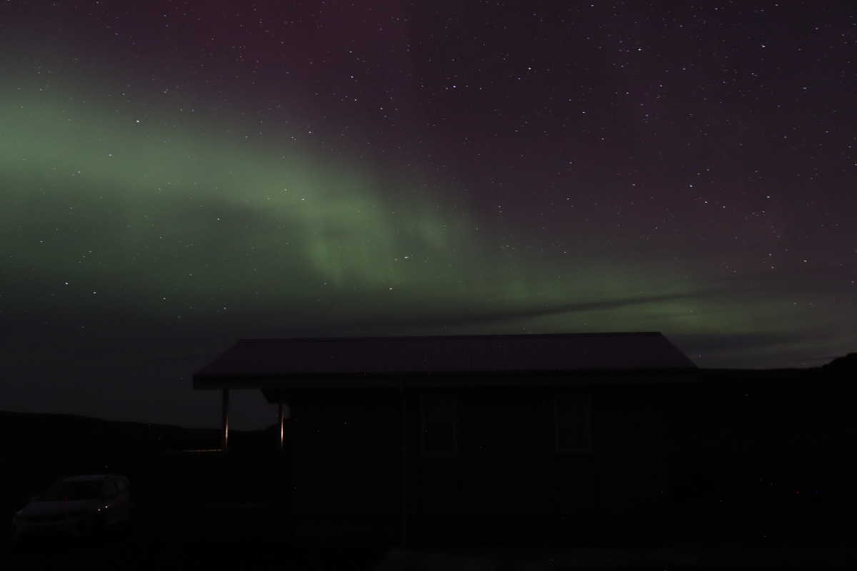
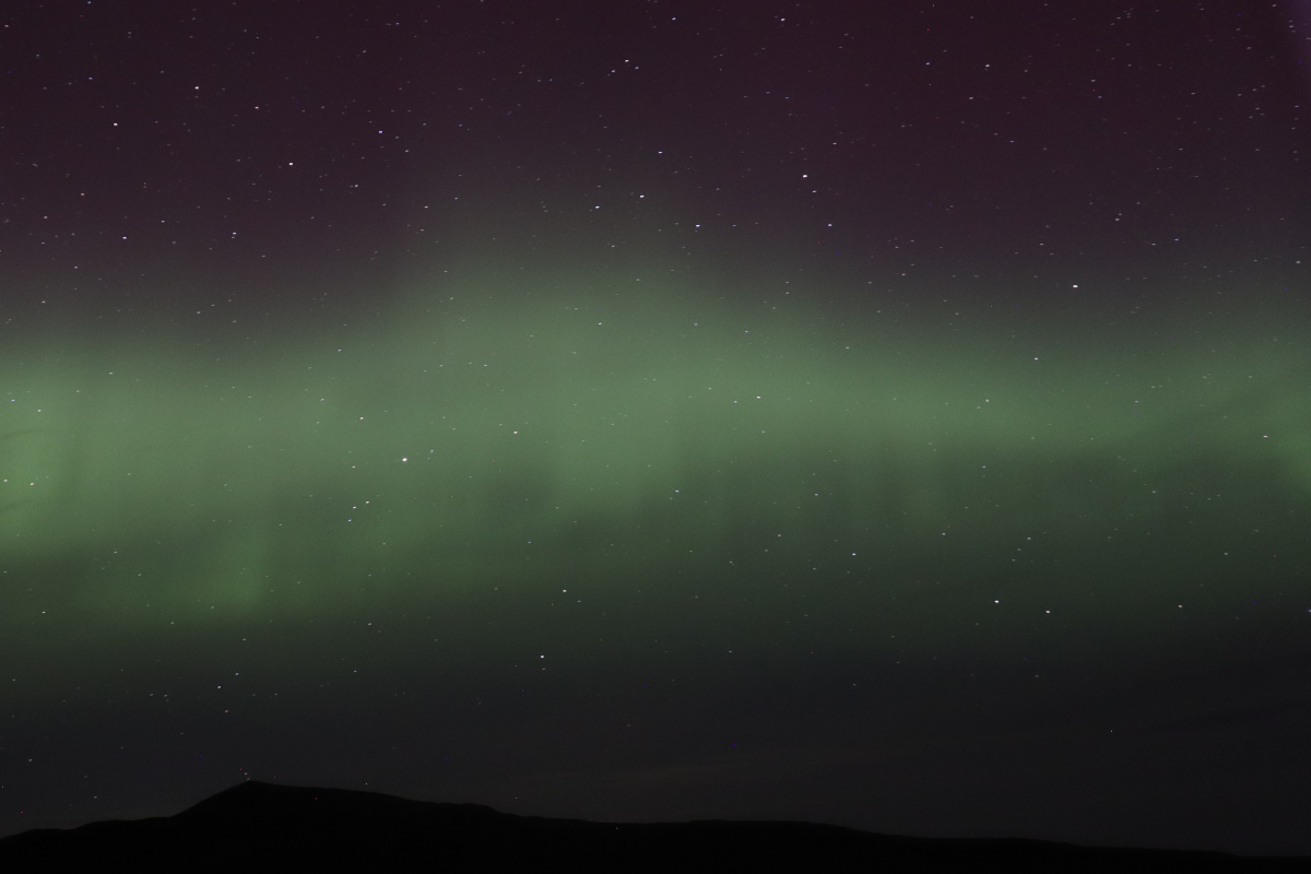
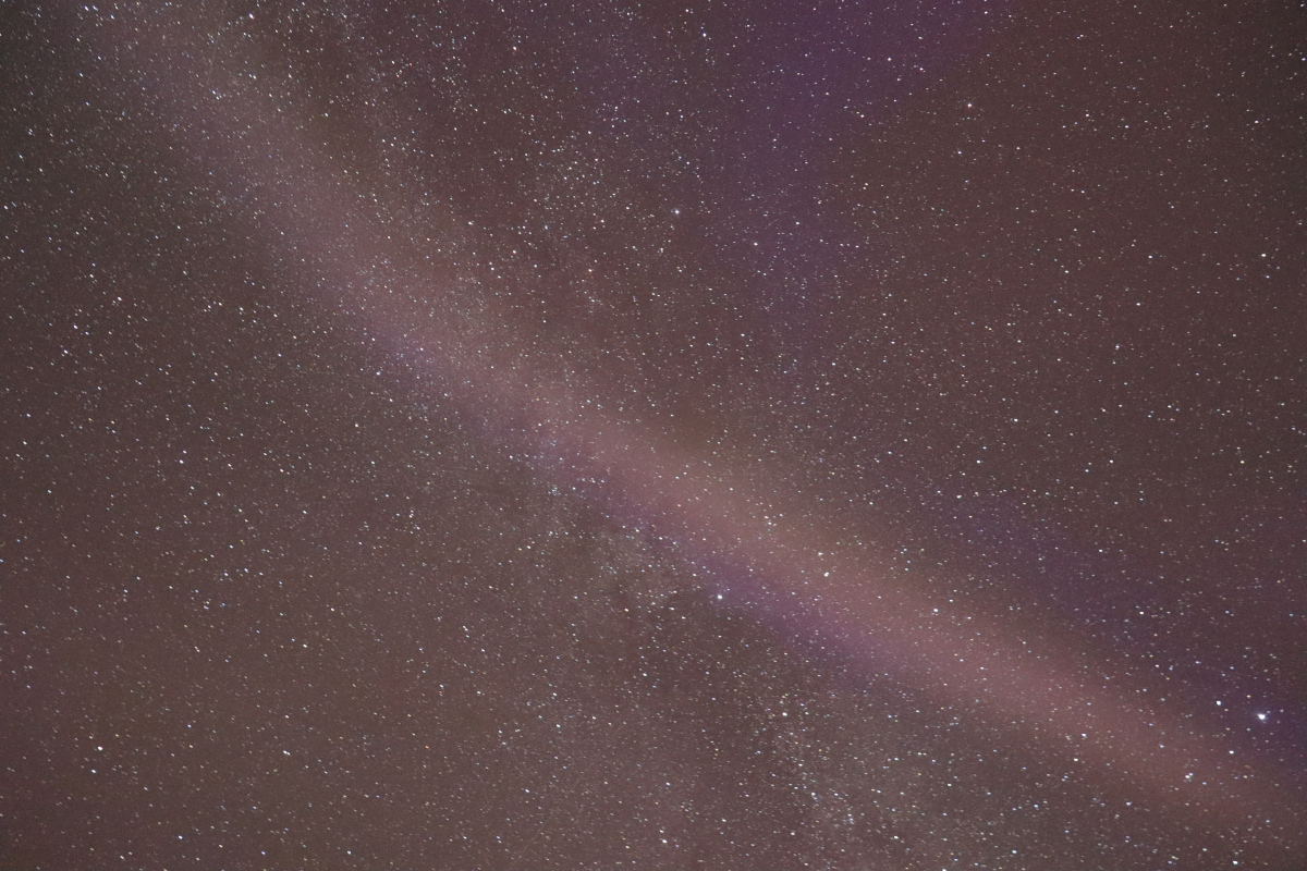
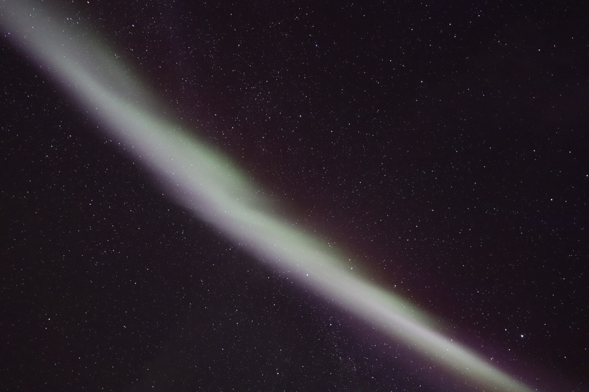
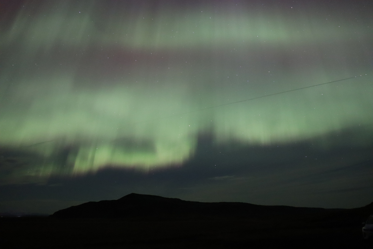
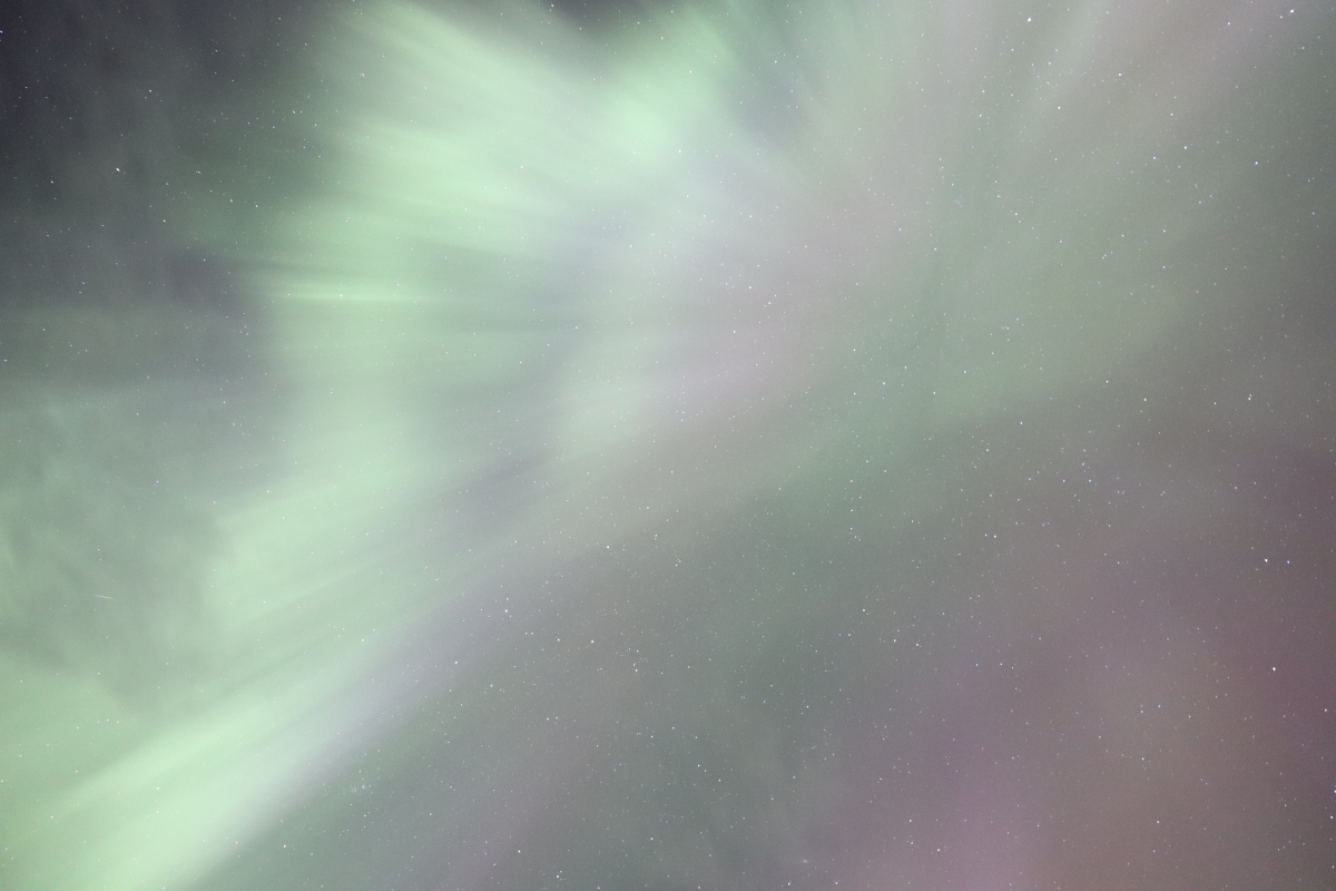
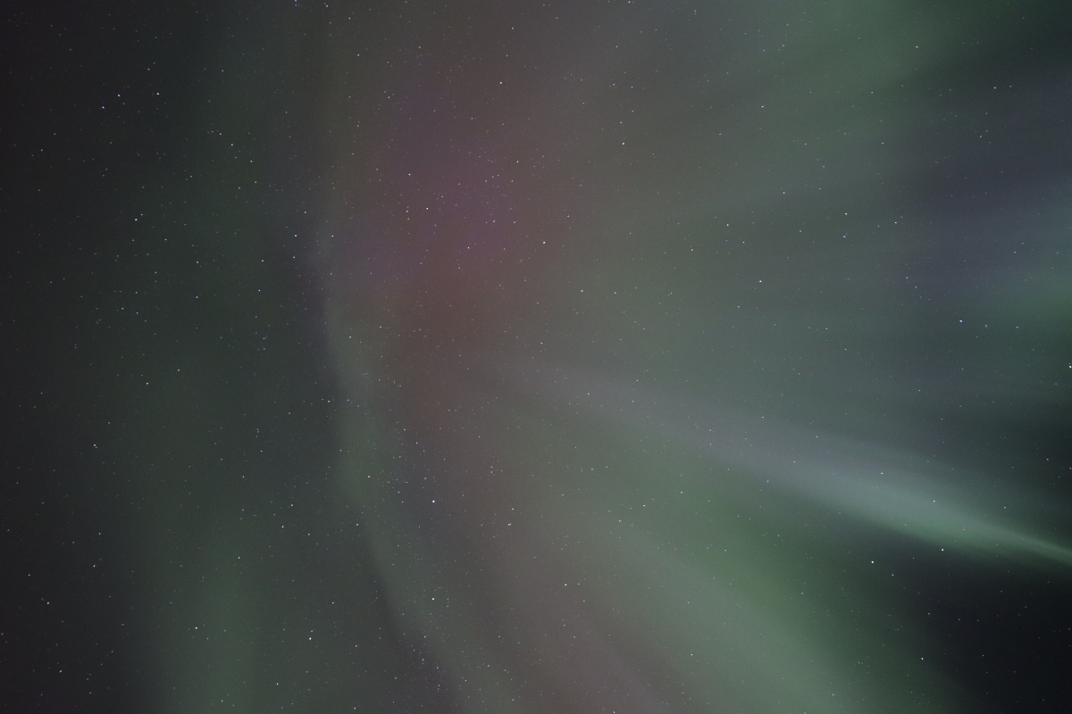
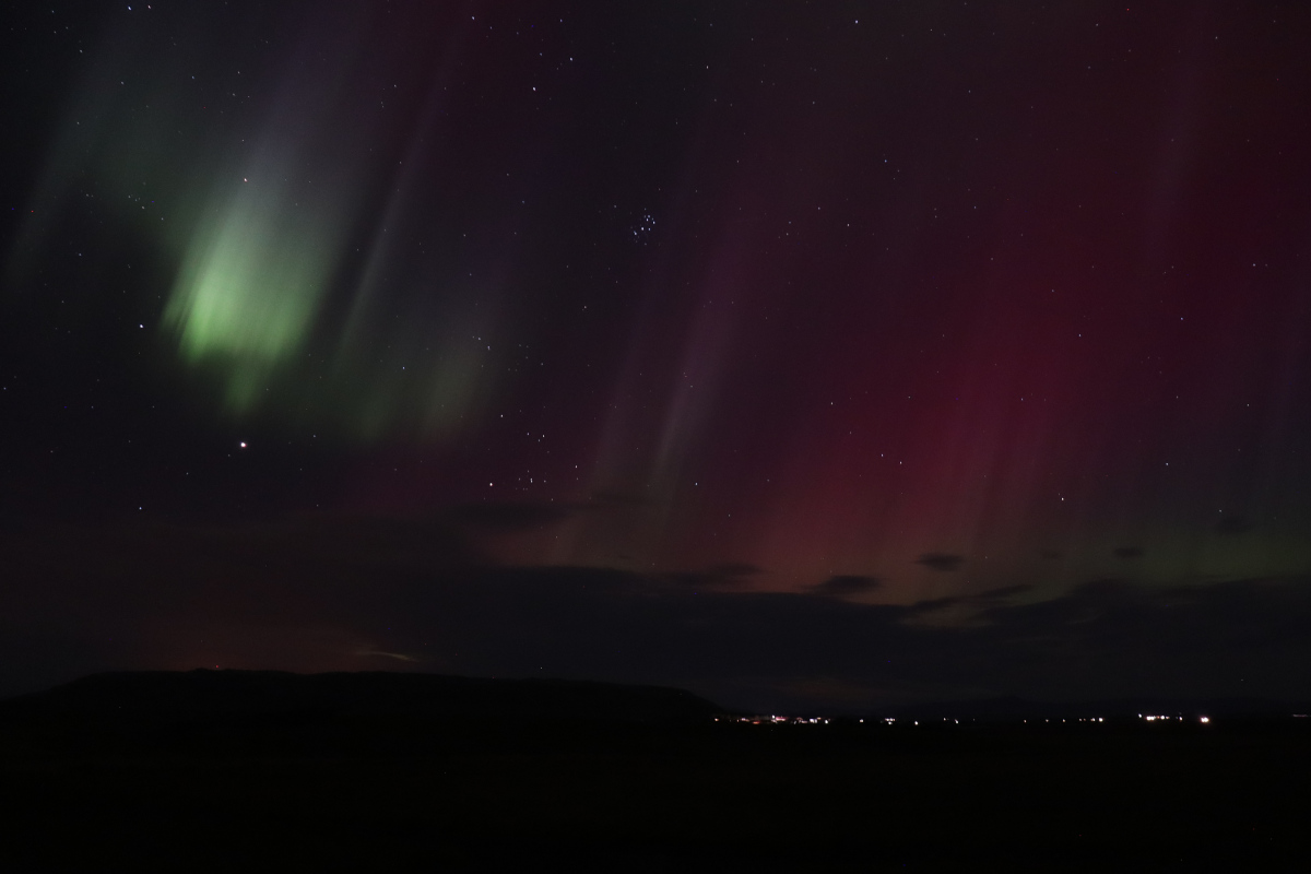
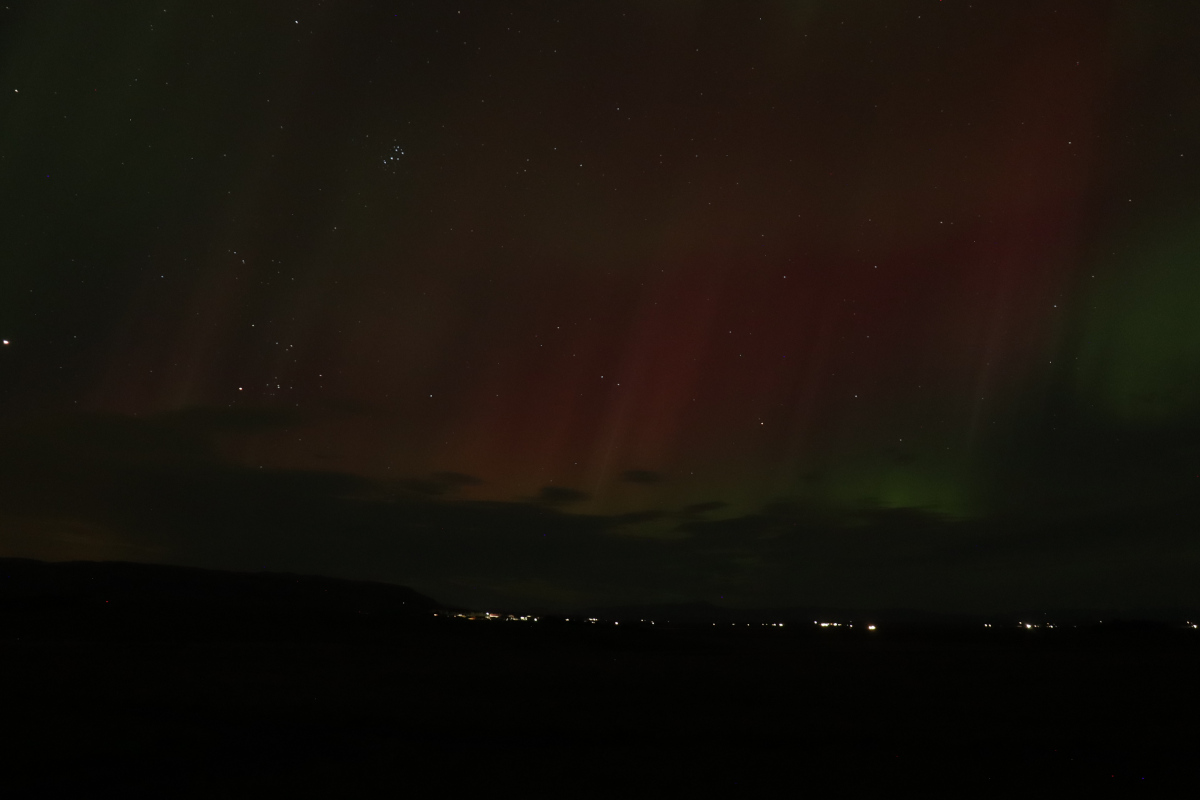
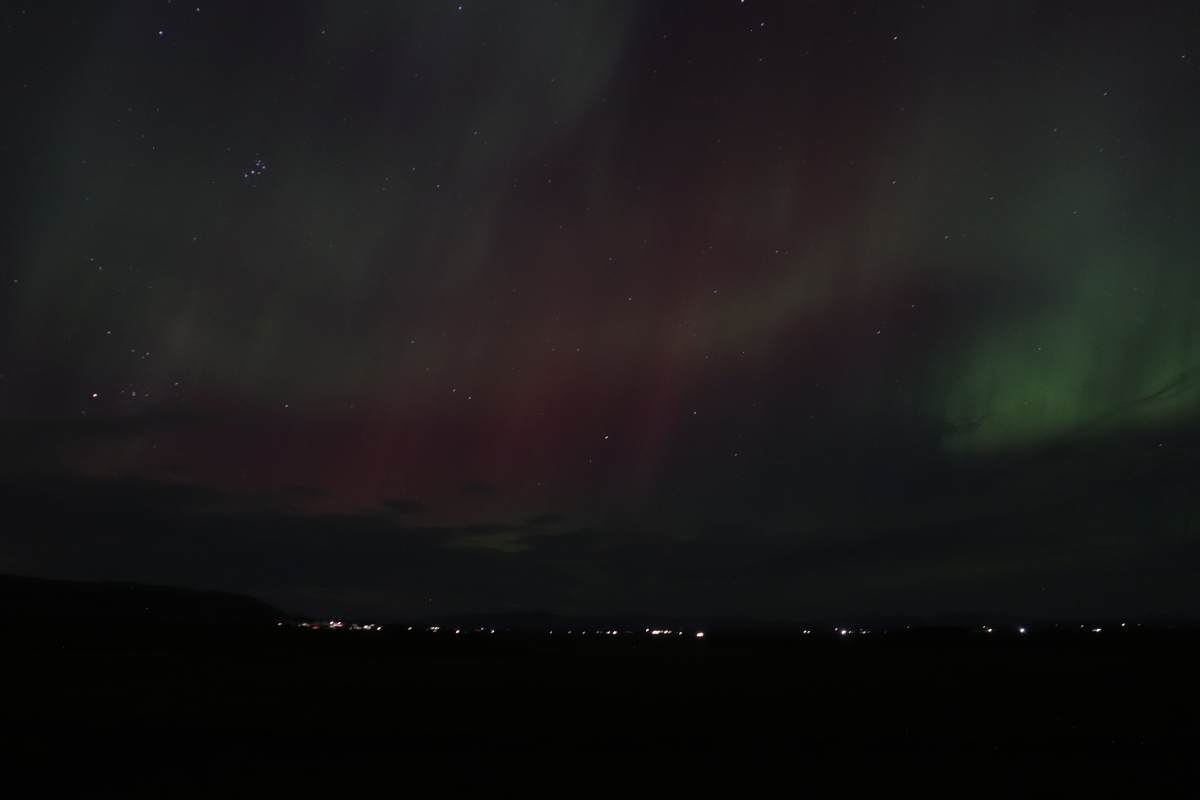
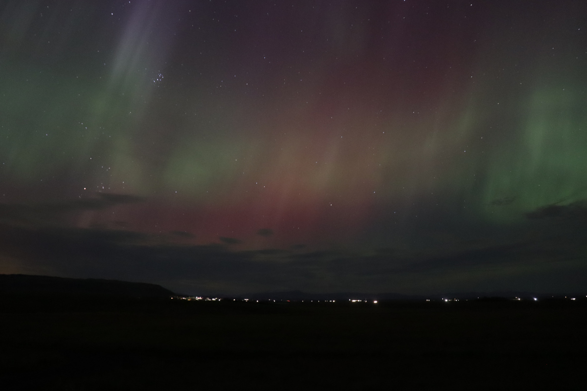
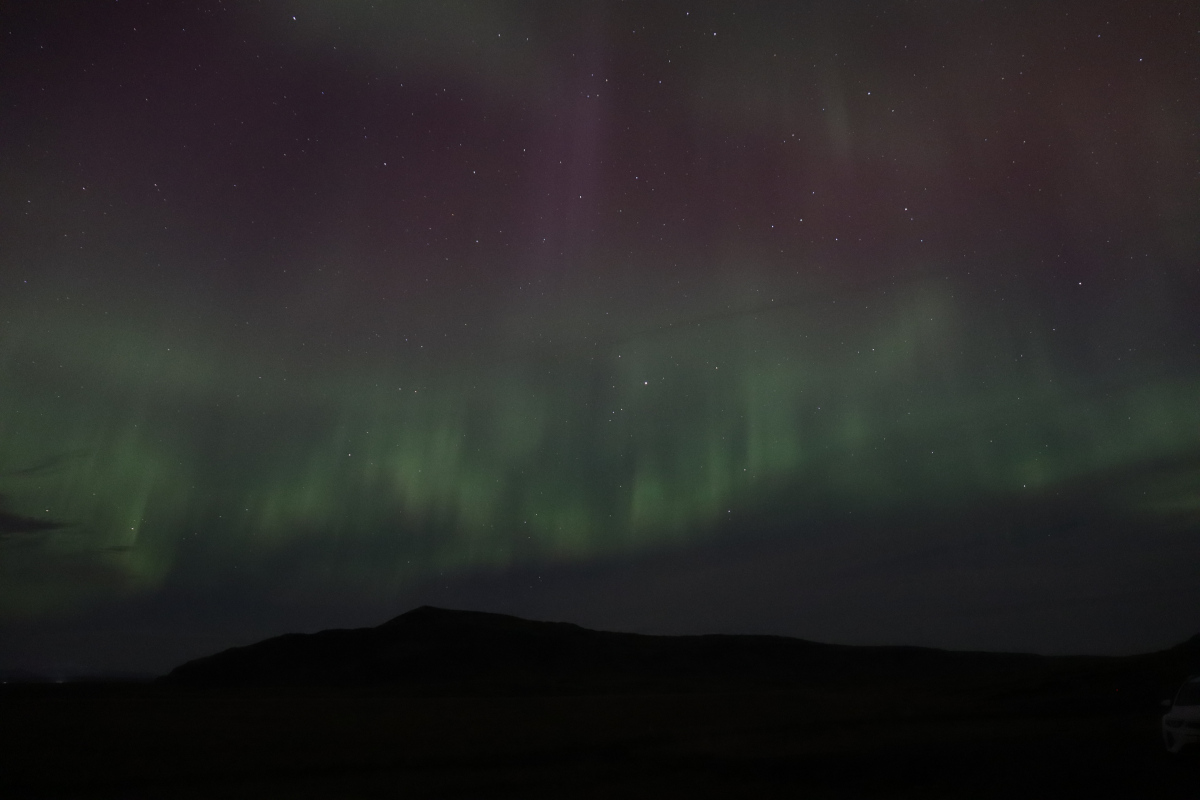
During our stay in Iceland, in a rural area 20 minutes north of Selfoss, we were fortunate enough to see the Aurora Borealis (Northern Lights) two nights in a row. The skies were relatively clear, and there was a solar storm with a Kp-index of between 6 to 8 out of 9. These are some of my favourite photos:
This time-lapse shows 7 minutes of aurora activity in 6 seconds, so is 70x faster than real life. It consists of 60 individual photos taken 7 seconds apart. The camera remained stationary, but enough time passes that you can see the stars move overhead.
The photos were taken by shooting manually, with the following settings:
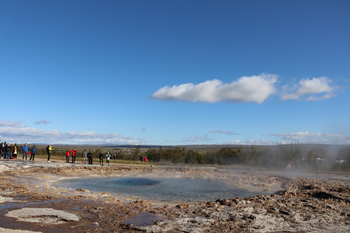
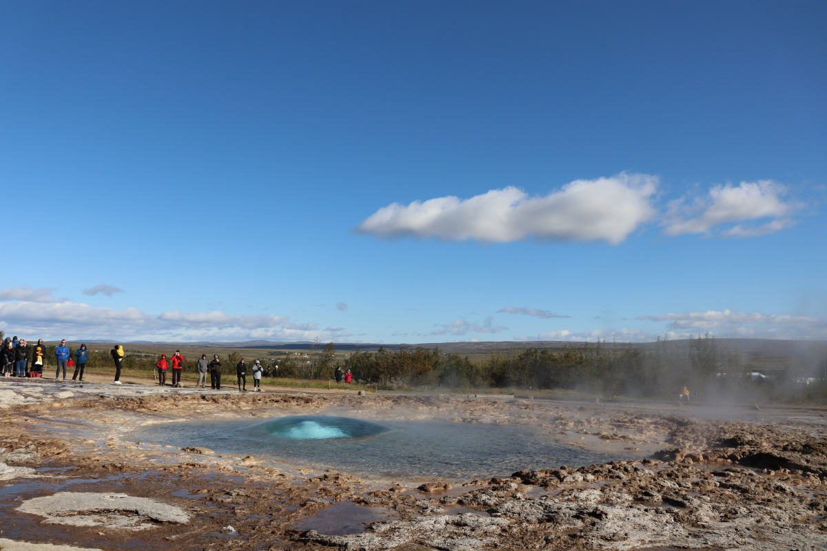
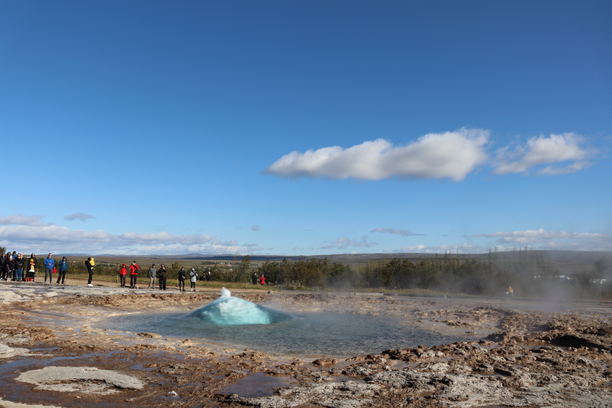
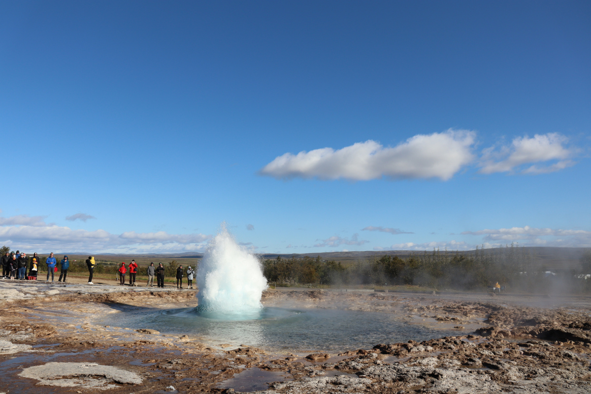
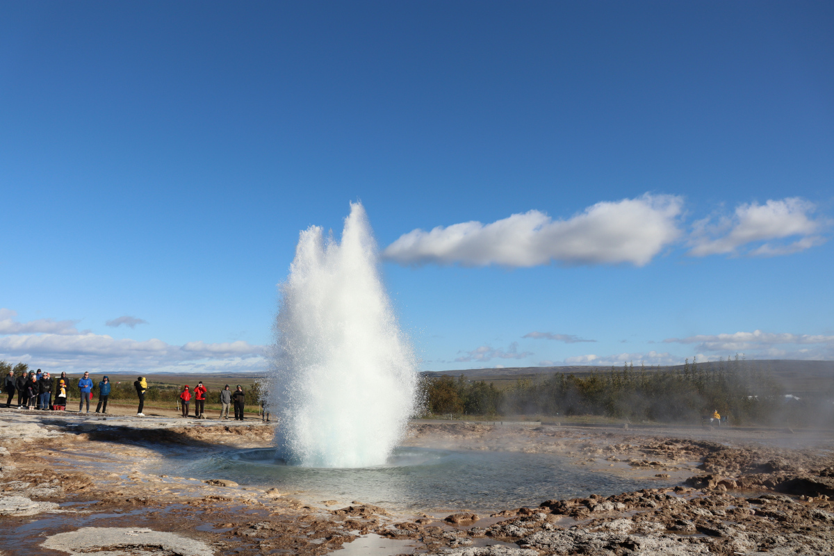
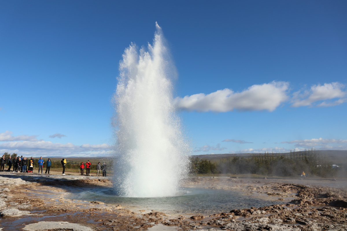
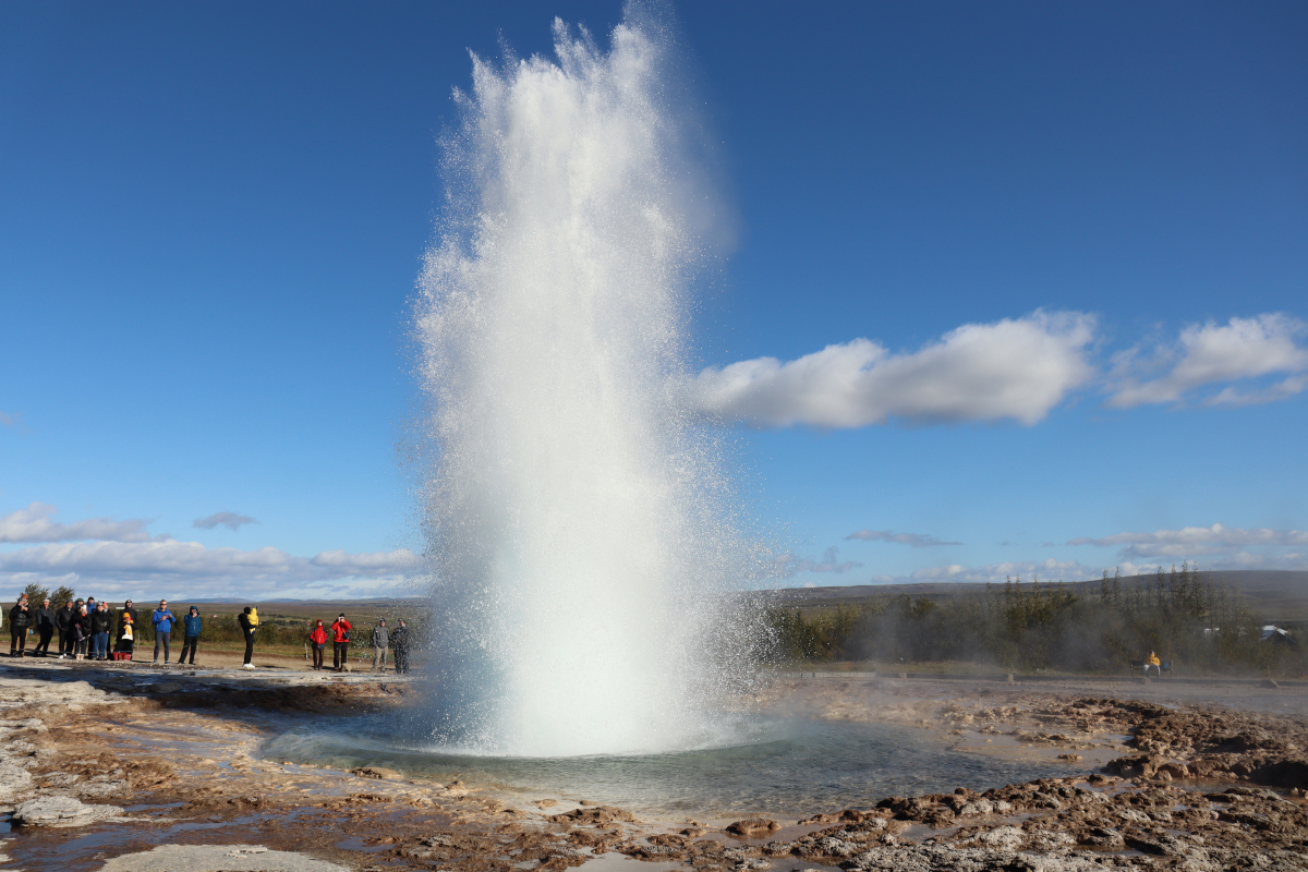
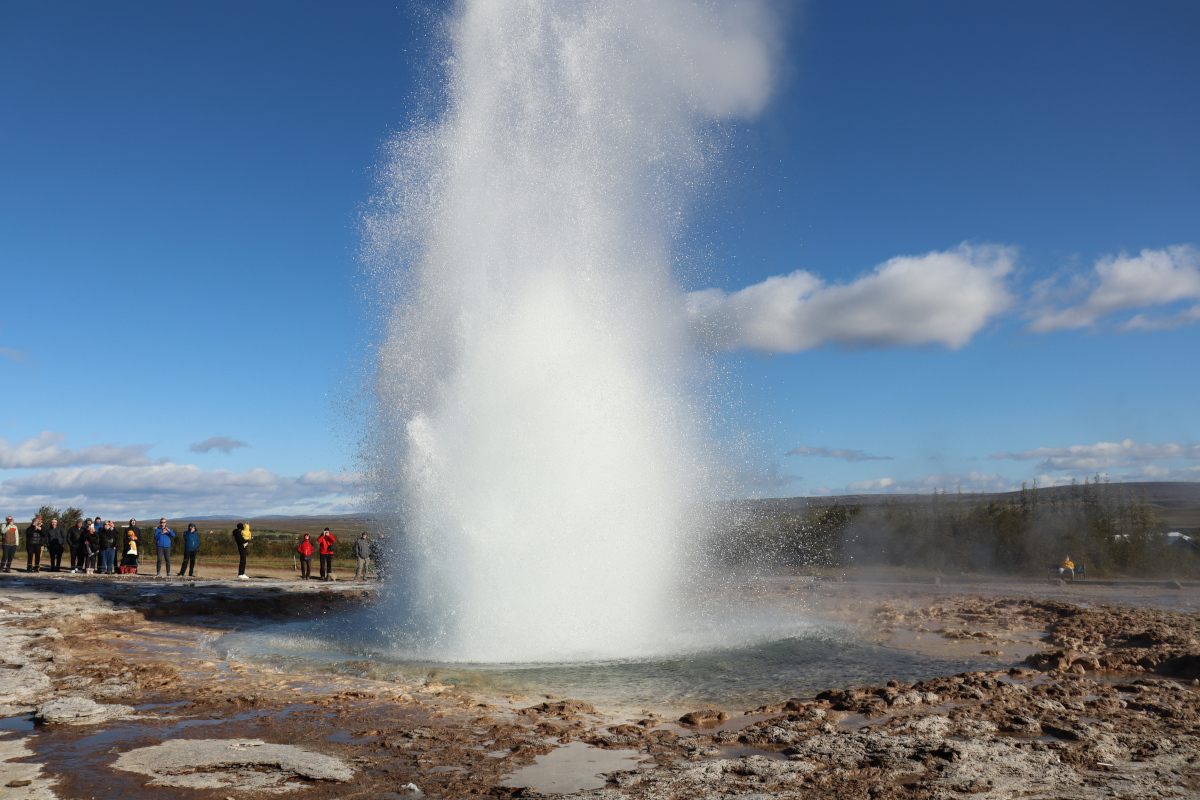
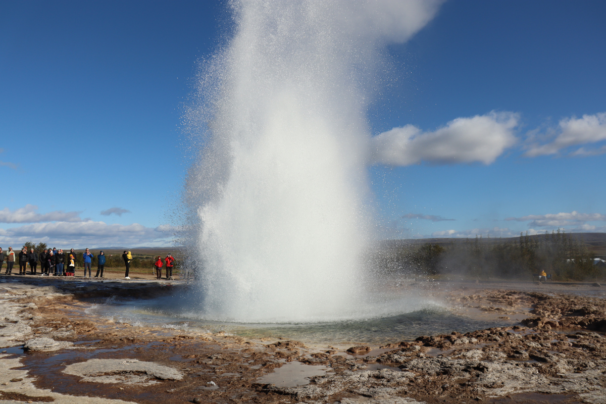
The main attraction at Geysir is Strokkur, a geyser that supposedly erupts about every 10 minutes. While we were there, it seemed to erupt about every 5 minutes! We saw more than half a dozen eruptions, and the height varied a lot.
Geysir
The namesake of Geysir, this geyser is a stone’s throw from Strokkur, but nowadays is dormant. Still, it was exciting to see Geysir up close even though there were no eruptions.
The remains of past industry are scattered throughout the valley. At some point, we passed this abandoned grindstone:
The river bends left, then as it bends right again there is a small clearing. Several stone brick pillars remain standing, overgrown, on both sides of the river. Presumably they used to form some sort of bridge that has long since collapsed. Here is one such pillar:
Despite the title of this trip, there is no single route called the Lathkill Dale Valley Loop. There are countless paths that weave through the valley, so if you search for routes, you’ll find numerous possibilities of varying lengths. Some are loops, others are there-and-back again. Some start at Over Haddon, or Monyash.
My goal was to take a route that was a loop, in the 5 to 10 mile range, and avoided roads as much as possible. I was also keen to see the cave, waterfall, ruins and mines. This route does all that, and was based upon these instructions, with the minor addition of a spur to visit the Lathkill Head Cave.
Map
SITE 1.ADMINISTRATIONCambridge RoadWimpoleRoadHaslingfieldRoadBarton RoadLord's BridgeStationAMI Small ArrayCOASTAMI Large Array†Pulsar Array4C Array†Half-Mile Telescope (small) & †One-Mile Telescope (large)†One-MileTelescopeTrack continues 1km eastwardse-MERLIN†CLFST†CATUnknown?Unknown?†SKA†HERAUnknown?†SKAPrototypearrayPrototypeindividualPrototypeRyle ControlRoomOne-MileControlRoom(Previously site of †Ryle Telescope)(Track is shared)Name†NameLong BrookBourn Brook𝕳𝖊𝖞 𝕳𝖎𝖑𝖑𝕽𝖔𝖒𝖆𝖓𝕭𝖆𝖗𝖗𝖔𝖜NSITE 6.SEWAGE DISPOSALSITE 2.BOMB STORESSITE 4.F.F.D.4.050403_AMI01_arrival02_station1 Mile1 Kilometerhttps://sam.hooke.me/mraoJune 2024Mullard Radio AstronomyObservatory (MRAO)KeyFormer railwayTelescope railwayMain roadMRAO tarmac roadMRAO trackTelescope (static)Telescope (on track)Telescope (approx. area)Telescope (active)Telescope (inactive)MRAO (approx. area)
Walking clockwise, following the road around the AMI Small Array, we reached the 4C Array, One-Mile Telescope and Half-Mile Telescope, which all run parallel to each other.
Map
SITE 1.ADMINISTRATIONCambridge RoadWimpoleRoadHaslingfieldRoadBarton RoadLord's BridgeStationAMI Small ArrayCOASTAMI Large Array†Pulsar Array4C Array†Half-Mile Telescope (small) & †One-Mile Telescope (large)†One-MileTelescopeTrack continues 1km eastwardse-MERLIN†CLFST†CATUnknown?Unknown?†SKA†HERAUnknown?†SKAPrototypearrayPrototypeindividualPrototypeRyle ControlRoomOne-MileControlRoom(Previously site of †Ryle Telescope)(Track is shared)Name†NameLong BrookBourn Brook𝕳𝖊𝖞 𝕳𝖎𝖑𝖑𝕽𝖔𝖒𝖆𝖓𝕭𝖆𝖗𝖗𝖔𝖜NSITE 6.SEWAGE DISPOSALSITE 2.BOMB STORESSITE 4.F.F.D.4.050403_AMI01_arrival02_station1 Mile1 Kilometerhttps://sam.hooke.me/mraoJune 2024Mullard Radio AstronomyObservatory (MRAO)KeyFormer railwayTelescope railwayMain roadMRAO tarmac roadMRAO trackTelescope (static)Telescope (on track)Telescope (approx. area)Telescope (active)Telescope (inactive)MRAO (approx. area)
Leaving the AMI Large Array (at the furthest east of MRAO), we drove west back along the road that follows the old east-west railway line, under the bridge, and then turned left at the fork. This gentle curve follows the line of the former railway sidings, for when this site used to be a munitions storage facility.
Perhaps best known for the discovery of the first pulsar, by Jocelyn Bell Burnell, the Mullard Radio Astronomy Observatory (MRAO) is located on the outskirts of Cambridge, located on the site of a former WWI mustard gas factory. The MRAO is home to many radio telescopes and antennas, with some equipment dating back to the 1950s, scattered across the several miles wide site. While most of the pre-1990s equipment is now decomissioned, there is still a lot of active work being done by the more recent arrays and telecopes.
Parked on the little gravel car park near The Bridge at Clayhithe (the name of a pub, but it is by a bridge). Room for about half a dozen cars, but it was almost empty.
Crossed the road brige and walked anti-clockwise around the loop. The first leg up to the lock was very peaceful, with several swans, coots and mallard bobbing along the river.
Bottisham Lock is actually quite far from Bottisham, over 3 miles away as the crow flies. Presumably it’s named as such because if you’re at Waterbeach, it’s the lock that leads towards Bottisham.1
While living in Seattle, it was fun when we came across British things that reminded us of home. Most of the time we just happened to stumble upon these things, though we were actively seeking out the best place to get proper fish & chips. Now that I’m back in the UK and can reflect upon on my 3.5 years in Seattle, I thought it would be interesting to record them all here:
We walked anti-clockwise from Southwold, along the edge of the sports grounds, and then through the sand dunes. There were quite a few people about, and lots of dogs.
At the mouth of the River Blyth you can see the ferry crossing to Walberswick. It was then easy going on the sand back to Southwold, with even more people and dogs, since it turned out to be a remarkably warm and sunny day for March.
We arrived at Horsey Gap at 12:45pm on a Saturday. There is a dedicated, paid car park, which is the only option for those who have come by car. The fee is reasonable, and although the car park is not very big, cars generally seem to leave frequently enough that you soon get a space.
Following are some of my favourite photos I took of the seals and their pups. While most of the seal pups are down on the beach, a handful were up in the dunes. Some helpful volunteers make sure that everyone keeps a safe distance away so as not to disturb the pups. Additionally, guide ropes help ensure that people stick to the paths, which helps preserve the terrain.
Arrived at 11:15am on Sunday. The main parking lot has room for about four cars, and there is an overflow parking lot just a stone’s throw down the road that looks like it can fit another two cars. We had no problem finding a space.
The hike is very pleasant, through tree cover all the way until you reach the summit. The trail is very easy to follow and in great condition, with some sections that have evidently been maintained recently. At various points there are benches beside the trail, including a nice viewpoint about half way up.
We chose Garfield Ledges for a short afternoon hike on a beautifully sunny Saturday. The drive near the Mailbox Peak parking lot had been rather slow, having to squeeze past an almost unbroken chain of parked cars about half a mile long, starting at the Valley Camp junction (where the one-way road ends). However, once past that traffic jam the road to Garfield Ledges was clear and quiet.
The road is paved almost the entire way. It turns to gravel just after the Middle Fork Campground. There are some hefty potholes right where the paving ends, and again on either side of the bridge, but once you’ve made it to the gravel parking lot the worst is over. A Prius and Tesla had made it seemingly in one piece, but most cars had higher clearance.
Trail is still snow covered, but both fairly compact and yet rather slushy. I used snowshoes, but others in our group were fine with Yaktrax, so long as they stayed on the well-trodden trail.
The lake (pond) still appears to be frozen, apart from the north end where the creek flows in, though the surface is somewhat slushy and seems to give way easily.
We arrived at 2:30pm on Tuesday and were able to park on the road right outside the winter trailhead. There were only three other cars, and the road was completely free of snow. We left about 4pm and were the last car present.
Arrived at 2pm for a brief visit. High tide had been 8.3ft at 1:05pm, so the tide was still very high. No tide pools accessible but still lots of fun to be had.
The little stream to the north that flows from the pond into the sea was too wide to jump across, and too deep to walk through in boots. However, with the help of some strangers we built a very primitive bridge out of the driftwood. Though it still required a good sense of balance.
Can confirm: is muddy. Though beware the mud doesn’t really begin until about 1 mile in. The first half mile or so is mostly board walks, which are in good condition and keep you safe above the squelchy terrain. After the board walks you join the old road, which is a little muddy but not too bad. The road ascends gently, turns to the left and levels out, then gradually gets more and more muddy, and before you know it the mud is unavoidable.
Arrived at 9:30am on Tuesday. Plenty of space in the parking lot. Pretty much had the trail to ourselves! On the way out we only bumped into a couple of other groups going the other way.
The trail is in great condition. At worst there are a few muddy patches, though typically with logs for stepping stones, but nothing challenging. The latter half of the trail is mostly board walks, and the viewpoints are all reasonably sized fenced wooden platforms.
View up towards Heather Ridge from the rock garden.
Summary
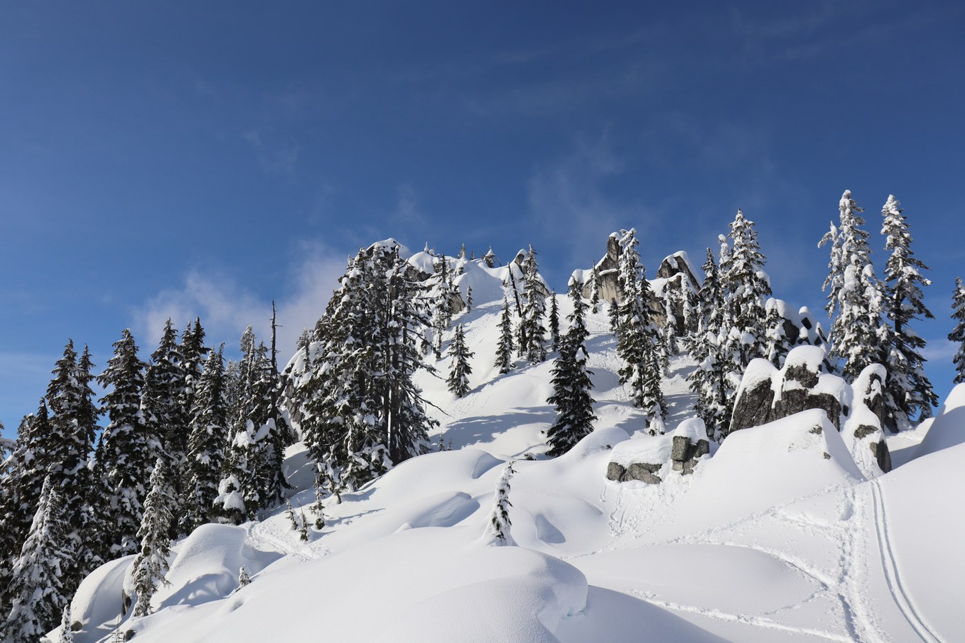
The ascent on this showshoe hike is relentless, but the views are spectacular, especially if you push past the lake a bit further on up to the “rock garden”.
We saw many people hiking using microspokes/yaktrax rather than snowshoes, and they were able to reach the lake but no further. The snow up to the rock garden is very deep, the forest is dense, and there is no clear trail. But once you reach the top there are fantastic snow covered boulders, and sweeping views across the valley.
The waterfall that flows beneath the Humpback Creek bridge (~0.3 miles from trailhead).
Arrived at 2:30pm for a quick snowshoe excursion up to the iron horse trail and back before sunset. Quite a short one, just over 2 miles round trip, almost 500ft elevation gain. We took our time going up, and got to the iron horse trail in ~55 minutes, and then got back down much faster in just ~30 minutes.
Used the south parking lot (Pinnacle Peak Park). Arrived about 1:30pm and there were plenty of spaces.
Did a lollipop hike (detailed below). Covered 3.2 miles in 2:15 (1:05 to ascend, 0:30 at the top, then 0:40 to descend).
On the way up, followed the road all the way to its end, then took the trail through the trees anti-clockwise. The last ~200yds before the summit had some very steep and rocky sections, though exposed roots and trees made for some good handholds. Climbed to the top of the fire lookout, which has some good views, though much is obscured by trees. Mt. Rainier was better viewed from the road on the way up than it was from the tower.
Arrived about 11am, and the parking lot had plenty of space. We walked clockwise around the lake. It was very easy going, and well maintained despite all the branches and trees that have been fallen down recently (all cleared out the way).
It took 35 minutes to walk around, though this included 5 or 10 minutes of occasional stops to look around or explore the side trails.
We met many others who were out for a casual walk around the lake, though at the same time it didn’t feel too busy. There were good facilities next to the parking lot, with decent restrooms, a play park and lots of picnic benches.
Arrived an hour before sunset, so only hiked just over a couple of miles out and back again. Although short, it was well worth the trip. The skies were clear, and Garfield Mountain descended into a deep shade of red as the sun went down. Along the first mile there are several expansive views looking north-east.
After a mile or so, we spotted a Gold Crested Kinglet, with a vibrant yellow stripe on its head. We could also hear other birds in the trees, but they all remained elusive. The only other animals we encountered were dogs with their human friends.
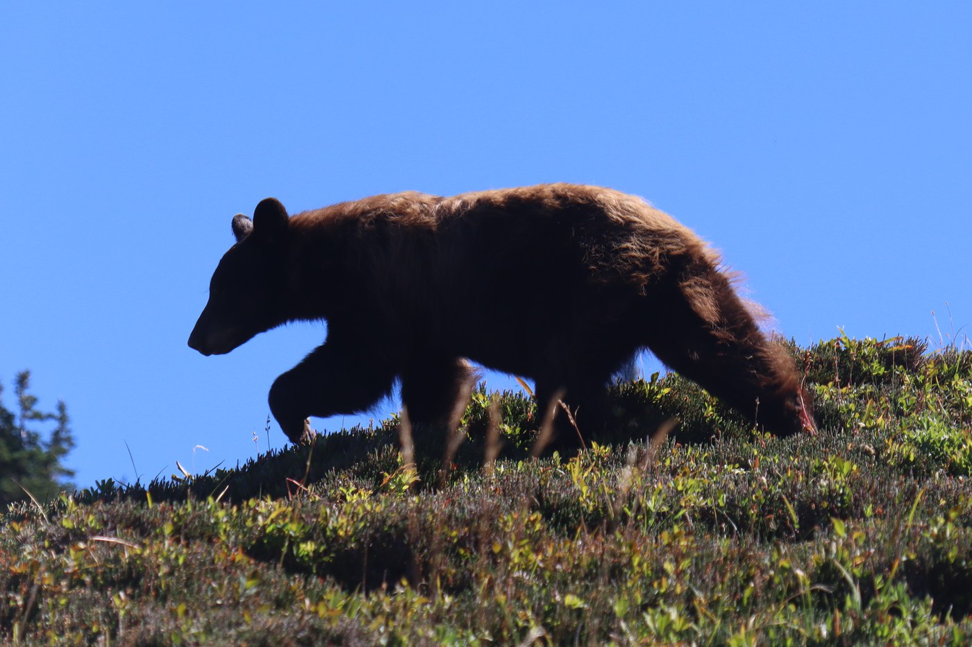
There are many routes available at Sunrise, and the trailhead is well equipped with a huge car park and great facilities. We originally intended to just do a there-and-back-again hike to Fremont Lookout, but ended up exploring more of the trails, and were rewarded with some fantastic wildlife sightings of a bear and mountain goats.
Details
Distance
15.13 km / 9.4 miles
Elevation gain
610 m / 2000 ft
Duration
6h50m
Moving
3h35m
Trip Report
We had our best hike yet - perfect weather, and an encounter with a fox, a bear, and mountain goats!
Arrived at 9am on a Saturday. Main parking lot was full, but overflow had a few spaces still.
The trail is in good condition, though obviously endures a lot of footfall, with lots of bare rock and roots exposed. Multiple sections feel like a “choose your own adventure” book, with the trail diverging into several possible routes, but they all quickly merge again. The first 2/3rds of the trail has several plateaus and even a few downhill seconds, but the last 1/3rd is a consistent steep ascent.
We arrived at 2:40pm on a Saturday, and there were only a dozen cars in the parking lot, with spaces for a few dozen more. There are no facilities at the trailhead, but the Coldwater Ridge Visitor Center and Johnston Ridge Observatory are both just a short drive away.
We hiked clockwise around the Hummocks Trail loop. (As an aside, confusingly there is another WTA hike named Hummocks Loop, but as far as I can tell, it’s actually the same as Boundary West, which forks off the Hummocks Trail at the Boundary Trail sign part way around the loop).
The fee is $8 per adult, but federal interagency recreation passes get you free entry (e.g. America the Beautiful Pass). Unlike at other trailheads, do not leave the pass in your car. Take it with you into the Johnston Ridge Observatory and claim your free entry (a wristband).
We arrived at the Johnston Ridge Observatory around 11am on a Saturday. The parking lot was about half full, but it is massive, so finding a space was not an issue.
We did a “lollipop hike”, extending the route slightly to a total length of 8.17 miles and 1,587ft elevation gain. We began as usual by heading first to Talapus Lake, then onward to Olallie Lake, and then took the much less well-trodden connector trail from the north-east corner of Olallie Lake straight up the mountainside to the Pratt Lake Trail. At this point we encountered intermittent patches of snow on the trail, continuing for a few hundred meters as we headed south. At the junction with the Talapus Cutoff Trail, we took the sharp right turn, and headed north back towards Olallie Lake, rejoining the Talapus Lake Trail with another sharp right turn, then retraced our steps back to Talapus Lake and the trailhead.
I was curious to try out an Oru Kayak (which folds up for storage), and some friends kindly let me borrow theirs. It was easy going heading south with the wind, but going back north again the kayak sometimes had a mind of its own.
Arrived shortly after midday on a hot Saturday with clear skies. Unsurprisingly the parking lot was pretty much full. The short road that leads up to the parking lot is gravel, and has quite a lot of pot holes, but nothing insurmountable.
I’ve visited Gold Creek Pond numerous times in winter, when it is beneath a blanket of snow, but never before in summer. It is still just as scenic as always, and well worth the visit.
We arrived about 9am on a Saturday. At first the parking lot looked full, but it’s quite long, and turned out there were actually still a lot of spaces.
The start of the trail can be hard to spot from a distance. If in doubt, keep walking towards the end of the parking lot with the restroom, and you’ll soon see the trailhead on your left. There is only a short climb up to the old railway line, after which the rest of the hike is unsurprisingly flat.
We arrived at the trailhead near the Sunnyside Cemetry at 9am, and were only the third car to arrive. A chorus of birdsong welcomed us, with countless birds in the bushes, trees and foraging in the fields. It was well worth taking this longer route (rather than parking by the seaside), since we were able to enjoy the very pleasant and easy walk between the fields to the bluff, and saw plenty of Red-winged Blackbirds, Starlings and more.
Just to confirm, Bowman Bay Boat Launch and the adjacent beach are still closed due to the elephant seal pup. The Bowman Bay parking lot itself is open, but if you plan on hiking along the coast to the lighthouse, you will need to take a detour (other trip reports have already shared the detour map). Pets/dogs are also disallowed at Bowman Bay due to the pup.
Today there were several volunteers nearby who are watching over the pup, with a little marquee set up at the north end of the Boatman Bay Boat Launch parking lot. The volunteers were very friendly and had lots of information, photos and videos of the pup. The pup itself was visible, though was 100m (300ft) away, however one of the volunteers kindly lent us their binoculars so we could get a good look!
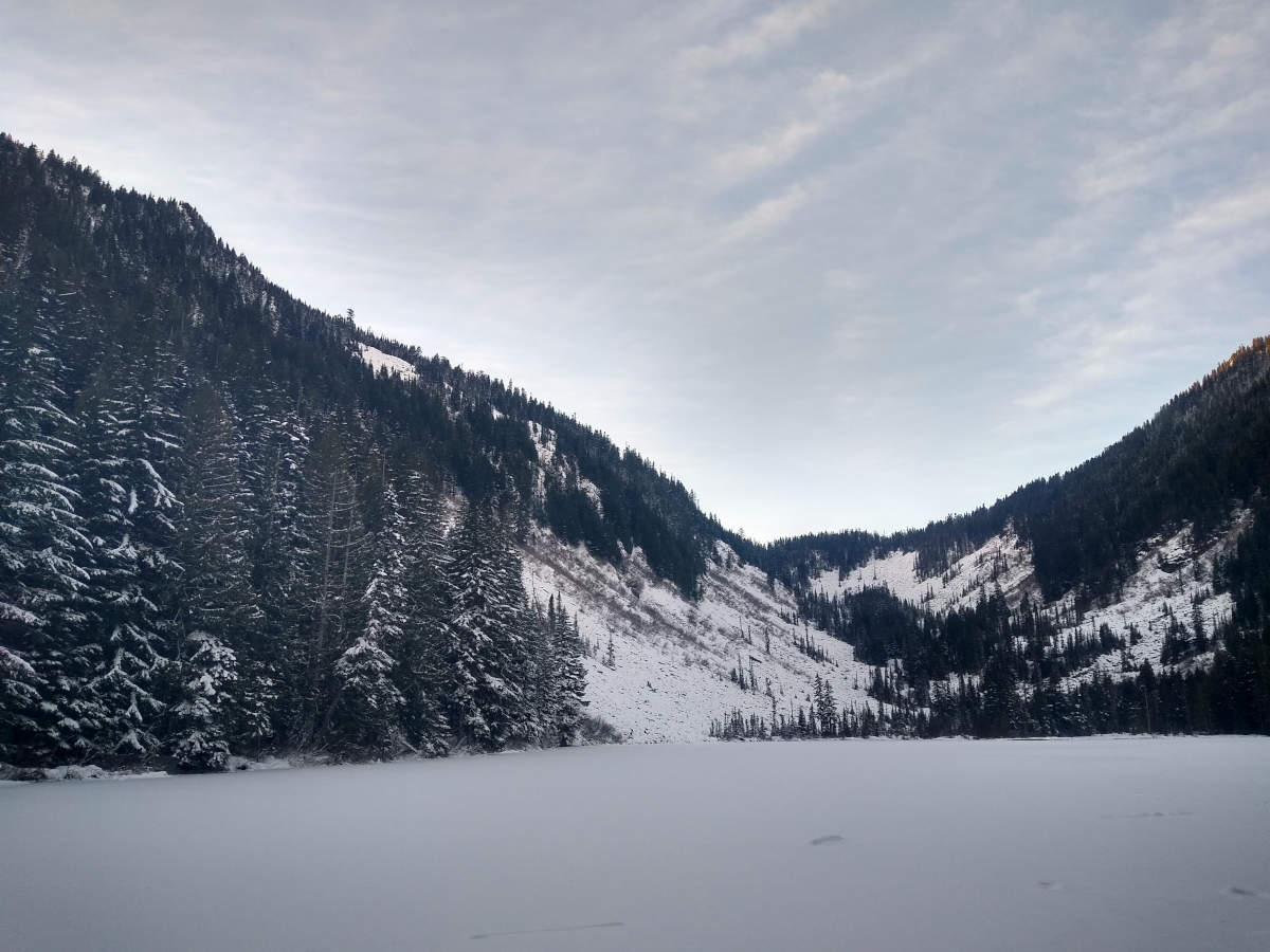
View from the campground southwards, across the partially frozen lake.
Summary: 5.5 mile round-trip snowshoe from Kachess Sno-Park to Kachess Campground.
Kachess Lake Road (from the I-90 to Kachess Sno-Park) was completely clear of snow, so very easy to access the trailhead. Even though we arrived at midday on a Saturday, there were still plenty of spaces. Parking is on the right side of the road, with a big turning circle at the end by the trailhead (since from that point on the road is snow covered). There are chemical toilets just before the trailhead on the left.
Arrived just after 7am to catch the sunrise. We were perhaps the fifth car, and got a space right next to the Gold Creek Snowshoe Trailhead. The road from the I-90 (NF-4832) was in a fairly good condition, with several snow free stretches, but also some stretches of hardened snow and ice. The iciest sections were at the corner by Gold Creek Sno-Park where you first enter the road, and by the Gold Creek Snowshoe Trailhead, but with our AWD it was fine.
Arrived at 1pm on Saturday, was able to get a spot without too much trouble. The parking lot was completely clear of snow. No snow on the trail either.
Just before the ledge, there is a new set of wide stairs which must have been installed somewhat recently. They make the final ascent (from just after the fork) very easy, and are better at handling the hiker traffic than the rough trail that used to be there. Thank you for adding them!
The road to Samish Overlook is very snowy and icy, starting from the moment you turn off Barrell Springs Rd onto 5 Mi Blanchard Hilltrail. Right off the bat, there is a “Road Closed” sign at right hand side, but it does not block the way forward, and evidently many others had driven past. We stopped to put on our show chains. Before reaching the Blanchard Mountain Trail Lower Parking lot, we saw a couple cars come back down which had passed us while we were chaining up.
View of Snow Lake as you descend the ridge.
Summary
Snow Lake is incredibly popular, and for good reason. The hike is beautiful from start to finish, especially with the low lying blankets of mist that roll through the trees and across the lake. It’s barely an hour’s drive from Seattle, yet feels like remote, unspoilt wilderness.
This scenic hike is named after its destination, Pyramid Lake. While the lake itself is a little on the small side, perhaps edging into “pond” territory, it is nevertheless beautiful, with some fascinating features. Carniverous sundew plants abound on the floating logs, and pikas hide in the nearby rocks.
Beware of icy conditions on the trail. Last weekend’s snowfall is still present on the trail once you get a couple of miles from the parking lot, and while the snow isn’t deep, it has been compacted into slippery ice in many places.
The parking lot and road are free of snow, so the actual drive there is no problem. The gravel road is in a good condition, with just the occasional potholes to watch out for. We arrived just after 10am on a Saturday and there were still 5 free spaces.
Distance
3.85 km / 2.39 miles
Elevation gain
33 m / 109 ft
Duration
1h30m
Moving
55m
Very wet, very few people about: good time to hike!
A rather short, easy hike in very heavy rain.
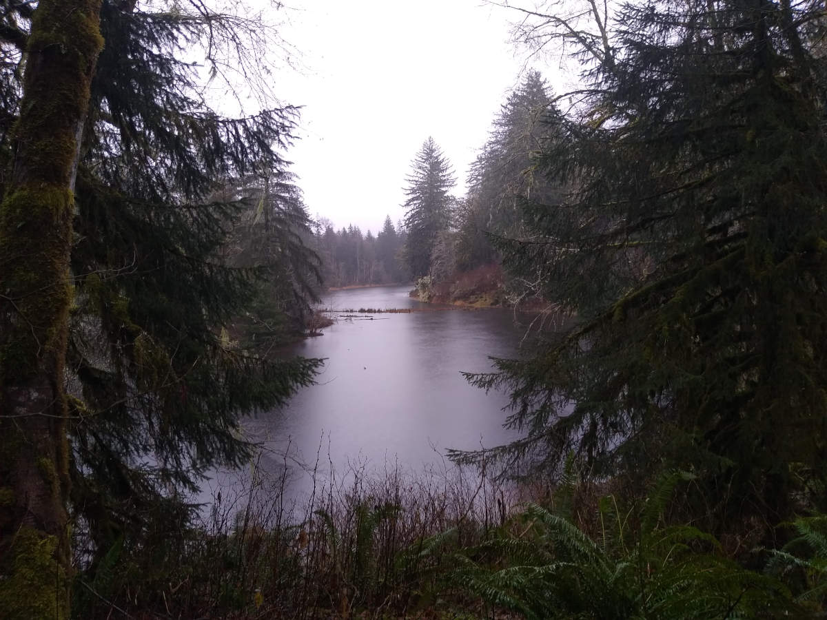
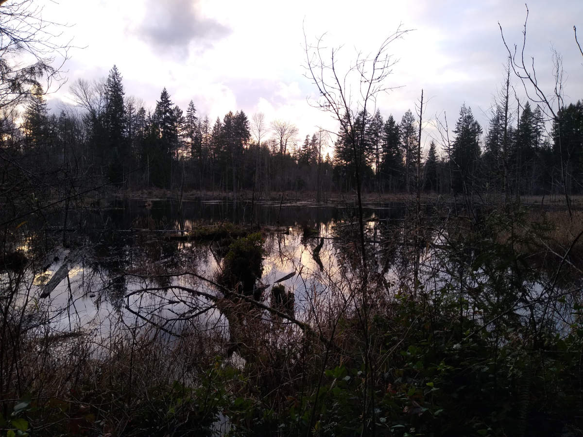
No one else was around, so it was easy to park at the trailhead. We went anti-clockwise around the lake (three months later we took the clockwise loop).
At the south-western tip of oxbow lake, looking north-east.
At the eastern side of the lake is a short trail that leads over to Middle Fork Snoqualmie River.
Distance
8.59 km / 5.34 miles
Elevation gain
236 m / 773 ft
Duration
4h25m
Moving
2h25m
We were mostly following the Kendall Peak Lakes Trail which starts at Gold Creek Sno-Park, though didn’t plan to actually reach the lakes. The main trail was quite popular, so we followed a side trail instead, which offered good views of the ski resort (smothered in mist) and inquisitive wildlife (camp robbers after our lunch). A tiny waterfall by the first switchback showcased some elaborate icy sculptures.
Distance
12.26 km / 7.62 miles
Elevation gain
222 m / 728 ft
Duration
5h25m
Moving
2h50
We left Seattle early, but due to the long drive across the Cascades it was already 10:30am by the time we set off.
I had read that the views from this hike were spectacular, but there was a thick mist as far as we could see. This was quite atmospheric and felt like being lost in a cloud.
Distance
8.22 km / 5.11 miles
Elevation gain
365 m / 1198 ft
Duration
4h45m
Moving
2h20m
No trip report yet.
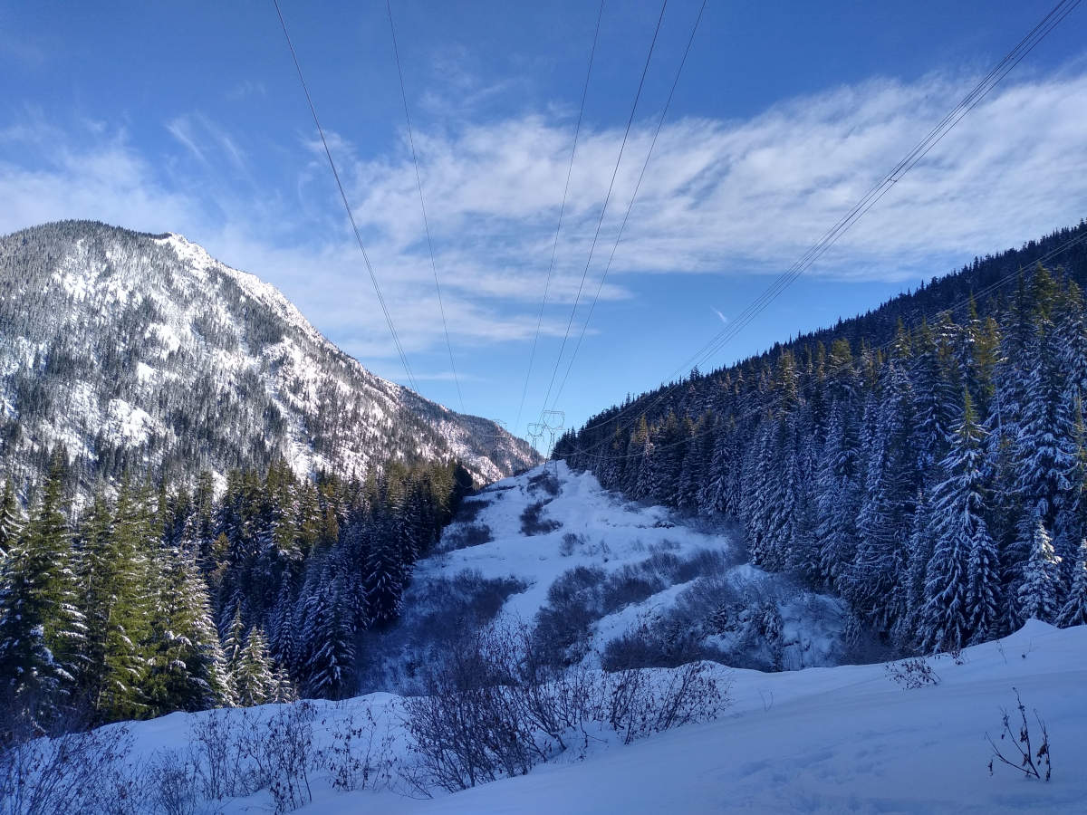
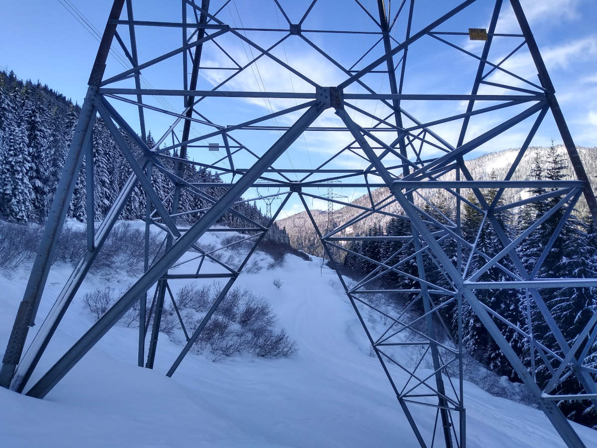
Looking along the line of pylons.
A close look at the pylon base.
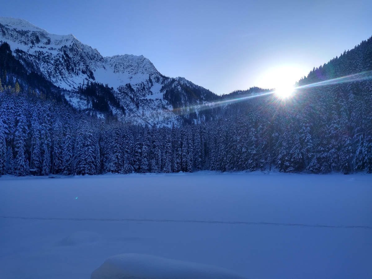
Lanhm Lake with the sun just about to vanish.
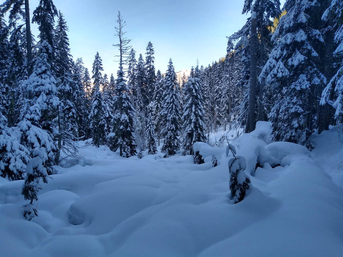
Snowy lumps amidst the trees.
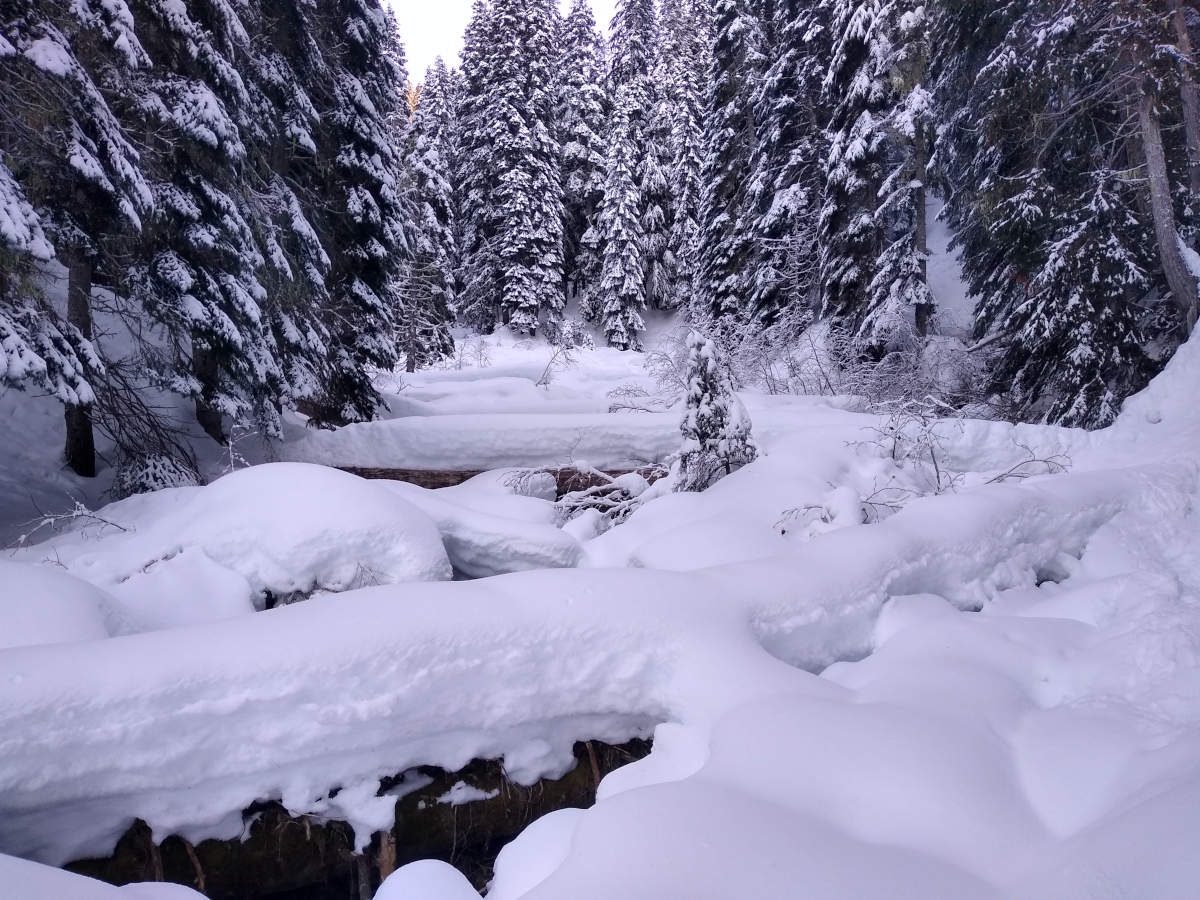
Snow logs amidst the trees.
Distance
5.87 km / 3.65 miles
Elevation gain
34 m / 112 ft
Duration
4h
Moving
1h40m
No trip report yet.
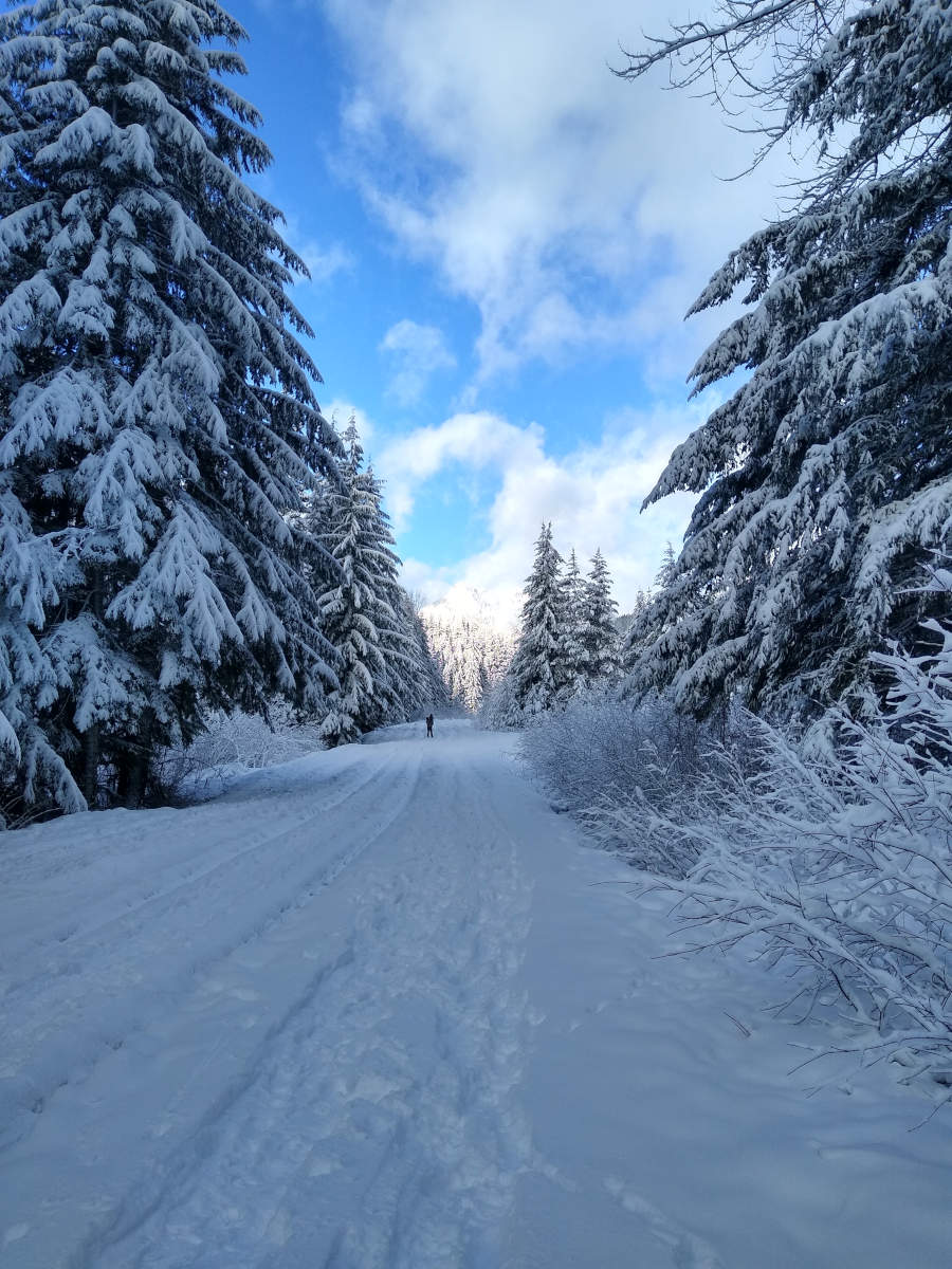
Following the trail from the trailhead to the lake.
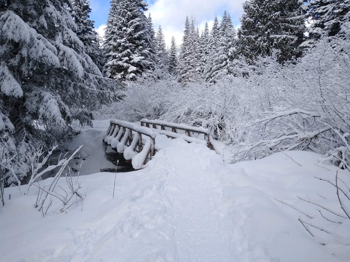
The snow covered bridge at the north side of the lake.
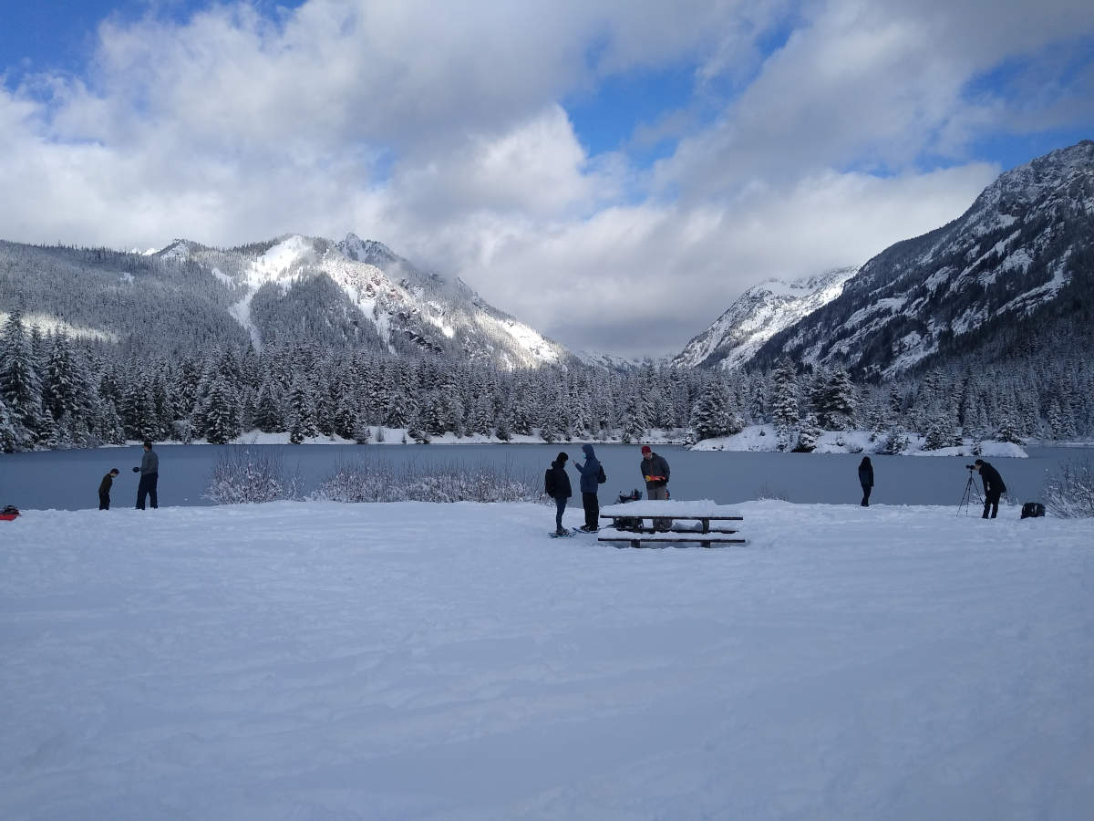
View of Gold Creek Pond from the south shore.
Talapus Lake. The best photo I have, because for some unknown reason I barely took any photos on this hike.
Distance
7.6 km / 4.72 miles
Elevation gain
233 m / 765 ft
Duration
3h10m
Moving
2h10m
Normally we like to start hiking bright and early, but today we went on an afternoon hike with friends.
After turning off the I-90, the drive up FR 9030 was pretty hairy. It’s a gravel road, with sharp blind bends, and at some points it’s rather narrow with a steep drop to the side through dense forest. By itself this wouldn’t have been an issue, but we weren’t the only people driving here. We were caught in a perfect storm between the morning hikers, who had got those precious spaces at the trailhead but were now trying to drive home; the midday hikers, who had found the trailhead car park full and opted to park in various places on the side of the narrow road; and the hopeful afternoon hikers (us included) who were playing slow motion dodgems on the side of a mountain.